Category:Grub am Forst

From Wikimedia Commons, the free media repository
Jump to navigation Jump to search
  Landkreis Coburg: Ahorn · Bad Rodach · Dörfles-Esbach · Ebersdorf bei Coburg · Großheirath · Grub am Forst · Itzgrund · Lautertal · Meeder · Neustadt bei Coburg · Niederfüllbach · Rödental · Seßlach · Sonnefeld · Untersiemau · Weidhausen bei Coburg · Weitramsdorf · Gemeindefreie Gebiete: Callenberger Forst-West · Gellnhausen · Köllnholz ·
<nowiki>Grub; Grub am Forst; Grub am Forst; Grub am Forst; Grub am Forst; Груб-ам-Форст; Grub am Forst; Груб ам Форст; 林区格鲁布; Grub am Forst; Grub am Forst; Grub am Forst; Grub am Forst; Груб-ам-Форст; Груб-ам-Форст; 林區格魯布; Grub am Forst; Груб-ам-Форст; Grub am Forst; Grub am Forst; Grub am Forst; Grub am Forst; Grub am Forst; 林區格魯布; Grub am Forst; Grub am Forst; Grub am Forst; Grub am Forst; گرۋب-ام-فورست; Grwb-am-Forst; グルプ・アム・フォルスト; Груб ам Форст; Груб-ам-Форст; Grub am Forst; Grub am Forst; Grub am Forst; Груб-ам-Форст; Grub am Forst; Grub am Forst; Grub am Forst; Ֆրոսթի Գրուբ; Груб-ам-Форст; گروب ام فورشت; Grub am Forst; Grub am Forst; جروب أم فورست; 林区格鲁布; Grub a.Forst; település Németországban; громада в Німеччині, федеральна земля Баварія; obec v zemském okresu Coburg v Německu; بلدية ألمانية في ولاية بافاريا; kommune i Tyskland; gemeente in Beieren; municipality of Germany; commune allemande; gmejna w Bayerskej; Gemeinde in Deutschland; komunë në Gjermani; komunumo en Bavario, Germanio; kumun alaman; Şaredariyeke Almanyayê; Grub a.Forst; Grub a.Forst; Grub (Forst); Grub; Grub a. Forst; Груб ам Форст; Grub-am-Forst; Груб-ам-Форст; Grub a.Forst; Grub a.Forst</nowiki>
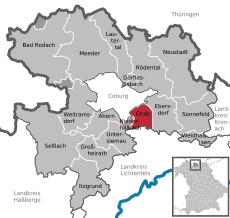
Grub am Forst 
municipality of Germany
Upload media
Instance of
  • non-urban municipality in Germany
Part of
  • Verwaltungsgemeinschaft Grub am Forst
  • Stimmkreis Coburg (2018)
LocationCoburg, Upper Franconia, Bavaria, Germany
Head of government
  • Jürgen Wittmann
Population
  • 2,806 (2022)
Area
  • 11.97 km² (2017)
Elevation above sea level
  • 300 m
official website
Map50° 13′ 46.31″ N, 11° 01′ 19.96″ E
Authority file
Wikidata Q572696
VIAF ID: 240068844
GND ID: 4387062-4
Bibliothèque nationale de France ID: 15184346s
OpenStreetMap relation ID: 956863
OpenStreetMap node ID: 69333343
Edit infobox data on Wikidata

Subcategories

This category has the following 5 subcategories, out of 5 total.

Media in category "Grub am Forst"

The following 5 files are in this category, out of 5 total.