Category:Grotekerksplein 1, Dordrecht
Jump to navigation
Jump to search
| Object location | | View all coordinates using: OpenStreetMap |
|---|
 | |||||
| Upload media | |||||
| Instance of |
| ||||
|---|---|---|---|---|---|
| Location | Dordrecht, South Holland, Netherlands | ||||
| Street address |
| ||||
| Located on street | |||||
| Heritage designation |
| ||||
 | |||||
|
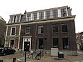
This is a category about rijksmonument number 13413
|
| Address |
|
Media in category "Grotekerksplein 1, Dordrecht"
The following 3 files are in this category, out of 3 total.
-
 + Grote Kerkbuurt, overzicht - Dordrecht - 20062018 - RCE.jpg 1,200 × 804; 167 KB
-
 Grote Kerksplein - Dordrecht - 20060146 - RCE.jpg 1,188 × 1,200; 283 KB
-
 RM13413 Dordrecht - Grotekerksplein 1.jpg 3,264 × 2,448; 1.8 MB

