Category:Grote Kerk, Vianen
Jump to navigation
Jump to search
| Object location | | View all coordinates using: OpenStreetMap |
|---|
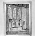
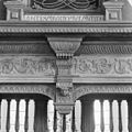
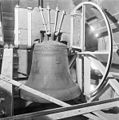
Nederlands: Afbeeldingen van de Grote Kerk gevestigd in de Voorstraat 110 in Vianen in de provincie Utrecht in het midden van Nederland.
church building in Vianen, Netherlands | |||||
| Upload media | |||||
| Instance of | |||||
|---|---|---|---|---|---|
| Location | Vianen, Vijfheerenlanden, Utrecht, Netherlands | ||||
| Street address |
| ||||
| Located on street |
| ||||
| Heritage designation |
| ||||
| Religion or worldview | |||||
 | |||||
Nederlands: protestantse Grote Kerk in Vianen, 1327–1435–1540
Deutsch: protestantische Grote Kerk (Große Kirche) in Vianen
Toren / tower / Turm:
|
This is a category about rijksmonument number 37388
|
Kerk / nave / Kirchenschiff:
|
This is a category about rijksmonument number 37389
|
| Address |
|
Subcategories
This category has only the following subcategory.
Media in category "Grote Kerk, Vianen"
The following 200 files are in this category, out of 220 total.
(previous page) (next page)-
37312-stadsmuur zuidzijde.jpg 2,592 × 1,944; 3.28 MB
-
Afsluiting noord en zuid kapel - Vianen - 20241810 - RCE.jpg 3,305 × 2,463; 1.49 MB
-
Afsluiting noord en zuid kapel - Vianen - 20241811 - RCE.jpg 3,311 × 2,451; 1.38 MB
-
Altaar in het noord koor - Vianen - 20241818 - RCE.jpg 2,140 × 2,694; 1.48 MB
-
Altaarretabel in de Grote Kerk te Vianen, RP-F-00-5243.jpg 4,362 × 5,968; 2.01 MB
-
Altaarretabel in de Grote Kerk te Vianen, RP-F-00-5244.jpg 4,414 × 5,968; 2.03 MB
-
Altaarretabel in de Grote Kerk te Vianen, RP-F-00-5245.jpg 6,000 × 4,378; 2 MB
-
Details - Vianen - 20241841 - RCE.jpg 2,238 × 3,341; 3.51 MB
-
Details - Vianen - 20241842 - RCE.jpg 2,244 × 3,300; 3.42 MB
-
Details - Vianen - 20241843 - RCE.jpg 2,244 × 3,335; 3.14 MB
-
Details - Vianen - 20241844 - RCE.jpg 2,238 × 3,324; 3.54 MB
-
Details - Vianen - 20241845 - RCE.jpg 2,244 × 3,318; 3.43 MB
-
Details - Vianen - 20241846 - RCE.jpg 2,244 × 3,323; 3.19 MB
-
Deur torenportaal - Vianen - 20241795 - RCE.jpg 2,098 × 2,646; 1.93 MB
-
Exterieur - Vianen - 20241789 - RCE.jpg 2,045 × 2,628; 2.45 MB
-
Exterieur DETAIL METSELWERK, NOORDWEST ZIJDE - Vianen - 20300606 - RCE.jpg 3,054 × 3,084; 5.35 MB
-
Exterieur DETAIL OOSTGEVEL - Vianen - 20300615 - RCE.jpg 2,480 × 3,100; 4.36 MB
-
Exterieur GEDEELTE NOORDGEVEL - Vianen - 20300608 - RCE.jpg 3,100 × 2,480; 3.92 MB
-
Exterieur GEVEL TOREN - Vianen - 20300603 - RCE.jpg 2,480 × 3,100; 3.6 MB
-
Exterieur NOORDGEVEL - Vianen - 20300607 - RCE.jpg 3,100 × 2,480; 3.83 MB
-
Exterieur NOORDGEVEL - Vianen - 20300609 - RCE.jpg 2,480 × 3,100; 3.59 MB
-
Exterieur NOORDOOST GEVEL - Vianen - 20300610 - RCE.jpg 3,100 × 2,480; 3.82 MB
-
Exterieur OOSTWAND, ZUIDER TRANSEPT - Vianen - 20300614 - RCE.jpg 2,480 × 3,100; 4.18 MB
-
Exterieur OVERZICHT OOSTGEVEL - Vianen - 20300611 - RCE.jpg 3,092 × 2,472; 3.37 MB
-
Exterieur OVERZICHT OOSTGEVEL - Vianen - 20300612 - RCE.jpg 3,092 × 2,472; 3.4 MB
-
Exterieur VOET VAN DE TOREN, WESTGEVEL - Vianen - 20300602 - RCE.jpg 2,463 × 3,095; 3.82 MB
-
Exterieur WESTGEVEL - Vianen - 20300604 - RCE.jpg 2,475 × 3,077; 3.73 MB
-
Exterieur WESTGEVEL - Vianen - 20300605 - RCE.jpg 2,480 × 3,100; 3.17 MB
-
Exterieur ZUIDGEVEL - Vianen - 20300613 - RCE.jpg 3,100 × 2,464; 3.93 MB
-
Foto Klok Both1.jpg 960 × 1,280; 292 KB
-
Foto Klok Both2.jpg 960 × 1,280; 291 KB
-
Foto Orgel1.jpg 960 × 1,280; 289 KB
-
Foto Vrouwekoor2.jpg 960 × 1,280; 221 KB
-
Foto Vrouwekoor3.jpg 960 × 1,280; 157 KB
-
Foto Vrouwekoor5.jpg 960 × 1,280; 230 KB
-
Foto Vrouwekoor6.jpg 1,280 × 960; 243 KB
-
Fundering - Vianen - 20241852 - RCE.jpg 3,083 × 2,457; 3.03 MB
-
Gewelf van het zuid koor - Vianen - 20241830 - RCE.jpg 2,700 × 2,158; 1.87 MB
-
Gezicht over de Lek richting Vianen - Vianen - 20388956 - RCE.jpg 3,543 × 2,362; 2 MB
-
Grote Kerk, Vianen DSCF8567.jpg 2,816 × 1,864; 2.58 MB
-
Grote Kerk, Vianen DSCF8568.jpg 1,864 × 2,816; 2.57 MB
-
Grote Kerk, Vianen DSCF8569.jpg 1,864 × 2,816; 2.51 MB
-
Grote Kerk, Vianen DSCF8570.jpg 1,864 × 2,816; 2.6 MB
-
Grote Kerk, Vianen DSCF8572.jpg 1,864 × 2,816; 2.56 MB
-
Grote Kerk, Vianen DSCF8573.jpg 2,816 × 1,864; 2.54 MB
-
Grote Kerk, Vianen DSCF8679.jpg 1,864 × 2,816; 2.56 MB
-
Impressie Vianen 118.JPG 3,264 × 2,448; 2.06 MB
-
Impressie Vianen 129.JPG 3,264 × 2,448; 2.24 MB
-
Interieur altaarretabel - Vianen - 20241857 - RCE.jpg 3,042 × 2,994; 2.17 MB
-
Interieur detail altaarretabel linkergedeelte - Vianen - 20241859 - RCE.jpg 3,066 × 3,089; 2.14 MB
-
Interieur detail altaarretabel linkergedeelte - Vianen - 20241860 - RCE.jpg 3,048 × 3,078; 1.58 MB
-
Interieur detail altaarretabel linkergedeelte - Vianen - 20241861 - RCE.jpg 3,054 × 3,072; 2.39 MB
-
Interieur detail altaarretabel linkerzijde - Vianen - 20241858 - RCE.jpg 3,042 × 3,024; 2.14 MB
-
Interieur detail altaarretabel middelste gedeelte. - Vianen - 20241862 - RCE.jpg 3,048 × 3,072; 2.08 MB
-
Interieur detail altaarretabel rechtergedeelte - Vianen - 20241863 - RCE.jpg 3,036 × 3,030; 1.99 MB
-
Interieur detail altaarretabel rechtergedeelte - Vianen - 20241867 - RCE.jpg 3,054 × 3,054; 2.4 MB
-
Interieur detail altaarretabel rechterzijde - Vianen - 20241864 - RCE.jpg 3,042 × 3,078; 2.18 MB
-
Interieur detail altaarretabel rechterzijde - Vianen - 20241865 - RCE.jpg 3,048 × 3,042; 2.16 MB
-
Interieur detail altaarretabel rechterzijde - Vianen - 20241866 - RCE.jpg 3,066 × 3,060; 2.41 MB
-
Interieur koperen(?)tekstplaat (in de Brederodekapel) - Vianen - 20241870 - RCE.jpg 3,048 × 3,054; 3.46 MB
-
Interieur loden grafplaat (in de Brederodekapel) - Vianen - 20241872 - RCE.jpg 3,042 × 3,072; 3.46 MB
-
Interieur loden grafplaat (in de Brederodekapel) - Vianen - 20241873 - RCE.jpg 3,060 × 3,060; 3.45 MB
-
Interieur loden grafplaat (in de Brederodekapel) - Vianen - 20241874 - RCE.jpg 3,042 × 3,078; 3.24 MB
-
Interieur loden grafplaat (in de Brederodekapel). - Vianen - 20241875 - RCE.jpg 3,054 × 3,047; 3.57 MB
-
Interieur metalen tekstplaat (in de Brederodekapel) - Vianen - 20241871 - RCE.jpg 3,066 × 3,072; 3.37 MB
-
Interieur naar het noord-oosten - Vianen - 20241813 - RCE.jpg 2,694 × 2,146; 1.17 MB
-
Interieur naar het noord-westen - Vianen - 20241814 - RCE.jpg 2,706 × 2,134; 1.08 MB
-
Interieur naar het oosten - Vianen - 20241817 - RCE.jpg 2,140 × 2,694; 1.17 MB
-
Interieur naar het westen - Vianen - 20241816 - RCE.jpg 2,152 × 2,682; 1.17 MB
-
Interieur naar het westen - Vianen - 20241819 - RCE.jpg 2,140 × 2,694; 1.18 MB
-
Interieur naar het zuid-oosten - Vianen - 20241815 - RCE.jpg 2,700 × 2,140; 1.2 MB
-
Interieur naar het zuid-westen - Vianen - 20241812 - RCE.jpg 1,990 × 2,520; 1.04 MB
-
Interieur schip naar het westen - Vianen - 20241820 - RCE.jpg 2,092 × 2,652; 1.15 MB
-
Interieur tekening altaarretabel van Gerrit Lamberts ca. 1840. - Vianen - 20241856 - RCE.jpg 3,036 × 3,054; 2.53 MB
-
Interieur tekstbord - Vianen - 20241868 - RCE.jpg 3,060 × 3,078; 2.3 MB
-
Interieur tekstbord - Vianen - 20241869 - RCE.jpg 3,066 × 3,089; 2.15 MB
-
Interieur, aanzicht orgel, orgelnummer 1560 - Vianen - 20358254 - RCE.jpg 1,519 × 2,228; 556 KB
-
Interieur, achterzijde van het middelste koorhek - Vianen - 20241824 - RCE.jpg 2,134 × 2,712; 1.39 MB
-
INTERIEUR, ALTAAR - Vianen - 20307093 - RCE.jpg 3,078 × 3,077; 2.1 MB
-
INTERIEUR, ALTAAR - Vianen - 20307094 - RCE.jpg 3,072 × 3,096; 1.69 MB
-
INTERIEUR, DETAIL FRONTON MET WAPEN VAN HERENBANK - Vianen - 20301160 - RCE.jpg 3,048 × 3,071; 2.11 MB
-
INTERIEUR, DETAIL HERENBANK - Vianen - 20301165 - RCE.jpg 3,084 × 3,060; 1.6 MB
-
INTERIEUR, DETAIL KAPCONSTRUCTIE - Vianen - 20300619 - RCE.jpg 3,060 × 3,078; 2.09 MB
-
INTERIEUR, DETAIL KLOK (1593) - Vianen - 20300624 - RCE.jpg 3,066 × 3,072; 2.48 MB
-
Interieur, detail koorhek - Vianen - 20301171 - RCE.jpg 3,060 × 3,060; 1.59 MB
-
INTERIEUR, DETAIL MUURSTIJL - Vianen - 20300616 - RCE.jpg 3,066 × 3,084; 2.03 MB
-
INTERIEUR, DETAIL MUURSTIJL - Vianen - 20300617 - RCE.jpg 3,066 × 3,072; 1.89 MB
-
INTERIEUR, DETAIL SNIJWERK HERENBANK - Vianen - 20301161 - RCE.jpg 3,072 × 3,060; 1.57 MB
-
INTERIEUR, DETAIL SNIJWERK HERENBANK - Vianen - 20301162 - RCE.jpg 3,060 × 3,060; 1.73 MB
-
INTERIEUR, DETAIL SNIJWERK HERENBANK - Vianen - 20301163 - RCE.jpg 3,042 × 3,072; 2.17 MB
-
INTERIEUR, DETAIL VAN KOORBANK - Vianen - 20301167 - RCE.jpg 3,072 × 3,084; 1.57 MB
-
INTERIEUR, DETAILS VAN ALTAAR - Vianen - 20307095 - RCE.jpg 3,066 × 3,072; 2.87 MB
-
INTERIEUR, GEDEELTE VAN KOORBANK - Vianen - 20301168 - RCE.jpg 3,066 × 3,036; 1.62 MB
-
INTERIEUR, GEWELF BREDERODE KAPEL - Vianen - 20300621 - RCE.jpg 3,054 × 3,084; 1.74 MB
-
INTERIEUR, GEWELF VAN ZUIDER KAPEL - Vianen - 20300620 - RCE.jpg 3,054 × 3,072; 1.97 MB
-
Interieur, grafmonument - Vianen - 20241832 - RCE.jpg 2,487 × 3,348; 1.33 MB
-
Interieur, grafmonument, detail - Vianen - 20241834 - RCE.jpg 3,305 × 2,463; 1.36 MB
-
INTERIEUR, HERENBANK 1624 - Vianen - 20301158 - RCE.jpg 1,200 × 953; 226 KB
-
INTERIEUR, HERENBANK 1624 ACHTERZIJDE - Vianen - 20301159 - RCE.jpg 1,200 × 957; 225 KB
-
INTERIEUR, KABINETORGEL MET GESLOTEN LUIKEN - Vianen - 20301156 - RCE.jpg 944 × 1,200; 192 KB
-
INTERIEUR, KABINETORGEL MET OPEN LUIKEN - Vianen - 20301157 - RCE.jpg 953 × 1,200; 202 KB
-
INTERIEUR, KAPCONSTRUCTIE - Vianen - 20300618 - RCE.jpg 1,200 × 1,197; 254 KB
-
INTERIEUR, KLOK (1593) - Vianen - 20300623 - RCE.jpg 1,192 × 1,200; 256 KB
-
INTERIEUR, KOOR, KOPEREN WANDARM - Vianen - 20301172 - RCE.jpg 1,193 × 1,200; 229 KB
-
Interieur, koorbank - Vianen - 20241821 - RCE.jpg 896 × 1,200; 193 KB
-
Interieur, koorhek van het middenkoor - Vianen - 20241823 - RCE.jpg 943 × 1,200; 223 KB
-
Interieur, koorhek van het noordkoor - Vianen - 20241826 - RCE.jpg 1,200 × 962; 210 KB
-
Interieur, koorhek van het zuidkoor - Vianen - 20241825 - RCE.jpg 1,200 × 954; 233 KB
-
Interieur, koorhek van het zuidkoor - Vianen - 20301170 - RCE.jpg 1,200 × 953; 237 KB
-
INTERIEUR, KOPEREN LEZENAAR OP DE TAFEL VOOR DE PREEKSTOEL - Vianen - 20301155 - RCE.jpg 1,191 × 1,200; 196 KB
-
INTERIEUR, LINKER DEUR VAN HERENBANK - Vianen - 20301164 - RCE.jpg 951 × 1,200; 229 KB
-
INTERIEUR, OVERZICHT KOORBANK - Vianen - 20301166 - RCE.jpg 3,092 × 2,464; 2.83 MB
-
INTERIEUR, PREEKSTOEL - Vianen - 20301152 - RCE.jpg 2,458 × 3,100; 2.73 MB
-
INTERIEUR, PREEKSTOEL, LEZENAAR - Vianen - 20301154 - RCE.jpg 3,072 × 3,059; 3.19 MB
-
INTERIEUR, PREEKSTOEL, VLEUGEL TRAPLEUNING - Vianen - 20301153 - RCE.jpg 3,072 × 3,077; 2.36 MB
-
INTERIEUR, TEKSTBORD IN NOORDER TRANSEPT - Vianen - 20301173 - RCE.jpg 3,054 × 3,060; 2.47 MB
-
INTERIEUR, TEKSTBORD IN NOORDER TRANSEPT - Vianen - 20301174 - RCE.jpg 3,054 × 3,042; 3.31 MB
-
INTERIEUR, TEKSTBORD IN ZUIDER TRANSEPT - Vianen - 20301175 - RCE.jpg 3,060 × 3,072; 2.68 MB
-
INTERIEUR, TEKSTBORD IN ZUIDER TRANSEPT - Vianen - 20301176 - RCE.jpg 3,066 × 3,072; 2.39 MB
-
INTERIEUR, TWEE KLOKKEN (1593) - Vianen - 20300622 - RCE.jpg 3,078 × 3,072; 3.5 MB
-
Interieur, voorzijde koorbank - Vianen - 20241822 - RCE.jpg 2,839 × 3,825; 3.19 MB
-
Interieur, zicht in het transept - Vianen - 20241809 - RCE.jpg 2,856 × 3,825; 2.94 MB
-
Interieur, zicht op het orgel uit 1803 - Vianen - 20241828 - RCE.jpg 2,856 × 3,825; 3.41 MB
-
INTERIEUR, ZILVEREN AVONDMAAL BEKER - Vianen - 20300558 - RCE.jpg 3,060 × 3,066; 3.53 MB
-
INTERIEUR, ZILVEREN AVONDMAAL KAN - Vianen - 20300556 - RCE.jpg 3,054 × 3,078; 2.91 MB
-
INTERIEUR, ZILVEREN AVONDMAAL SCHOTEL - Vianen - 20300559 - RCE.jpg 3,048 × 3,072; 3.26 MB
-
INTERIEUR, ZILVEREN AVONDMAAL SCHOTEL - Vianen - 20300560 - RCE.jpg 3,042 × 3,066; 2.17 MB
-
INTERIEUR, ZILVEREN AVONDMAAL SCHOTEL - Vianen - 20300561 - RCE.jpg 3,054 × 3,072; 3.03 MB
-
INTERIEUR, ZILVEREN COLLECTESCHAAL - Vianen - 20300555 - RCE.jpg 3,066 × 3,078; 3.61 MB
-
INTERIEUR, ZILVEREN DOOPSCHAAL - Vianen - 20300554 - RCE.jpg 3,054 × 3,084; 2.63 MB
-
INTERIEUR, ZILVEREN KELK - Vianen - 20300557 - RCE.jpg 3,054 × 3,078; 3.33 MB
-
Kerk detail zuid-gevel - Vianen - 20241803 - RCE.jpg 2,694 × 2,128; 3.34 MB
-
Kerk detail zuid-gevel - Vianen - 20241805 - RCE.jpg 2,146 × 2,724; 2.77 MB
-
Kerk noord-west zijde - Vianen - 20241802 - RCE.jpg 2,718 × 2,158; 2.77 MB
-
Kerk noord-west zijde - Vianen - 20241808 - RCE.jpg 2,440 × 3,065; 3.15 MB
-
Kerk oost-gevel van zuid-transept - Vianen - 20241806 - RCE.jpg 2,122 × 2,688; 3.1 MB
-
Kerk tijdens de restauratie - Vianen - 20241791 - RCE.jpg 2,640 × 2,098; 2.5 MB
-
Kerk tijdens de restauratie - Vianen - 20241792 - RCE.jpg 2,092 × 2,634; 2.38 MB
-
Kerk tijdens de restauratie - Vianen - 20241793 - RCE.jpg 2,086 × 2,616; 2.83 MB
-
Kerk tijdens restauratie - Vianen - 20241790 - RCE.jpg 2,100 × 2,652; 2.29 MB
-
Kerk vanuit het noorden - Vianen - 20241801 - RCE.jpg 3,280 × 2,438; 2.67 MB
-
Kerk vanuit het zuid-westen - Vianen - 20241799 - RCE.jpg 2,315 × 3,095; 2.36 MB
-
Kerk vanuit het zuid-westen - Vianen - 20241800 - RCE.jpg 3,286 × 2,457; 3.07 MB
-
Kerk west-gevel van zuidelijke zijbeuk - Vianen - 20241807 - RCE.jpg 2,134 × 2,688; 2.59 MB
-
Kerk zuid-west zijde - Vianen - 20241804 - RCE.jpg 2,134 × 2,700; 2.52 MB
-
Omwalling Vianen.JPG 5,681 × 2,309; 3.41 MB
-
Orgeltje - Vianen - 20241829 - RCE.jpg 2,140 × 2,688; 1.21 MB
-
Overzicht met kerk, kerktoren en gracht - Vianen - 20379703 - RCE.jpg 3,077 × 2,454; 1.55 MB
-
Overzicht met kerk, kerktoren en gracht - Vianen - 20379704 - RCE.jpg 3,084 × 3,090; 1.93 MB
-
Overzicht zuid-zijde - Vianen - 20241847 - RCE.jpg 3,082 × 2,428; 1.48 MB
-
Overzicht zuid-zijde - Vianen - 20241848 - RCE.jpg 3,083 × 2,440; 1.6 MB
-
Overzicht zuid-zijde - Vianen - 20241849 - RCE.jpg 3,083 × 2,457; 1.84 MB
-
Overzicht zuidgevel kerk en overzicht stadsmuur - Vianen - 20376531 - RCE.jpg 1,200 × 924; 1.1 MB
-
Plattegrond - Vianen - 20241788 - RCE.jpg 2,417 × 3,269; 1.79 MB
-
Plattegrond en doorsnede - Vianen - 20241853 - RCE.jpg 2,385 × 3,071; 2.02 MB
-
Protestant church of Vianen at 17 March 2015 - panoramio.jpg 4,288 × 2,848; 3.33 MB
-
Sluitwerk torenportaal - Vianen - 20241796 - RCE.jpg 2,652 × 2,104; 1.86 MB
-
Walls.Vianen.jpg 2,710 × 2,170; 1.23 MB
-
Vianen 117.JPG 3,264 × 2,448; 1.93 MB
-
VIANEN GROTE KERK 01.jpg 4,608 × 3,456; 1.69 MB
-
VIANEN GROTE KERK 02.jpg 4,608 × 3,456; 2.58 MB
-
VIANEN GROTE KERK 03.jpg 3,336 × 4,448; 1.01 MB
-
VIANEN GROTE KERK 04.jpg 4,608 × 3,456; 2.02 MB
-
VIANEN GROTE KERK 05.jpg 3,346 × 4,462; 1.58 MB
-
VIANEN GROTE KERK 06.jpg 3,456 × 4,608; 1.59 MB
-
VIANEN GROTE KERK 07.jpg 3,379 × 4,506; 1.58 MB
-
VIANEN GROTE KERK 08.jpg 4,608 × 3,456; 1.61 MB
-
VIANEN GROTE KERK 09.jpg 4,608 × 3,456; 1.78 MB
-
VIANEN GROTE KERK 10.jpg 4,535 × 3,401; 1.44 MB
-
VIANEN GROTE KERK 11.jpg 3,456 × 4,608; 3.88 MB


