Category:Grosmont, Monmouthshire
Jump to navigation
Jump to search
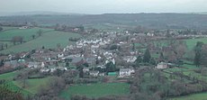
Cymraeg: Pentref yn Sir Fynwy, de-ddwyrain Cymru, yw Y Grysmwnt (Saesneg: Grosmont); Cyfeirnod OS: SO4024. Fe'i lleolir yng ngogledd eithaf y sir, 10 milltir i'r gogledd o Drefynwy, o fewn tafliad carreg â'r ffin rhwng Sir Fynwy a Swydd Henffordd yn Lloegr.
village in Monmouthshire, Wales | |||||
| Upload media | |||||
| Instance of | |||||
|---|---|---|---|---|---|
| Location | Monmouthshire, Wales | ||||
| Heritage designation |
| ||||
| Point in time |
| ||||
| Population |
| ||||
| Elevation above sea level |
| ||||
 | |||||
Subcategories
This category has the following 15 subcategories, out of 15 total.
B
- Barn at Lower Tresenny (3 F)
G
- Glyndwr House, Grosmont (2 F)
- Great Tresenny (1 F)
- St Nicholas Church, Grosmont (29 F)
- Grosmont Town Hall (9 F)
H
- Howell's House, Grosmont (1 F)
L
- Lower Celliau (1 F)
- Lower Dyffryn House (1 F)
O
- Old Court, Grosmont (1 F)
T
- Town Farm, Grosmont (2 F)
U
- Upper Dyffryn House (2 F)
Media in category "Grosmont, Monmouthshire"
The following 200 files are in this category, out of 552 total.
(previous page) (next page)-
... post office at Grosmont, pais de gales. (3663811624).jpg 3,072 × 2,304; 2.64 MB
-
2010 Wales Monmouthshire Community Grosmont map.svg 512 × 682; 699 KB
-
2024 Wales Monmouthshire Community Grosmont map.svg 512 × 682; 603 KB
-
A cwm in the Black Mountains - geograph.org.uk - 2107419.jpg 2,048 × 1,536; 1.11 MB
-
A rare straight road - geograph.org.uk - 2697576.jpg 1,024 × 768; 608 KB
-
A shed in a field - geograph.org.uk - 2752036.jpg 1,024 × 685; 608 KB
-
A summer garden beside the Old Ross Road - geograph.org.uk - 3061208.jpg 640 × 480; 135 KB
-
A view of Grosmont village - geograph.org.uk - 6597516.jpg 640 × 480; 104 KB
-
A465 at Little Goytre - geograph.org.uk - 2773057.jpg 1,024 × 768; 398 KB
-
A465 near Great Goytre - geograph.org.uk - 2953403.jpg 640 × 480; 77 KB
-
A465 near Llangua - geograph.org.uk - 2953406.jpg 640 × 481; 84 KB
-
A465 near Maerdy Farm - geograph.org.uk - 2953404.jpg 640 × 480; 58 KB
-
A465 near Pentwyn - geograph.org.uk - 2953405.jpg 640 × 481; 58 KB
-
A465 old alignments - geograph.org.uk - 2784275.jpg 1,024 × 768; 397 KB
-
A465 towards Hereford - geograph.org.uk - 2784350.jpg 1,024 × 768; 385 KB
-
Access for anglers - geograph.org.uk - 2784341.jpg 1,024 × 768; 400 KB
-
Access road to Great Goytre Farm - geograph.org.uk - 3229258.jpg 640 × 480; 93 KB
-
Access road to Pentwyn Farm - geograph.org.uk - 3228996.jpg 640 × 499; 115 KB
-
Access to Grosmont Castle - geograph.org.uk - 6597519.jpg 640 × 480; 133 KB
-
Access to Grosmont Castle - geograph.org.uk - 6597521.jpg 480 × 640; 125 KB
-
Advertising bike at Grosmont - geograph.org.uk - 6596110.jpg 640 × 480; 116 KB
-
Afon Troddi-River Trothy - geograph.org.uk - 3895039.jpg 1,024 × 680; 282 KB
-
Approaching Little Marlborough - geograph.org.uk - 4637325.jpg 640 × 480; 155 KB
-
Around Edmund's Tump (1) - geograph.org.uk - 2723430.jpg 4,320 × 3,240; 4.97 MB
-
Around Edmund's Tump (2) - geograph.org.uk - 2723433.jpg 4,320 × 3,240; 4.86 MB
-
Ascending footpath - geograph.org.uk - 5217885.jpg 1,600 × 901; 697 KB
-
Autumnal lane - geograph.org.uk - 2697144.jpg 1,024 × 768; 620 KB
-
B4347 by Sky Covert - geograph.org.uk - 6597550.jpg 480 × 640; 132 KB
-
B4347 passing through Grosmont - geograph.org.uk - 1191817.jpg 640 × 480; 101 KB
-
B4347 towards Monmouth - geograph.org.uk - 2697058.jpg 1,024 × 768; 664 KB
-
B4521 at Llanvetherine - geograph.org.uk - 4994130.jpg 1,600 × 901; 694 KB
-
Barn at Little Pool Hall.jpg 4,000 × 3,000; 1.25 MB
-
Best kept village 2003 - geograph.org.uk - 1191470.jpg 640 × 480; 133 KB
-
Between borders - geograph.org.uk - 3683829.jpg 1,600 × 963; 430 KB
-
Bevan Court, Grosmont - geograph.org.uk - 2812318.jpg 640 × 533; 67 KB
-
Birches Wood - geograph.org.uk - 2723830.jpg 4,320 × 3,240; 4.82 MB
-
Border Farmland - geograph.org.uk - 889884.jpg 640 × 481; 155 KB
-
Bower Farm - geograph.org.uk - 216750.jpg 640 × 480; 107 KB
-
Bridge over Tresseny Brook, Grosmont - geograph.org.uk - 3940861.jpg 4,320 × 3,240; 6.27 MB
-
Bus stop near Little Goytre Farm - geograph.org.uk - 3229326.jpg 640 × 480; 86 KB
-
Campston Hill - geograph.org.uk - 888819.jpg 640 × 379; 33 KB
-
Cap House - geograph.org.uk - 7129259.jpg 1,024 × 683; 748 KB
-
Cap House - geograph.org.uk - 7129260.jpg 1,024 × 683; 808 KB
-
Cap House, Llangua - geograph.org.uk - 3227205.jpg 640 × 587; 101 KB
-
Capel Cwm Merra Chapel - geograph.org.uk - 4498689.jpg 640 × 452; 59 KB
-
Caravan and chalet near Llanvetherine - geograph.org.uk - 2009056.jpg 800 × 600; 190 KB
-
Castle House (Grosmont) - geograph.org.uk - 6758557.jpg 3,648 × 2,736; 4.74 MB
-
Castle Wood (Grosmont) - geograph.org.uk - 6758554.jpg 3,648 × 2,736; 4.4 MB
-
Cattle beside the River Monnow - geograph.org.uk - 4454525.jpg 640 × 480; 80 KB
-
Cattle beside the River Monnow - geograph.org.uk - 4454526.jpg 640 × 480; 82 KB
-
Celyn Farm (5) - geograph.org.uk - 2723808.jpg 4,320 × 3,240; 4.97 MB
-
Chancel, St. Nicholas' church, Grosmont - geograph.org.uk - 6006204.jpg 1,024 × 768; 160 KB
-
Chapel at Llanvetherine - geograph.org.uk - 5160318.jpg 1,500 × 1,125; 1.94 MB
-
Chimney on Grosmont Castle (North block) - geograph.org.uk - 6757917.jpg 3,648 × 2,736; 4.17 MB
-
Chimney on Grosmont Castle (North block) - geograph.org.uk - 6757942.jpg 2,736 × 3,648; 4.69 MB
-
Chimney on Grosmont Castle (North block) - geograph.org.uk - 6757966.jpg 2,736 × 3,648; 4.92 MB
-
Chimney on Grosmont Castle (North block) - geograph.org.uk - 6757967.jpg 3,648 × 2,736; 4.81 MB
-
Chimney on Grosmont Castle (North block) - geograph.org.uk - 6758024.jpg 3,648 × 2,736; 2.95 MB
-
Church at Llangua - geograph.org.uk - 6855573.jpg 1,024 × 768; 294 KB
-
Church Cottage, Llangattock Lingoed - geograph.org.uk - 5591933.jpg 800 × 464; 117 KB
-
Church of St James the Elder - geograph.org.uk - 2008353.jpg 800 × 600; 182 KB
-
Corrugated shelter - geograph.org.uk - 1191444.jpg 640 × 480; 135 KB
-
Cottages in Llangattock Lingoed - geograph.org.uk - 2114318.jpg 1,024 × 681; 191 KB
-
Country road and Ysgyryd Fawr - geograph.org.uk - 3892524.jpg 1,024 × 680; 176 KB
-
Cupid's Hill near Grosmont - geograph.org.uk - 2815611.jpg 640 × 519; 78 KB
-
Cupid's Hill, Grosmont - geograph.org.uk - 2703152.jpg 1,024 × 768; 686 KB
-
Date stone and bell - geograph.org.uk - 1191460.jpg 640 × 614; 137 KB
-
Drive to Blantrothy Farm - geograph.org.uk - 2854782.jpg 1,024 × 680; 179 KB
-
Driveway to the Lawns Farm - geograph.org.uk - 6597525.jpg 640 × 480; 81 KB
-
Driveway to the Lawns Farm - geograph.org.uk - 6597530.jpg 640 × 480; 90 KB
-
Edge of Birches Wood - geograph.org.uk - 5217932.jpg 1,600 × 899; 896 KB
-
Edge of Sky Covert - geograph.org.uk - 5217935.jpg 1,600 × 1,200; 1.19 MB
-
Edmund's Tump (2) - geograph.org.uk - 2722549.jpg 4,320 × 3,240; 4.64 MB
-
Effigy inside St. Nicholas' Church (Nave ^ Grosmont) - geograph.org.uk - 6758434.jpg 1,500 × 1,125; 414 KB
-
Emergency telephone near Little Goytre - geograph.org.uk - 3229308.jpg 640 × 569; 141 KB
-
Entrance to Barns Farm - geograph.org.uk - 2784364.jpg 1,024 × 770; 436 KB
-
Entrance to Grosmont castle - geograph.org.uk - 2475597.jpg 640 × 480; 96 KB
-
Entrance to Grosmont Castle - geograph.org.uk - 4010078.jpg 800 × 546; 128 KB
-
Entrance to Part-y-seal Farm - geograph.org.uk - 1190441.jpg 640 × 480; 123 KB
-
Entrance to the castle at Grosmont - geograph.org.uk - 1191484.jpg 640 × 493; 110 KB
-
Farm buildings - geograph.org.uk - 2702613.jpg 1,024 × 768; 666 KB
-
Farm buildings by Birches Wood - geograph.org.uk - 2697083.jpg 1,024 × 768; 614 KB
-
Farmhouse, Mill Farm near Kentchurch - geograph.org.uk - 2815504.jpg 640 × 522; 82 KB
-
Farmland above the Monnow valley - geograph.org.uk - 2854706.jpg 1,024 × 680; 179 KB
-
Farmland above Tump Farm - geograph.org.uk - 2009171.jpg 800 × 600; 152 KB
-
Farmland and Offa's Dyke Path - geograph.org.uk - 3901958.jpg 800 × 531; 111 KB
-
Farmland at Gelli-llwyd - geograph.org.uk - 2009162.jpg 800 × 600; 177 KB
-
Farmland at The Court - geograph.org.uk - 2094402.jpg 800 × 600; 176 KB
-
Farmland east of Llanddewi Skirrid - geograph.org.uk - 2094315.jpg 800 × 600; 191 KB
-
Farmland in the Trothy valley - geograph.org.uk - 3901973.jpg 1,024 × 680; 302 KB
-
Farmland near Blantrothy Farm - geograph.org.uk - 2854802.jpg 1,024 × 680; 192 KB
-
Farmland near Grosmont - geograph.org.uk - 3766489.jpg 1,024 × 680; 221 KB
-
Farmland near Llangattock Lingoed - geograph.org.uk - 2114185.jpg 1,024 × 681; 194 KB
-
Farmland near Llangattock Lingoed - geograph.org.uk - 2114191.jpg 1,024 × 681; 249 KB
-
Farmland near Llangua - geograph.org.uk - 2854734.jpg 1,024 × 680; 207 KB
-
Farmland north of Caggle Street - geograph.org.uk - 2009071.jpg 800 × 600; 206 KB
-
Farmland north of Steppes Farm - geograph.org.uk - 5958934.jpg 2,438 × 1,828; 897 KB
-
Farmland north-west of Grosmont Wood Farm - geograph.org.uk - 5958911.jpg 2,560 × 1,920; 2.35 MB
-
Farmland on the Monnow Valley - geograph.org.uk - 3582711.jpg 1,024 × 680; 276 KB
-
Ffarm Little Pool Farm - geograph.org.uk - 4498703.jpg 640 × 454; 55 KB
-
Field - geograph.org.uk - 7129253.jpg 1,024 × 683; 773 KB
-
Field and River Monnow - geograph.org.uk - 1285631.jpg 640 × 480; 74 KB
-
Field entrance opposite Crossways - geograph.org.uk - 2697128.jpg 768 × 1,024; 681 KB
-
Field entrance, Llangua - geograph.org.uk - 3227231.jpg 640 × 529; 99 KB
-
Field of oats on Graig Syfyrddin - geograph.org.uk - 212304.jpg 640 × 480; 145 KB
-
Fields and clouds - geograph.org.uk - 4637320.jpg 640 × 480; 149 KB
-
Fields near Little Hand farm - geograph.org.uk - 4637318.jpg 640 × 480; 163 KB
-
Fields near Llangua - geograph.org.uk - 2005127.jpg 640 × 480; 68 KB
-
Follow the track - geograph.org.uk - 2722219.jpg 4,320 × 3,240; 4.95 MB
-
Footbridge near Llanvetherine - geograph.org.uk - 3060880.jpg 640 × 480; 150 KB
-
Footbridge over River Monnow - geograph.org.uk - 1285644.jpg 640 × 480; 114 KB
-
Footbridge over River Monnow - geograph.org.uk - 1286118.jpg 640 × 426; 125 KB
-
Footbridge over the River Monnow - geograph.org.uk - 6597543.jpg 640 × 480; 135 KB
-
Footpath - geograph.org.uk - 7129252.jpg 1,024 × 683; 912 KB
-
Footpath leaves the road - geograph.org.uk - 2723801.jpg 4,320 × 3,240; 5.26 MB
-
Footpath north - geograph.org.uk - 2697600.jpg 1,024 × 768; 640 KB
-
Footpath west - geograph.org.uk - 5217806.jpg 1,600 × 899; 806 KB
-
Ford of Tresenny Brook - geograph.org.uk - 1070735.jpg 640 × 480; 137 KB
-
Former Grosmont Mission Hall - geograph.org.uk - 2812235.jpg 640 × 495; 71 KB
-
Forsooth^ - geograph.org.uk - 6597523.jpg 640 × 480; 123 KB
-
Four Llangua houses - geograph.org.uk - 3227216.jpg 640 × 461; 58 KB
-
From field to track - geograph.org.uk - 2722192.jpg 4,320 × 3,240; 4.9 MB
-
Frosty slope - geograph.org.uk - 5217873.jpg 1,600 × 901; 696 KB
-
Garden in a layby - geograph.org.uk - 6597539.jpg 640 × 480; 127 KB
-
Garway Hill (Viewed from Grosmont Castle) - geograph.org.uk - 6757985.jpg 3,648 × 2,736; 3.79 MB
-
Garway Hill viewed from Graig Syfyrddin - geograph.org.uk - 2773080.jpg 1,024 × 769; 427 KB
-
Gate to St. James' church, Llangua - geograph.org.uk - 3818746.jpg 640 × 480; 57 KB
-
Gateway to Coed Corras - geograph.org.uk - 2722211.jpg 4,320 × 3,240; 4.85 MB
-
Gateway to Part-y-Seal - geograph.org.uk - 6597536.jpg 640 × 480; 112 KB
-
Gelli-llwyd Farmhouse - 1 - geograph.org.uk - 2009139.jpg 800 × 600; 189 KB
-
Gelli-llwyd Farmhouse - 2 - geograph.org.uk - 2009145.jpg 800 × 600; 200 KB
-
Gelli-lwyd Farm - geograph.org.uk - 3901964.jpg 800 × 531; 142 KB
-
George VI postbox, Grosmont - geograph.org.uk - 1191472.jpg 480 × 640; 92 KB
-
Ger - Near Nant Full Brook - geograph.org.uk - 4498723.jpg 640 × 439; 60 KB
-
Grade II listed Alma House, Grosmont - geograph.org.uk - 2814245.jpg 640 × 541; 94 KB
-
Grade II listed Angel Inn, Grosmont - geograph.org.uk - 2813001.jpg 633 × 640; 81 KB
-
Grade II listed Athelstan, Grosmont - geograph.org.uk - 2814242.jpg 640 × 480; 83 KB
-
Grade II listed York House, Grosmont - geograph.org.uk - 2812663.jpg 640 × 540; 80 KB
-
Graig Syfyrddin - geograph.org.uk - 2697572.jpg 1,024 × 768; 564 KB
-
Graig Syfyrddin paths (1) - geograph.org.uk - 2721186.jpg 4,320 × 3,240; 4.79 MB
-
Grass field and Grosmont Bridge - geograph.org.uk - 7159683.jpg 1,024 × 768; 286 KB
-
Grasshopper in Grosmont Castle (Moat) - geograph.org.uk - 6758048.jpg 3,648 × 2,736; 4.66 MB
-
Grasshopper in Grosmont Castle (Moat) - geograph.org.uk - 6758052.jpg 3,648 × 2,736; 5.03 MB
-
Grassland of the Trothy valley - geograph.org.uk - 2697121.jpg 1,024 × 768; 593 KB
-
Grazing land west of Great House - geograph.org.uk - 4703783.jpg 800 × 451; 148 KB
-
Grazing near the River Monnow - geograph.org.uk - 6944399.jpg 640 × 451; 53 KB
-
Grazing towards Sunnybank Farm - geograph.org.uk - 6944398.jpg 640 × 484; 53 KB
-
Great Goytre Farm - geograph.org.uk - 3229280.jpg 640 × 431; 70 KB
-
Greig Zion Chapel - geograph.org.uk - 4512655.jpg 800 × 600; 184 KB
-
Grosmont - geograph.org.uk - 3940888.jpg 4,320 × 3,240; 4.67 MB
-
Grosmont Castle (Footbridge) - geograph.org.uk - 6487852.jpg 3,648 × 2,736; 5.17 MB
-
Grosmont Castle (Footbridge) - geograph.org.uk - 6758545.jpg 3,648 × 2,736; 4.86 MB
-
Grosmont Castle (Footbridge) - geograph.org.uk - 6758562.jpg 3,648 × 2,736; 4.64 MB
-
Grosmont Castle (Garderobe) - geograph.org.uk - 6758060.jpg 3,648 × 2,736; 5.04 MB
-
Grosmont Castle (Gatehouse) - geograph.org.uk - 6758008.jpg 3,648 × 2,736; 5.14 MB
-
Grosmont Castle (Hall block) - geograph.org.uk - 6757929.jpg 3,648 × 2,736; 4.62 MB
-
Grosmont Castle (Hall block) - geograph.org.uk - 6757940.jpg 3,648 × 2,736; 5.02 MB
-
Grosmont Castle (Hall block) - geograph.org.uk - 6757965.jpg 3,648 × 2,736; 5 MB
-
Grosmont Castle (Hall block) - geograph.org.uk - 6757993.jpg 3,648 × 2,736; 4.72 MB
-
Grosmont Castle (Hall block) - geograph.org.uk - 6758026.jpg 3,648 × 2,736; 4.64 MB
-
Grosmont Castle (Hall block) - geograph.org.uk - 6758561.jpg 3,648 × 2,736; 4.92 MB
-
Grosmont Castle (Moat) - geograph.org.uk - 6487956.jpg 3,648 × 2,736; 5.24 MB
-
Grosmont Castle (Moat) - geograph.org.uk - 6758018.jpg 3,648 × 2,736; 5.19 MB
-
Grosmont Castle (North block) - geograph.org.uk - 6758023.jpg 3,648 × 2,736; 4.43 MB
-
Grosmont Castle (North block) - geograph.org.uk - 6758037.jpg 1,920 × 1,080; 984 KB
-
Grosmont Castle (Outer ward) - geograph.org.uk - 6758063.jpg 3,648 × 2,736; 4.74 MB
-
Grosmont Castle (South-West Tower) - geograph.org.uk - 6518740.jpg 2,736 × 3,648; 4.37 MB
-
Grosmont Castle (South-west tower) - geograph.org.uk - 6757937.jpg 3,648 × 2,736; 4.74 MB
