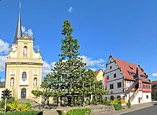
Category:Grettstadt
Jump to navigation
Jump to search
municipality of Germany | |||||
| Upload media | |||||
| Instance of |
| ||||
|---|---|---|---|---|---|
| Part of |
| ||||
| Location | Schweinfurt, Lower Franconia, Bavaria, Germany | ||||
| Head of government |
| ||||
| Population |
| ||||
| Area |
| ||||
| Elevation above sea level |
| ||||
| official website | |||||
 | |||||
Subcategories
This category has the following 10 subcategories, out of 10 total.
D
F
- Friedhof Grettstadt (2 F)
G
Q
- Quellmoor (Grettstadt) (7 F)
R
- Riedwiese (Grettstadt) (10 F)
S
Ü
- Übungsplatz Sulzheim (6 F)
Media in category "Grettstadt"
The following 10 files are in this category, out of 10 total.
-
DEU Grettstadt COA.svg 512 × 596; 35 KB
-
Baum in der Flurabteilung Heidenfelder Weg westlich von Grettstadt.jpg 5,567 × 2,880; 6.85 MB
-
Brunnen vor dem Rathaus in Grettstadt.jpg 5,611 × 3,662; 7.03 MB
-
DEU Grettstadt (a) COA.svg 517 × 610; 30 KB
-
Digitales Orthofoto von Grettstadt (Bayerische Vermessungsverwaltung).tif 25,000 × 20,000; 980.53 MB
-
Grettstadt in SW.svg 569 × 630; 1.2 MB
-
Grettstadt pano 2016.jpg 4,928 × 3,264; 7.14 MB
-
Gänsegehege am östlichen Ortsrand von Grettstadt.jpg 4,160 × 2,391; 4.35 MB
-
Pterophoridae bottom-side.jpg 1,144 × 1,004; 187 KB
-
Wappen Grettstadt.png 158 × 180; 20 KB


