Category:Gressingham
Jump to navigation
Jump to search
English: Gressingham is a small village and civil parish in the City of Lancaster in the English county of Lancashire. It is north of the River Lune and across the river from Hornby. In the 2001 census, it had a population of 153. (→Gressingham)
Nederlands: Gressingham is een plaats en civil parish in het bestuurlijke gebied Lancaster, in het Engelse graafschap Lancashire met 153 inwoners. (→Gressingham)
Polski: Gressingham – wieś w Anglii, w hrabstwie Lancashire, w dystrykcie Lancaster. Leży 78 km na północ od miasta Manchester i 336 km na północny zachód od Londynu. W 2001 miejscowość liczyła 153 mieszkańców. (→Gressingham)
village in the United Kingdom  | |||||
| Upload media | |||||
| Instance of | |||||
|---|---|---|---|---|---|
| Location | Lancaster, Lancashire, North West England, England | ||||
| Population |
| ||||
| Said to be the same as | Gressingham (Wikimedia duplicated page, civil parish) | ||||
 | |||||
Subcategories
This category has the following 2 subcategories, out of 2 total.
L
- Loyn Bridge (12 F)
Media in category "Gressingham"
The following 200 files are in this category, out of 249 total.
(previous page) (next page)-
 A unique metal grave marker, Gressingham - geograph.org.uk - 4665030.jpg 600 × 800; 204 KB
-
 Across the River Lune - geograph.org.uk - 4308817.jpg 4,998 × 3,451; 7.47 MB
-
 Aughton Road - geograph.org.uk - 4579730.jpg 1,600 × 1,067; 565 KB
-
 Aughton Road towards Gressingham - geograph.org.uk - 2464058.jpg 1,600 × 1,200; 660 KB
-
 Aughton Road towards Gressingham - geograph.org.uk - 2464063.jpg 1,600 × 1,200; 508 KB
-
 Aughton Road, Gressingham - geograph.org.uk - 2898412.jpg 640 × 480; 102 KB
-
 B6254 - geograph.org.uk - 5417329.jpg 4,458 × 3,211; 1.52 MB
-
 B6254 near The Haven - geograph.org.uk - 6143482.jpg 1,024 × 769; 85 KB
-
 B6254 towards Kirkby Lonsdale - geograph.org.uk - 5923301.jpg 640 × 480; 70 KB
-
 B6254 towards Kirkby Lonsdale - geograph.org.uk - 5923308.jpg 640 × 480; 58 KB
-
 B6254 west of Springfield Farm - geograph.org.uk - 6143483.jpg 1,024 × 769; 111 KB
-
 Beside Crow Wood - geograph.org.uk - 2061798.jpg 2,816 × 2,112; 1.9 MB
-
 Blockage on the Lune Valley Ramble - geograph.org.uk - 4807429.jpg 640 × 480; 120 KB
-
 Bridge over Gressingham Beck - geograph.org.uk - 3345348.jpg 640 × 425; 241 KB
-
 Bridleway near Gressingham - geograph.org.uk - 1923693.jpg 800 × 531; 165 KB
-
 Bridleway near the Red Well Inn - geograph.org.uk - 4174940.jpg 640 × 480; 110 KB
-
 Bridleway to the Red Well Inn - geograph.org.uk - 2909219.jpg 640 × 480; 119 KB
-
 Bridleway to the Redwell Inn - geograph.org.uk - 2628744.jpg 640 × 480; 74 KB
-
 Cattle and trees near Gressingham - geograph.org.uk - 3978103.jpg 800 × 600; 81 KB
-
 Church of St. John the Evangelist - geograph.org.uk - 4390298.jpg 1,024 × 562; 488 KB
-
 Collapsed wall, Loyn Bridge - geograph.org.uk - 4882144.jpg 640 × 425; 208 KB
-
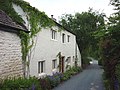
 Cottage near The Snab - geograph.org.uk - 3302089.jpg 2,048 × 1,536; 514 KB
-
 Countryside near Gressingham - geograph.org.uk - 981142.jpg 640 × 427; 54 KB
-
 Countryside west of Gressingham - geograph.org.uk - 4174884.jpg 640 × 480; 75 KB
-

-
 Cows near Gressingham - geograph.org.uk - 2545729.jpg 800 × 569; 74 KB
-
 Crow Trees, Gressingham - geograph.org.uk - 4808142.jpg 640 × 480; 81 KB
-

-
 Date stone, Crow Trees, Gressingham - geograph.org.uk - 4808150.jpg 640 × 480; 87 KB
-
 Dwelling beside The Snab - geograph.org.uk - 2061779.jpg 2,816 × 2,112; 2.56 MB
-
 East parapet, Gressingham Mill Bridge - geograph.org.uk - 4174842.jpg 640 × 480; 134 KB
-
 Eskrigge Farm - geograph.org.uk - 6431829.jpg 1,024 × 768; 253 KB
-
 Eskrigge House - geograph.org.uk - 1918011.jpg 640 × 480; 126 KB
-
 Eskrigge House - geograph.org.uk - 2619835.jpg 640 × 480; 130 KB
-
 Eskrigge House - geograph.org.uk - 6431824.jpg 1,024 × 768; 318 KB
-
 Evening falls at Loyn Bridge - geograph.org.uk - 2287629.jpg 800 × 529; 69 KB
-
 Fall Kirk towards Gressingham - geograph.org.uk - 2464069.jpg 1,600 × 1,200; 463 KB
-
 Farmland near Gressingham - geograph.org.uk - 2464066.jpg 1,600 × 1,200; 585 KB
-
 Farmland off Aughton Road - geograph.org.uk - 4671000.jpg 1,024 × 767; 640 KB
-

-
 Fishing the Lune near Gressingham - geograph.org.uk - 2545726.jpg 960 × 720; 174 KB
-
 Flood damage at the Loyn Bridge - geograph.org.uk - 4808535.jpg 640 × 480; 55 KB
-

-

-

-
 Flooded footpath by River Lune - geograph.org.uk - 2241076.jpg 640 × 425; 194 KB
-
 Flooded road junction at Gressingham - geograph.org.uk - 2241078.jpg 640 × 425; 97 KB
-
 Footbridge and ford, Gressingham - geograph.org.uk - 1918230.jpg 640 × 480; 149 KB
-
 Footbridge in Thrush Gill Wood - geograph.org.uk - 3302122.jpg 2,048 × 1,536; 513 KB
-
 Footbridge in Thrush Gill Wood - geograph.org.uk - 6431848.jpg 1,024 × 768; 334 KB
-
 Footbridge over Gressingham Beck - geograph.org.uk - 5077921.jpg 1,280 × 959; 1.3 MB
-
 Footbridge over Thrush Gill - geograph.org.uk - 2187689.jpg 640 × 425; 277 KB
-
 Footbridge south of Fleets Farm - geograph.org.uk - 3302102.jpg 2,048 × 1,536; 514 KB
-
 Footpath between Storrs Gate and the River Lune - geograph.org.uk - 4308594.jpg 5,179 × 3,451; 4.82 MB
-

-
 Footpath heads for the river from The Snab - geograph.org.uk - 3302092.jpg 2,048 × 1,536; 660 KB
-
 Ford at Gressingham - geograph.org.uk - 4251809.jpg 3,872 × 2,592; 4.56 MB
-
 Ford at Gressingham - geograph.org.uk - 4251828.jpg 3,872 × 2,592; 4.84 MB
-
 Freshly cut grass crop - geograph.org.uk - 1917995.jpg 640 × 480; 133 KB
-
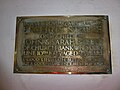
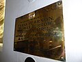
 George Marton memorial panel - geograph.org.uk - 2454143.jpg 640 × 480; 132 KB
-
 Gowan Hall - geograph.org.uk - 5413271.jpg 5,047 × 2,337; 1.75 MB
-
 Grassy path from Eskrigge to Crow Wood - geograph.org.uk - 6431835.jpg 1,024 × 768; 180 KB
-
 Graveyard, Gressingham - geograph.org.uk - 5923914.jpg 1,280 × 1,280; 1.19 MB
-
 Graveyard, Gressingham - geograph.org.uk - 5923915.jpg 1,280 × 1,024; 851 KB
-
 Grazing and woodland near Gowan Hall - geograph.org.uk - 5923316.jpg 640 × 480; 71 KB
-
 Grazing land near Gressingham - geograph.org.uk - 2607108.jpg 640 × 425; 248 KB
-
 Grazing land, Netherby - geograph.org.uk - 2464055.jpg 1,600 × 1,200; 462 KB
-
 Grazing near Springfield - geograph.org.uk - 5923299.jpg 640 × 480; 61 KB
-
 Grazing near the Haven - geograph.org.uk - 5923304.jpg 640 × 480; 57 KB
-
 Gressingham - geograph.org.uk - 2898418.jpg 640 × 480; 138 KB
-
 Gressingham Beck - geograph.org.uk - 2464060.jpg 1,600 × 1,200; 525 KB
-
 Gressingham Church - geograph.org.uk - 2464075.jpg 1,600 × 1,200; 282 KB
-
 Gressingham Hall - geograph.org.uk - 4808742.jpg 640 × 480; 76 KB
-
 High Snab Farm - geograph.org.uk - 1923652.jpg 800 × 531; 138 KB
-
 High Snab Farm - geograph.org.uk - 2628751.jpg 640 × 450; 66 KB
-
 High Snab Farm - geograph.org.uk - 2909224.jpg 640 × 480; 170 KB
-
 High Snab Farm - geograph.org.uk - 5417327.jpg 5,000 × 3,086; 1.89 MB
-
 High Snab Farm - geograph.org.uk - 981148.jpg 640 × 427; 74 KB
-
 Hitching a ride - geograph.org.uk - 5077917.jpg 1,280 × 958; 923 KB
-
 Hornby Castle viewed from the west - geograph.org.uk - 6373523.jpg 4,320 × 3,240; 5.31 MB
-
 Horse jump - geograph.org.uk - 2187688.jpg 640 × 425; 177 KB
-
 House on Fall Kirk - geograph.org.uk - 5077936.jpg 1,280 × 960; 1.17 MB
-
 House, Gressingham village - geograph.org.uk - 2464072.jpg 1,600 × 1,200; 513 KB
-
 House, Gressingham village - geograph.org.uk - 2464082.jpg 1,600 × 1,200; 561 KB
-
 Hut on stilts - geograph.org.uk - 3345360.jpg 640 × 391; 120 KB
-
 Ingleborough - the lion couchant - geograph.org.uk - 1920032.jpg 640 × 480; 71 KB
-

-
 Inscription on grave, Gressingham - geograph.org.uk - 4665035.jpg 483 × 800; 204 KB
-

-

-

-

-
-

-
 June evening on the edge of Melling - geograph.org.uk - 3528224.jpg 800 × 600; 118 KB
-
 Juniper Cottage, Gressingham - geograph.org.uk - 1992543.jpg 1,280 × 960; 386 KB
-
 Lane towards Gressingham - geograph.org.uk - 5923319.jpg 640 × 480; 73 KB
-
 Last light on the Lune - geograph.org.uk - 1862293.jpg 1,280 × 960; 375 KB
-
 Last light on the Lune - geograph.org.uk - 2158399.jpg 480 × 640; 94 KB
-
 Lea Lane - geograph.org.uk - 2909214.jpg 640 × 480; 142 KB
-
 Lea Lane - geograph.org.uk - 2909234.jpg 640 × 480; 154 KB
-
 Lea Lane through Eskrigge - geograph.org.uk - 1918017.jpg 640 × 480; 98 KB
-
 Low House, Eskrigge near Gressingham - geograph.org.uk - 30462.jpg 640 × 480; 63 KB
-

-
 Loyn Bridge - geograph.org.uk - 1862294.jpg 1,280 × 960; 448 KB
-
 Loyn Bridge - geograph.org.uk - 2061845.jpg 2,620 × 2,109; 2.03 MB
-
 Loyn Bridge - geograph.org.uk - 2187685.jpg 640 × 425; 186 KB
-
 Loyn Bridge - geograph.org.uk - 2241070.jpg 640 × 425; 152 KB
-
 Loyn Bridge - geograph.org.uk - 2464084.jpg 1,600 × 1,200; 592 KB
-
 Loyn Bridge - geograph.org.uk - 2607109.jpg 640 × 425; 342 KB
-
 Loyn Bridge - geograph.org.uk - 3302111.jpg 2,048 × 1,536; 541 KB
-
 Loyn Bridge - geograph.org.uk - 4882187.jpg 640 × 425; 178 KB
-
 Loyn Bridge - geograph.org.uk - 6373491.jpg 4,320 × 3,240; 4.98 MB
-
 Loyn Bridge - geograph.org.uk - 6373493.jpg 4,320 × 3,240; 5.46 MB
-
 Loyn Bridge and Marl Hole Wood - geograph.org.uk - 3044977.jpg 800 × 600; 137 KB
-

-

-
 Lune floodplain near Gressingham - geograph.org.uk - 3345378.jpg 640 × 425; 135 KB
-
 Lune Valley drumlin country - geograph.org.uk - 2220193.jpg 640 × 480; 69 KB
-
 Lune Valley Ramble approaching Loyn Bridge - geograph.org.uk - 2061827.jpg 2,816 × 2,112; 2.04 MB
-
 Lune valley, upstream of Loyn Bridge - geograph.org.uk - 3345388.jpg 640 × 425; 129 KB
-

-
 Milk churns awaiting collection - geograph.org.uk - 5095631.jpg 1,280 × 960; 997 KB
-
 Minor road near Gressingham - geograph.org.uk - 1923714.jpg 800 × 531; 166 KB
-
 Minor road out of Gressingham - geograph.org.uk - 2464078.jpg 1,600 × 1,200; 610 KB
-
 Monkeyflower in woodland by the Lune - geograph.org.uk - 3526989.jpg 640 × 480; 83 KB
-

-
 Net bags of stone, Loyn Bridge - geograph.org.uk - 4808722.jpg 640 × 480; 68 KB
-

-
 Pasture, Fleets Farm, Gressingham - geograph.org.uk - 1918203.jpg 640 × 480; 59 KB
-
 Priory Farm across the River Lune - geograph.org.uk - 3302105.jpg 2,048 × 1,536; 520 KB
-
 River Lune - geograph.org.uk - 5077916.jpg 1,280 × 959; 881 KB
-
 River Lune - geograph.org.uk - 5077923.jpg 1,280 × 960; 1.08 MB
-
 River Lune - geograph.org.uk - 981162.jpg 640 × 480; 42 KB
-
 River Lune below Loyn Bridge - geograph.org.uk - 2241072.jpg 640 × 425; 99 KB
-
 River Lune from Loyn Bridge - geograph.org.uk - 2061851.jpg 640 × 480; 60 KB
-
 River Lune near Gressingham - geograph.org.uk - 3345381.jpg 640 × 425; 182 KB
-
 River Lune near Gressingham - geograph.org.uk - 5077918.jpg 1,280 × 960; 1.39 MB
-
 River Lune near Sandbeds - geograph.org.uk - 2061810.jpg 2,816 × 2,112; 2.16 MB
-
 River Lune near the Snab - geograph.org.uk - 3345363.jpg 640 × 425; 192 KB
-
 River Lune northeast of Aughton - geograph.org.uk - 3302083.jpg 2,048 × 1,536; 546 KB
-
 River Lune overflowing its banks south of Loyn Bridge - geograph.org.uk - 3267905.jpg 4,320 × 3,240; 4.82 MB
-
 River Lune South of Arkholme - geograph.org.uk - 4308587.jpg 5,184 × 3,456; 7.17 MB
-

-
 River Lune, upstream of Loyn Bridge - geograph.org.uk - 3345385.jpg 640 × 425; 152 KB
-
 River Lune, upstream of Loyn Bridge - geograph.org.uk - 4775227.jpg 640 × 425; 186 KB
-
 Riverside path near Loyne Bridge - geograph.org.uk - 6431841.jpg 1,024 × 768; 202 KB
-
 Road from Gressingham to Borwick - geograph.org.uk - 1923780.jpg 800 × 531; 169 KB
-
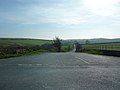
 Road junction near Gressingham - geograph.org.uk - 1923706.jpg 800 × 531; 189 KB
-
 Road junction near Gressingham - geograph.org.uk - 1923789.jpg 800 × 531; 151 KB
-
 Road to High Snab Farm - geograph.org.uk - 2909227.jpg 640 × 480; 153 KB
-
 Road to Low House - geograph.org.uk - 2909238.jpg 640 × 480; 134 KB
-

-
 Rush hour in Gressingham - geograph.org.uk - 5516765.jpg 640 × 480; 70 KB
-
-
 Sheep and Lambs - geograph.org.uk - 139518.jpg 640 × 480; 75 KB
-
 Shingle and grassland, Loyn Bridge - geograph.org.uk - 1998476.jpg 1,200 × 1,600; 1.66 MB
-
 Shingle, Loyn Bridge - geograph.org.uk - 1862296.jpg 1,280 × 960; 512 KB
-
 Spring - a source for Gressingham Beck - geograph.org.uk - 4174963.jpg 640 × 480; 109 KB
-
 Springfield Stables, near Gressingham - geograph.org.uk - 30457.jpg 640 × 480; 119 KB
-
 St John the Evangelist church, Gressingham - geograph.org.uk - 6216472.jpg 2,592 × 1,944; 1.95 MB
-
 St John the Evangelist, Gressingham - geograph.org.uk - 2898428.jpg 640 × 480; 137 KB
-
 St John the Evangelist, Gressingham - geograph.org.uk - 2909207.jpg 640 × 480; 135 KB
-

-

-

-

-

-

-

-

-

-

-

-

-

-

-

-

-

-

-

-

-
-
-

-

-

-

-
-

-

-

-
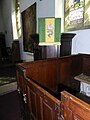
 St John the Evangelist, Gressingham, nave - geograph.org.uk - 5481012.jpg 1,024 × 768; 615 KB
-

-

-

-

-

-


_-_geograph.org.uk_-_4808207.jpg)


_-_geograph.org.uk_-_5510415.jpg)
_-_geograph.org.uk_-_5510467.jpg)
_-_geograph.org.uk_-_5510469.jpg)
_-_geograph.org.uk_-_5516766.jpg)
_-_geograph.org.uk_-_5516767.jpg)
_-_geograph.org.uk_-_5516768.jpg)


_-_geograph.org.uk_-_4808525.jpg)


_-_geograph.org.uk_-_5510470.jpg)
_-_geograph.org.uk_-_5510471.jpg)
_-_geograph.org.uk_-_5516769.jpg)
_-_geograph.org.uk_-_5516770.jpg)
_-_geograph.org.uk_-_5516772.jpg)
_-_geograph.org.uk_-_5516784.jpg)
_-_geograph.org.uk_-_5516785.jpg)


_-_geograph.org.uk_-_5516787.jpg)
_-_geograph.org.uk_-_5516803.jpg)
_-_geograph.org.uk_-_5516804.jpg)
_-_geograph.org.uk_-_5516805.jpg)
_-_geograph.org.uk_-_5516814.jpg)
_-_geograph.org.uk_-_5516807.jpg)
_-_geograph.org.uk_-_5516810.jpg)
_-_geograph.org.uk_-_5516811.jpg)
_-_geograph.org.uk_-_5516812.jpg)
_-_geograph.org.uk_-_5516816.jpg)


