Category:Greenside Mine
Jump to navigation
Jump to search
English: Locality: Greenside Mine, Glenridding, Ullswater, South Eastern Region (Westmorland), Cumbria, England, UK (Locality at mindat.org)
Deutsch: Fundort: Greenside Mine, Glenridding, Ullswater, South Eastern Region (Westmorland), Cumbria, England, Vereinigtes Königreich (Fundort bei mindat.org)
Former lead mine in the Lake District of England | |||||
| Upload media | |||||
| Instance of | |||||
|---|---|---|---|---|---|
| Location |
| ||||
 | |||||
Media in category "Greenside Mine"
The following 20 files are in this category, out of 20 total.
-
Calcite-261743.jpg 454 × 600; 22 KB
-
Frost Encrusted Tree, Greenside - geograph.org.uk - 1106826.jpg 640 × 427; 90 KB
-
Greenside collapse holes.JPG 640 × 427; 187 KB
-
Greenside geology.jpg 350 × 498; 39 KB
-
Greenside Keppel Cove.JPG 640 × 480; 197 KB
-
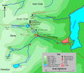
Greenside location map.png 800 × 698; 176 KB
-
Greenside Mine - geograph.org.uk - 747386.jpg 480 × 640; 74 KB
-
Greenside Mine - levels in mountain-side.png 500 × 279; 35 KB
-
Greenside Mine 1910 mine plan.png 1,000 × 658; 414 KB
-
Greenside Mine Smith Shaft.png 500 × 819; 65 KB
-
Greenside Mine, site 2014.JPG 800 × 600; 229 KB
-
Greenside ore wagon.JPG 640 × 480; 225 KB
-
Greenside ore.JPG 640 × 530; 248 KB
-
Greenside Power House 1.JPG 640 × 383; 143 KB
-
Greenside water resources.png 800 × 698; 162 KB
-
Land stabilization, Greenside - geograph.org.uk - 1524182.jpg 640 × 480; 135 KB
-
Mine opening in Glencoyne.JPG 1,024 × 768; 409 KB
-
Rake Head Cottages.JPG 640 × 480; 170 KB
-
Seldom Seen in Glencoyne Dale.JPG 4,349 × 2,786; 4.86 MB
-
Spoil Heaps - geograph.org.uk - 1188758.jpg 480 × 640; 101 KB


