Category:Greenodd
Jump to navigation
Jump to search
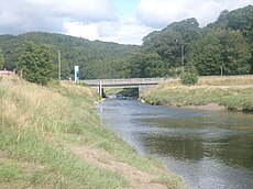
English: Greenodd is a village in the Furness area of the county of Cumbria but within the historical county of Lancashire. For local government purposes the village is also within the area of South Lakeland District. It is located 3 miles (5 km) north-east of Ulverston at the junction of the A590 trunk road and the A5092 trunk road. The village is just outside the boundary of the Lake District National Park at (OS grid ref. SD 315825). Greenodd is within the Crake Valley area of South Lakeland District. The 2001 UK census gives a population of 1823 for the Crake Valley. Greenodd and adjacent Penny Bridge are the main districts in the Crake Valley. The River Crake flows into the estuary of the River Leven at Greenodd. (→Greenodd)
Polski: Greenodd – wieś w Anglii, w Kumbrii, w dystrykcie South Lakeland. Leży 74 km na południe od miasta Carlisle i 361 km na północny zachód od Londynu. (→Greenodd)
village in Cumbria, England | |||||
| Upload media | |||||
| Instance of | |||||
|---|---|---|---|---|---|
| Location | Egton with Newland, South Lakeland, Cumbria, North West England, England | ||||
 | |||||
Media in category "Greenodd"
The following 40 files are in this category, out of 40 total.
-
Country Road - geograph.org.uk - 141272.jpg 640 × 480; 110 KB
-
Country Seat - geograph.org.uk - 126968.jpg 640 × 426; 80 KB
-
Crakeside Fish ^ Chips, Greenodd - geograph.org.uk - 3021490.jpg 640 × 480; 122 KB
-
Farm Buildings Plumpton - geograph.org.uk - 99274.jpg 640 × 480; 101 KB
-
Footbridge over the river Leven - geograph.org.uk - 612948.jpg 640 × 439; 106 KB
-
Greenodd geograph-3581461-by-Ben-Brooksbank.jpg 2,336 × 1,360; 2.45 MB
-
Greenodd Sands - geograph.org.uk - 2193407.jpg 640 × 457; 171 KB
-
Greenodd Sands - geograph.org.uk - 2193414.jpg 640 × 457; 181 KB
-
Greenodd Sands - geograph.org.uk - 2193433.jpg 640 × 457; 152 KB
-
Greenodd Sands - geograph.org.uk - 83646.jpg 640 × 480; 75 KB
-
Greenodd Sands from Nab Point - geograph.org.uk - 1405566.jpg 640 × 425; 94 KB
-
Greenodd Village Stores - geograph.org.uk - 1818710.jpg 640 × 480; 105 KB
-
Happy days - geograph.org.uk - 126972.jpg 640 × 426; 150 KB
-
Lady Syke, across the Levens Estuary - geograph.org.uk - 126983.jpg 640 × 426; 51 KB
-
Old Lime Kiln - geograph.org.uk - 609783.jpg 640 × 472; 131 KB
-
Road to Barrow - geograph.org.uk - 1405214.jpg 640 × 457; 344 KB
-
The Ship Inn, Greenodd - geograph.org.uk - 1818657.jpg 640 × 480; 87 KB
-
View across Greenodd Sands - geograph.org.uk - 1405565.jpg 640 × 425; 73 KB
-
Beck near Bowstead Gates - geograph.org.uk - 141256.jpg 480 × 640; 143 KB
-
Ben Crag - geograph.org.uk - 187758.jpg 600 × 450; 228 KB
-
Coastal wall - geograph.org.uk - 1405598.jpg 640 × 425; 107 KB
-
Cumbria Coastal Way - geograph.org.uk - 613243.jpg 640 × 618; 130 KB
-
Estuary of the River Leven - geograph.org.uk - 84139.jpg 640 × 480; 77 KB
-
Field stream near Plumpton - geograph.org.uk - 1405593.jpg 640 × 425; 101 KB
-
From the country seat.. - geograph.org.uk - 126970.jpg 640 × 426; 74 KB
-
Furness Wildflowers Association sign - geograph.org.uk - 1405569.jpg 640 × 425; 116 KB
-
Great Oath Hill - geograph.org.uk - 190157.jpg 640 × 480; 79 KB
-
Greenodd Estuary Footbridge - geograph.org.uk - 98207.jpg 640 × 480; 57 KB
-
Hollin Hall - geograph.org.uk - 126966.jpg 640 × 426; 99 KB
-
Leven estuary at Greenodd - geograph.org.uk - 310381.jpg 640 × 424; 85 KB
-
Low Scathwaite - geograph.org.uk - 141264.jpg 640 × 480; 100 KB
-
Path in Roudsea Wood - geograph.org.uk - 609727.jpg 640 × 472; 150 KB
-
Road to Frith Hall - geograph.org.uk - 155062.jpg 480 × 640; 80 KB
-
The Leven Estuary - geograph.org.uk - 210418.jpg 640 × 480; 144 KB
-
Wall and Woods - geograph.org.uk - 190158.jpg 480 × 640; 157 KB


