Category:Greenmount, Greater Manchester
Jump to navigation
Jump to search
English: Greenmount is a village amongst the West Pennine Moors, within the northern area of the Metropolitan Borough of Bury, in Greater Manchester, England.
village in Greater Manchester, England, UK  | |||||
| Upload media | |||||
| Instance of | |||||
|---|---|---|---|---|---|
| Location | Bury, Greater Manchester, North West England, England | ||||
 | |||||
Media in category "Greenmount, Greater Manchester"
The following 42 files are in this category, out of 42 total.
-
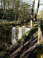 "Waterfall" in Redisher Woods - geograph.org.uk - 373004.jpg 480 × 640; 161 KB
-
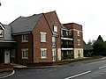 Apartments, Greenmount - geograph.org.uk - 469959.jpg 640 × 480; 108 KB
-
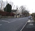
 B6215, Greenmount - geograph.org.uk - 470388.jpg 480 × 640; 72 KB
-
 Brandlesholme Road - geograph.org.uk - 2772909.jpg 2,986 × 2,673; 3.22 MB
-
 Brandlesholme Road and URC, Greenmount - geograph.org.uk - 1743760.jpg 2,112 × 2,816; 750 KB
-
 Brandlesholme Road, Greenmount - geograph.org.uk - 1627222.jpg 640 × 428; 70 KB
-
 Brandlesholme Road, Greenmount - geograph.org.uk - 1627237.jpg 640 × 428; 65 KB
-
 Brookhouse, Tottington - panoramio.jpg 1,600 × 1,058; 252 KB
-
 Footpath off Brandlesholme Road - geograph.org.uk - 2772972.jpg 4,000 × 3,000; 6.35 MB
-
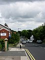
 Greenmount - geograph.org.uk - 374611.jpg 640 × 480; 80 KB
-
 Greenmount Community Centre - panoramio - jolmartyn.jpg 3,072 × 2,304; 3.17 MB
-
 Greenmount Community Centre - panoramio.jpg 3,072 × 2,304; 2.79 MB
-
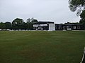 Greenmount Cricket Club - Pavilion - geograph.org.uk - 2982766.jpg 1,600 × 1,200; 303 KB
-
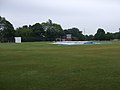 Greenmount Cricket Club - Scoreboard - geograph.org.uk - 2982754.jpg 1,600 × 1,200; 298 KB
-
 Greenmount Golf Club - geograph.org.uk - 6652442.jpg 6,000 × 4,000; 4.42 MB
-
 Greenmount Medical Centre - geograph.org.uk - 469961.jpg 640 × 480; 125 KB
-
 Greenmount Old School Community Centre - geograph.org.uk - 1743724.jpg 2,350 × 1,763; 683 KB
-
 Greenmount Primary School - geograph.org.uk - 1627244.jpg 640 × 428; 104 KB
-
 Greenmount Primary School - panoramio.jpg 3,072 × 2,304; 3.06 MB
-
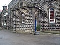
 Greenmount United Reformed Church - geograph.org.uk - 1743773.jpg 1,538 × 2,050; 438 KB
-
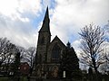 Greenmount United Reformed Church - geograph.org.uk - 3798605.jpg 1,024 × 768; 424 KB
-
 Greenmount United Reformed Church - geograph.org.uk - 85701.jpg 426 × 640; 61 KB
-
 Greenmount Village - geograph.org.uk - 5023166.jpg 640 × 640; 437 KB
-

-
 Greenmount Village War Memorial - geograph.org.uk - 5023185.jpg 640 × 480; 529 KB
-
 Greenmount,peeltower,rain.jpg 1,600 × 800; 124 KB
-
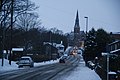
 Greenmount,peeltower,snow.jpg 1,600 × 802; 175 KB
-
 Higher Ridge - geograph.org.uk - 4869576.jpg 2,048 × 1,536; 593 KB
-

-
 Hollymount housing - geograph.org.uk - 470378.jpg 640 × 480; 116 KB
-
 Longsight Road, Holcombe Brook - geograph.org.uk - 1627203.jpg 640 × 428; 68 KB
-
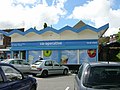 New Co-op Holcombe Brook - geograph.org.uk - 497229.jpg 640 × 480; 105 KB
-
 New Hoyles - geograph.org.uk - 1751826.jpg 3,872 × 2,592; 5.67 MB
-
 Ruined outbuilding, two Brooks Valley - geograph.org.uk - 470353.jpg 640 × 480; 130 KB
-
 Soggy path near Holly Mount - geograph.org.uk - 6652461.jpg 6,000 × 4,000; 4.63 MB
-
 Stream under Brandlesholme Road - geograph.org.uk - 2772932.jpg 4,000 × 3,000; 7.03 MB
-
 The first hint of autumn - geograph.org.uk - 4676612.jpg 6,000 × 4,000; 5.02 MB
-
 To Lumb Carr Road - geograph.org.uk - 3764512.jpg 3,648 × 2,736; 4.88 MB
-
 Toby Carvery at Bulls Head - geograph.org.uk - 470390.jpg 640 × 480; 102 KB
-
 Two Brooks Valley - geograph.org.uk - 6652495.jpg 6,000 × 4,000; 5.03 MB
-
 Two Brooks Valley - geograph.org.uk - 6652509.jpg 6,000 × 4,000; 6.03 MB
-
 Two footpaths leave from this point - geograph.org.uk - 1627213.jpg 640 × 428; 51 KB


_-_geograph.org.uk_-_1769090.jpg)


