Category:Greek-language SVG maps
Jump to navigation
Jump to search
Subcategories
This category has the following 3 subcategories, out of 3 total.
Media in category "Greek-language SVG maps"
The following 65 files are in this category, out of 65 total.
-
2022 Russian invasion of Ukraine.svg 2,199 × 1,478; 4.36 MB
-
2022 Russian invasion of Ukraine; 31 December 2023.svg 2,199 × 1,478; 3.68 MB
-
Aegean with legend EL.svg 553 × 600; 148 KB
-
Aegean with legend EL2.svg 553 × 600; 148 KB
-
Alps-Mediterranean Euroregion map-el.svg 1,465 × 1,126; 344 KB
-
Anaximander world map-el.svg 1,063 × 1,063; 11 KB
-
Argentina - mapa de las provincias - el.svg 908 × 1,581; 765 KB
-
Corfu topographic map-el.svg 2,100 × 2,345; 2.45 MB
-
Crete integrated map-el.svg 900 × 425; 266 KB
-
Eesti maakonnad 2006 el.svg 884 × 636; 535 KB
-
Epirus across Greece and Albania el.svg 744 × 1,052; 159 KB
-
EpirusInLayers.svg 744 × 1,052; 1.51 MB
-
Euro2008 venues el.svg 730 × 320; 183 KB
-
France map Lambert-93 with regions and departments-occupation-el.svg 1,996 × 1,894; 718 KB
-
Gaza Strip el.svg 725 × 888; 425 KB
-
Gaza Strip map el.svg 839 × 906; 159 KB
-
Gde.svg 1,151 × 774; 1.22 MB
-
Georgia, Ossetia, Russia and Abkhazia (el).svg 676 × 400; 118 KB
-
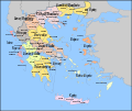
Greece subnat el.svg 5,102 × 4,312; 1.87 MB
-
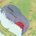
Illyrian Tribes satellite Map (Greek).svg 947 × 791; 2.36 MB
-
Illyrians (Greek).svg 1,600 × 1,600; 5.11 MB
-
Imbros Tenedos map location el.svg 725 × 674; 427 KB
-
Imia with legends el.svg 570 × 588; 86 KB
-
Isle of Man topographic map-el.svg 1,200 × 1,100; 653 KB
-
Laptev Sea map-el.svg 1,498 × 839; 310 KB
-
Macedonia overview-el.svg 556 × 589; 553 KB
-
Map New Zealand-el.svg 1,313 × 1,618; 1.27 MB
-
Map of Barbados.svg 1,170 × 1,442; 187 KB
-
Map of Dominica.svg 1,167 × 1,440; 329 KB
-
Map of French Guiana.svg 1,283 × 1,581; 446 KB
-
Map of Iceland el.svg 1,834 × 1,489; 732 KB
-
Map of Ioannina prefecture.svg 744 × 1,052; 938 KB
-
Map of Martinique.svg 1,170 × 1,442; 305 KB
-
Map of Mayotte.svg 1,025 × 1,262; 199 KB
-
Map of Montserrat el.svg 1,168 × 1,440; 162 KB
-
Map of region of Campania, Italy, with provinces-el.svg 2,045 × 1,861; 105 KB
-
Map of Saint Kitts and Nevis el.svg 1,168 × 1,439; 186 KB
-
Map of sinitic languages-el.svg 437 × 981; 282 KB
-
Map of United Kingdom.svg 1,156 × 1,424; 991 KB
-
Map provinces Netherlands-el.svg 743 × 881; 887 KB
-
October 2023 Gaza−Israel conflict.svg 3,763 × 3,258; 8.43 MB
-
Plan Olympia sanctuary-el.svg 2,500 × 1,580; 834 KB
-
Plan Pella-el.svg 389 × 500; 72 KB
-
Plan Troy-Hisarlik-el.svg 1,280 × 1,155; 100 KB
-
Plates tect2-el.svg 4,167 × 2,844; 244 KB
-
Provinces of Belgium with CoA-el.svg 1,000 × 819; 1.67 MB
-
Ribbentrop-Molotov-gr.svg 1,052 × 744; 253 KB
-
Seven Hills of Rome-el.svg 654 × 624; 23 KB
-
Standard time zones of the world (2012, with Exclusive Economic Zones) EL.svg 1,672 × 900; 1.9 MB
-
Stroomgebied van de Maas-el.svg 660 × 1,000; 227 KB
-
Thessaloniki historical center el.svg 741 × 945; 272 KB
-
Tribes in Illyria (Greek).svg 1,600 × 1,600; 5.18 MB
-
Troas el.svg 520 × 539; 93 KB
-
Turkey-kizilirmak el.svg 553 × 309; 790 KB
-
Ukraine September 2022.svg 2,199 × 1,478; 2.33 MB
-
Weserübung el.svg 321 × 581; 121 KB
-
World 2000 BC EL.svg 4,500 × 2,234; 824 KB
-
World alphabets & writing systems EL.svg 2,714 × 1,256; 2.97 MB
-
World map pol 2005 v02 GRK.svg 2,753 × 1,538; 2.39 MB
-
Ακρωτηρίου και Δεκέλιας.svg 1,080 × 581; 2.93 MB
-
Ελληνικές αποικίες Ευξείνου Πόντου.svg 1,280 × 684; 350 KB
-
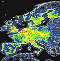
Ευρώπη.jpg 199 × 200; 61 KB
-
Ινδοελληνικό βασίλειο.svg 970 × 981; 322 KB
-
Νησιά της ελληνικής επικράτειας.svg 1,288 × 1,059; 791 KB
-
Χάρτης της Κεντρικής Ασία 130 π.Χ..svg 800 × 478; 331 KB


