Category:Great Stainton
Jump to navigation
Jump to search
English: Great Stainton is a village in the borough of Darlington and ceremonial county of County Durham, England. It is situated to the north of Darlington, and to the west of Stockton-on-Tees.
village in the United Kingdom  | |||||
| Upload media | |||||
| Instance of | |||||
|---|---|---|---|---|---|
| Location | Darlington, County Durham, North East England, England | ||||
| Population |
| ||||
 | |||||
Subcategories
This category has only the following subcategory.
Media in category "Great Stainton"
The following 57 files are in this category, out of 57 total.
-
 Bishopton Lane - geograph.org.uk - 3227920.jpg 640 × 480; 88 KB
-
 Bishopton Lane heading north - geograph.org.uk - 3227915.jpg 640 × 480; 69 KB
-
 Boundary Marker , Newton Ketton. - geograph.org.uk - 161116.jpg 640 × 479; 152 KB
-
 Brafferton, Preston Lodge - geograph.org.uk - 6821404.jpg 1,600 × 1,200; 304 KB
-
 Bridleway at Petty's Nook - geograph.org.uk - 167527.jpg 480 × 640; 112 KB
-
 Catkill Lane. - geograph.org.uk - 161156.jpg 640 × 479; 146 KB
-
 Cattle, Whinny Hill - geograph.org.uk - 5258504.jpg 1,024 × 683; 275 KB
-
 Drive to Broad Lea Farm - geograph.org.uk - 2816185.jpg 3,648 × 2,736; 2.22 MB
-
 Elstob Hall. - geograph.org.uk - 189667.jpg 640 × 404; 85 KB
-
 Entering Darlington - geograph.org.uk - 6613763.jpg 1,600 × 1,075; 355 KB
-
 Entrance to Lea Close Farm - geograph.org.uk - 6613770.jpg 1,600 × 1,065; 406 KB
-
 Farmhouse at Stainton Hill House Farm - geograph.org.uk - 2580146.jpg 3,648 × 2,736; 2.72 MB
-
 Farmhouse at Town Farm - geograph.org.uk - 6264247.jpg 1,600 × 927; 514 KB
-
 Farmland off Bishopton Lane - geograph.org.uk - 3227911.jpg 640 × 480; 60 KB
-
 Farmland, Hauxley Farm - geograph.org.uk - 3227924.jpg 640 × 398; 42 KB
-
 Farmland, Oat Hill Farm - geograph.org.uk - 3227938.jpg 640 × 480; 68 KB
-
 Field with straw - geograph.org.uk - 6262834.jpg 1,600 × 837; 390 KB
-
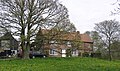
 Great Stainton - geograph.org.uk - 2051165.jpg 600 × 450; 300 KB
-
 Great Stainton - geograph.org.uk - 5944229.jpg 1,024 × 768; 205 KB
-
 Great Stainton - geograph.org.uk - 5944230.jpg 1,024 × 768; 275 KB
-
 Grindon Lane. - geograph.org.uk - 178059.jpg 640 × 343; 85 KB
-
 Kings Arms , Great Stainton. - geograph.org.uk - 178054.jpg 640 × 494; 107 KB
-
 Kings Arms public house, Great Stainton - geograph.org.uk - 6613773.jpg 1,600 × 1,065; 484 KB
-
 Kings Arms, Great Stainton - geograph.org.uk - 2051155.jpg 600 × 450; 321 KB
-
 Lane to Hauxley Farm. - geograph.org.uk - 178057.jpg 640 × 479; 78 KB
-
 Lodge Lane - geograph.org.uk - 5258507.jpg 1,024 × 683; 364 KB
-
 Lodge Lane east towards Great Stainton - geograph.org.uk - 2580159.jpg 3,648 × 2,736; 1.98 MB
-
 Looking north to Great Stainton. - geograph.org.uk - 177992.jpg 640 × 479; 119 KB
-
 Minor road towards Bishopton - geograph.org.uk - 3227922.jpg 640 × 480; 80 KB
-
 Minor road towards Brafferton - geograph.org.uk - 3227928.jpg 640 × 480; 59 KB
-
 Power Cables in the snow - geograph.org.uk - 594108.jpg 640 × 480; 179 KB
-
 Preston Lodge - geograph.org.uk - 3227930.jpg 640 × 432; 86 KB
-
 Public right of way towards Viewley Hill Farm - geograph.org.uk - 6613777.jpg 1,600 × 1,065; 439 KB
-
 Road junction east of Great Stainton - geograph.org.uk - 6613767.jpg 1,600 × 1,075; 390 KB
-
 Salters Lane heading south - geograph.org.uk - 3227933.jpg 640 × 480; 99 KB
-
 The King's Arms - geograph.org.uk - 6262609.jpg 1,600 × 967; 539 KB
-
 Track to Hauxley Farm - geograph.org.uk - 3227927.jpg 640 × 480; 43 KB
-
 Track towards All Saints Church - geograph.org.uk - 3227917.jpg 640 × 480; 142 KB
-
 Viewley Hill Farm - geograph.org.uk - 2580169.jpg 3,648 × 2,736; 2.86 MB
-
 Viewley Hill Farm - geograph.org.uk - 3227913.jpg 2,736 × 1,504; 363 KB
-
 Viewly Hill Farm. - geograph.org.uk - 178051.jpg 640 × 286; 50 KB
-

-
 Bracken Hill - geograph.org.uk - 481700.jpg 640 × 480; 62 KB
-
 Byer's Gill Wood - geograph.org.uk - 481861.jpg 640 × 480; 93 KB
-
 Dales View Farm. - geograph.org.uk - 161227.jpg 640 × 479; 85 KB
-
 Dogs Trust, Hill House Farm, Sadberge - geograph.org.uk - 167521.jpg 640 × 480; 74 KB
-
 Fir Tree Farm , Salters Lane. - geograph.org.uk - 161146.jpg 640 × 379; 71 KB
-
 Footpath from the bend at Elstob - geograph.org.uk - 418711.jpg 480 × 640; 103 KB
-
 Hauxley Farm - geograph.org.uk - 481823.jpg 640 × 480; 90 KB
-
 High Grindon , Deserted Medieval Village. - geograph.org.uk - 178064.jpg 640 × 479; 113 KB
-
 Moor House Farm. - geograph.org.uk - 161163.jpg 640 × 478; 69 KB
-
 Newton Ketton Farm. - geograph.org.uk - 161128.jpg 640 × 423; 112 KB
-
 Newton Ketton. - geograph.org.uk - 161140.jpg 640 × 380; 125 KB
-
 Pasture, Lea Close - geograph.org.uk - 151448.jpg 640 × 480; 98 KB
-
 Petty's Nook. - geograph.org.uk - 161193.jpg 640 × 479; 68 KB
-
 Roman Road. - geograph.org.uk - 161218.jpg 640 × 479; 78 KB
-
 Track to Broad Lea - geograph.org.uk - 151446.jpg 640 × 480; 45 KB


