Category:Great Salkeld
Jump to navigation
Jump to search
English: Great Salkeld is a small village and civil parish in Eden district, Cumbria, England, a few miles to the north east of Penrith.
village and civil parish in Cumbria, UK  | |||||
| Upload media | |||||
| Instance of | |||||
|---|---|---|---|---|---|
| Location | Eden, Cumbria, North West England, England | ||||
| Population |
| ||||
| Said to be the same as | Great Salkeld (Wikimedia duplicated page, civil parish) | ||||
 | |||||
Subcategories
This category has the following 5 subcategories, out of 5 total.
C
G
- Great Salkeld War Memorial (1 F)
L
- Long Meg viaduct (6 F)
N
- North Dykes (1 F)
S
- Salkeld Dykes (1 F)
Media in category "Great Salkeld"
The following 75 files are in this category, out of 75 total.
-

-
 B6412 heading north past Scatterbeck House - geograph.org.uk - 6624838.jpg 1,024 × 683; 289 KB
-
 Boundary stone beside loop of old road off B6412 - geograph.org.uk - 6625131.jpg 1,024 × 683; 296 KB
-
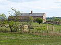
 Burrell Green Farm - geograph.org.uk - 6631800.jpg 640 × 480; 92 KB
-
 Chapel Cottage, Green Lane - geograph.org.uk - 6627441.jpg 1,024 × 683; 199 KB
-
 Clay pigeon shooting range - geograph.org.uk - 6631488.jpg 640 × 458; 79 KB
-
 Cottage at Salkeld Dykes - geograph.org.uk - 6631801.jpg 640 × 480; 103 KB
-
 Crossing The Eden - geograph.org.uk - 5713806.jpg 640 × 410; 79 KB
-
 Crossroads in North Dykes - geograph.org.uk - 6627504.jpg 1,024 × 683; 169 KB
-

-

-

-
 Derelict Farm Shed - geograph.org.uk - 6590310.jpg 1,600 × 666; 390 KB
-
 Descent into Great Salkeld - geograph.org.uk - 5780712.jpg 640 × 480; 285 KB
-
 Driveway to Chambers Common Farm - geograph.org.uk - 6631795.jpg 640 × 480; 84 KB
-
 Driveway to Green Ghyll farm - geograph.org.uk - 5780676.jpg 640 × 480; 323 KB
-
 Eden valley - geograph.org.uk - 5781239.jpg 640 × 480; 237 KB
-

-
 Farm building at Salkeld Dykes - geograph.org.uk - 5780697.jpg 640 × 480; 246 KB
-
 Farm buildings at Salkeld Dykes - geograph.org.uk - 5780699.jpg 640 × 480; 268 KB
-
 Farm buildings at Salkeld Dykes - geograph.org.uk - 6631802.jpg 640 × 480; 73 KB
-
 Farmland, Great Salkeld - geograph.org.uk - 4335538.jpg 640 × 480; 149 KB
-
 Farmland, Great Salkeld - geograph.org.uk - 4335586.jpg 640 × 480; 170 KB
-
 Field above Salkeld Dykes - geograph.org.uk - 6631787.jpg 640 × 480; 91 KB
-
 Field entrance near Green Ghyll Farm - geograph.org.uk - 5780672.jpg 640 × 480; 294 KB
-
 Field of beet below Ladyrigg Farm - geograph.org.uk - 6631797.jpg 640 × 480; 96 KB
-
 Fields above the Faulds - geograph.org.uk - 6631785.jpg 640 × 480; 69 KB
-
 Fields at junction of B6412 and road to Plumpton - geograph.org.uk - 6620760.jpg 683 × 1,024; 219 KB
-

-
 Force Mill, Great Salkeld - geograph.org.uk - 1168820.jpg 640 × 474; 133 KB
-
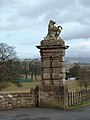 Gate Pillar Gargoyle - geograph.org.uk - 1776973.jpg 768 × 1,024; 161 KB
-
 Grazing Horse near Greengill and Wan Fell - geograph.org.uk - 153835.jpg 640 × 480; 111 KB
-
 Great Salkeld Village Hall - geograph.org.uk - 5781236.jpg 640 × 480; 340 KB
-
 Green Ghyll Farm - geograph.org.uk - 5780668.jpg 640 × 480; 281 KB
-

-
 Inglewood Christmas Trees - geograph.org.uk - 6631790.jpg 640 × 480; 87 KB
-
 Inglewood Christmas Trees - geograph.org.uk - 6631792.jpg 640 × 480; 96 KB
-
 Mill Race, Little Salkeld - geograph.org.uk - 50095.jpg 640 × 480; 173 KB
-

-
 Old Wood near Inglewoodbank - geograph.org.uk - 6631494.jpg 640 × 457; 70 KB
-
 Overgrown track near Great Salkeld - geograph.org.uk - 6590305.jpg 1,600 × 778; 541 KB
-
 Recycling centre, Great Salkeld - geograph.org.uk - 5781238.jpg 640 × 481; 246 KB
-
 Road from Great Salkeld to Lazonby - geograph.org.uk - 5781223.jpg 640 × 481; 286 KB
-
 Salkeld Dykes Methodist Church - geograph.org.uk - 5780705.jpg 640 × 480; 264 KB
-
 Salkeld Dykes Road - geograph.org.uk - 6454461.jpg 640 × 360; 76 KB
-

-
 Settle Carlisle Railway - geograph.org.uk - 50098.jpg 640 × 480; 125 KB
-
 Shed on Keld Farm - geograph.org.uk - 5780682.jpg 640 × 480; 265 KB
-
 Sheep at Beckbank - geograph.org.uk - 153658.jpg 640 × 480; 188 KB
-

-
 Signpost at crossroads west of Salked Dykes - geograph.org.uk - 6625813.jpg 1,024 × 683; 154 KB
-

-
 St Cuthbert's Church - geograph.org.uk - 6627337.jpg 1,024 × 683; 140 KB
-
 The Eden Valley - geograph.org.uk - 5713793.jpg 640 × 385; 86 KB
-
 The Faulds - geograph.org.uk - 6631783.jpg 640 × 438; 79 KB
-
 The Lodge and Entrance, Inglewood Bank - geograph.org.uk - 955607.jpg 640 × 425; 105 KB
-

-
 View across B6412 at parish boundary - geograph.org.uk - 6622501.jpg 1,024 × 683; 222 KB
-
 View across B6412 at Wain Gate junction - geograph.org.uk - 6625084.jpg 683 × 1,024; 189 KB
-
 View along Wain Gate from B6412 - geograph.org.uk - 6625092.jpg 1,024 × 683; 173 KB
-
 View from Lacy's Caves, Glassonby - geograph.org.uk - 1170778.jpg 496 × 640; 103 KB
-
 View of fields over Scatter Beck from footpath - geograph.org.uk - 6627546.jpg 1,024 × 683; 260 KB
-
 View to fields from T-junction in South Dykes - geograph.org.uk - 6625691.jpg 683 × 1,024; 198 KB
-

-
 A nice Sward up to the woods. - geograph.org.uk - 146668.jpg 640 × 332; 33 KB
-
 Avenue of Trees at Chambers Common - geograph.org.uk - 251992.jpg 426 × 640; 241 KB
-
 Bridleway Near Chambers Common - geograph.org.uk - 251987.jpg 640 × 426; 296 KB
-
 Chambers Common - geograph.org.uk - 251989.jpg 640 × 426; 262 KB
-
 Farm at Halfwaywell - geograph.org.uk - 242901.jpg 640 × 426; 132 KB
-
 Field near Halfwaywell - geograph.org.uk - 242249.jpg 640 × 426; 125 KB
-
 Grounds of Nunwick Hall - geograph.org.uk - 153652.jpg 640 × 480; 163 KB
-
 Ladyrigg Farm - geograph.org.uk - 251982.jpg 640 × 426; 211 KB
-
 Looking NE to Half Moon Wood - geograph.org.uk - 242247.jpg 640 × 426; 116 KB
-
 Near Halfwaywell - geograph.org.uk - 242905.jpg 640 × 426; 105 KB
-
 Public Bridleway to Salkeld Dykes - geograph.org.uk - 153642.jpg 640 × 480; 117 KB


