Category:Graphs and maps by User:Podzemnik
Jump to navigation
Jump to search
Subcategories
This category has only the following subcategory.
A
Media in category "Graphs and maps by User:Podzemnik"
The following 57 files are in this category, out of 57 total.
-
 African continent-cs.svg 1,525 × 1,440; 674 KB
-
 Ancient India cs.png 800 × 655; 115 KB
-
 Angkor Wat map(cs).svg 1,768 × 1,235; 123 KB
-
 Bird migration - chain migration.svg 512 × 667; 25 KB
-
 Bird migration - leapfrog migration.svg 512 × 667; 28 KB
-
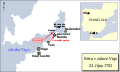
 Bitva v zátoce Vigo.png 1,768 × 1,052; 203 KB
-
 Bitva v zátoce Vigo.svg 1,052 × 627; 48 KB
-
 Borobudur-Pawon-Mendut-cs.png 802 × 395; 152 KB
-
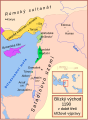
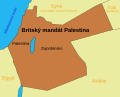 BritishMandatePalestine1920-cs.svg 675 × 542; 14 KB
-
 Bycatch - tori lines (streamer lines).svg 4,734 × 2,367; 213 KB
-
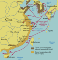
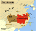 Cina roku 1365.svg 672 × 580; 1.14 MB
-
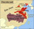 Cina v roce 1358.svg 672 × 580; 1.1 MB
-
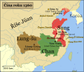 Cina v roce 1360.svg 672 × 580; 1.07 MB
-
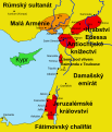
 Crusader States 1190 cs.svg 978 × 1,330; 250 KB
-
 Dravidske jazyky.png 2,923 × 2,717; 1.59 MB
-
 Dutch and Portuguese in Asia c. 1665-cs.svg 771 × 591; 191 KB
-
 EdictsOfAshoka-cs.png 1,811 × 1,669; 1.06 MB
-
 Harappska kultura.svg 699 × 641; 121 KB
-
 Historic Tibet Map-cs.svg 1,213 × 760; 508 KB
-
 Italy 1000 AD-cs.svg 565 × 811; 673 KB
-
 Italy and Illyria 1084 AD-cs.svg 588 × 735; 399 KB
-
 Kingdom of Sicily 1154-cs.svg 712 × 807; 670 KB
-
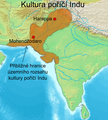 Kultura poříčí Indu.png 1,234 × 1,366; 798 KB
-
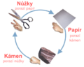 Kámen, nůžky, papír.png 833 × 667; 202 KB
-
 Křižácké státy.png 457 × 817; 385 KB
-
 Laurasia-Gondwana-cs.svg 519 × 435; 28 KB
-
 Map Crusader states 1102-cs.svg 589 × 687; 148 KB
-
 Map Crusader states 1135-cs.svg 978 × 1,330; 169 KB
-
 Map Crusader states 1190-cs.svg 507 × 690; 445 KB
-
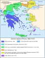 Map Greece expansion 1832-1947-cs-2.svg 734 × 962; 111 KB
-
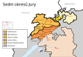 Map of the jurassic districts - cs.svg 739 × 502; 1.28 MB
-
 Map Índia Portuguesa-cs.svg 512 × 622; 62 KB
-
 Mapa Kalingy.PNG 1,565 × 1,666; 960 KB
-
 Mapa Lumbiní.svg 925 × 1,600; 166 KB
-
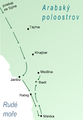
 Mapa pouti do mekky.svg 1,123 × 680; 36 KB
-
 Mapka bitvy u Badru.png 668 × 966; 92 KB
-
 Mattheus Seuter, Ducatus Teschenensis - Horní Suchá.jpg 920 × 624; 501 KB
-
 Maurjovská říše.png 1,877 × 1,672; 1.11 MB
-
 Mingská Čína za největšího rozmachu.jpg 3,632 × 3,496; 1.34 MB
-
 Mingská Čína, nájezdy japonských pirátů.png 2,000 × 2,088; 759 KB
-
 Norwegianmalforms-cz verze.png 700 × 785; 42 KB
-
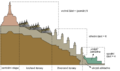
 Ocean floor basic diagram EN.svg 1,920 × 1,080; 153 KB
-
 Pitcairnovy ostrov.png 1,094 × 1,173; 106 KB
-
 Plánek Borobuduru.png 4,333 × 2,550; 345 KB
-
 Provincie říše Ming.svg 628 × 641; 634 KB
-
 Saturn.Aurora.HST.UV-Vis-2.png 1,000 × 1,008; 727 KB
-
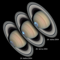
 Saturnoppositions-cs.png 2,140 × 2,457; 1.31 MB
-
 Schéma oceánského dna.svg 3,167 × 1,781; 105 KB
-
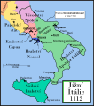 Southern Italy 1112-cs.svg 712 × 807; 669 KB
-
 Stewart Island map-cs (coldfish to ulva).svg 1,710 × 1,635; 1.71 MB
-
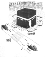 Tavaf (cs).png 1,744 × 2,214; 2.52 MB
-
 TecnaRovina.png 650 × 650; 23 KB
-
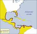 The Spanish Main-cs.svg 803 × 726; 171 KB
-
 WikiProjekt Chráněná území - logo EN.png 1,433 × 1,437; 192 KB
-
 WikiProjekt Chráněná území - logo.png 1,425 × 1,433; 178 KB
-
 WikiProjekt Chráněná území - logo.svg 510 × 510; 17 KB
-
 Říše Ming.png 2,304 × 2,344; 1.72 MB


.svg)


.svg)


.svg)
.png)


