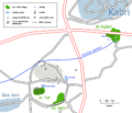
Category:Graphical derivatives of Survey of Palestine maps
Jump to navigation
Jump to search
Media in category "Graphical derivatives of Survey of Palestine maps"
The following 8 files are in this category, out of 8 total.
-
ArtufHavtuv.png 826 × 906; 46 KB
-
DeganiaRegion.png 1,048 × 1,034; 82 KB
-
Elyashiv1941.jpg 500 × 684; 196 KB
-
Fasayil.png 500 × 649; 15 KB
-
KiryatGat.png 877 × 701; 28 KB
-
Lydda and Ramla area - 9 July 1948.PNG 823 × 1,263; 92 KB
-
Mishmar HaEmek region.png 698 × 677; 33 KB
-
TelKabriRegion.png 1,002 × 862; 58 KB


