Category:Graphic Lab tools
Jump to navigation
Jump to search

Hello, a "Graphic LAb tools" category is open for putting inside all files (mostly svg files) which will be useful to use, again and again, and be really convenient for all the graphists, or are pedagogic.
This may include :
- Most-used blind maps.
- The Wikiman 1m80.svg
- Examples of map legend.
- Color gradients.
- ...
There is a selection of useful graphic tools. All blank maps shouldn't be here, only a selection of the most convenient. For others see Category:Blank maps.
See also:
Subcategories
This category has the following 4 subcategories, out of 4 total.
A
- Animated SVG maps (21 F)
M
Pages in category "Graphic Lab tools"
This category contains only the following page.
Media in category "Graphic Lab tools"
The following 95 files are in this category, out of 95 total.
-
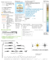
Maps template-fr.svg 1,100 × 1,600; 316 KB
-
Maps template-hu.svg 1,100 × 1,500; 215 KB
-
Toolbox SVG locator maps (location map based)-en.svg 962 × 848; 61 KB
-
2008 Locator maps color test 1.svg 6,743 × 3,245; 2.2 MB
-
A4 Macro Shoot wiki background.png 2,480 × 3,508; 710 KB
-
Administrative map tagged AdobeRGB.jpg 350 × 328; 61 KB
-
Administrative map tagged AdobeRGB.svg 350 × 328; 53 KB
-
Administrative map tagged sRGB.jpg 350 × 328; 68 KB
-
Age of majority.svg 863 × 443; 1.59 MB
-
AK47map.png 1,480 × 625; 21 KB
-
Atrad estadisticas.JPG 294 × 204; 13 KB
-
Battle Trebia-en.gif 999 × 755; 344 KB
-
Biafrane.jpg 1,320 × 1,712; 169 KB
-
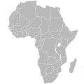
BlankMap-Africa.svg 1,000 × 1,000; 184 KB
-
BlankMap-Africa3.svg 1,000 × 1,000; 181 KB
-
BlankMap-World-Compact.svg 2,560 × 1,134; 1.01 MB
-
BlankMap-World.png 1,350 × 625; 29 KB
-
BlankMap-World.svg 2,754 × 1,398; 1.05 MB
-
BlankMap-World6 steradian.svg 863 × 443; 1.58 MB
-
BlankMap-WorldSICN.svg 2,692 × 1,473; 1.2 MB
-
BlankMap-WorldSICNAfiliações.svg 2,692 × 1,473; 1.2 MB
-
ColorMap-World.png 1,500 × 740; 41 KB
-
Driniplantilla.svg 600 × 990; 794 KB
-
Egypt Libya Yemen Locator.png 365 × 271; 43 KB
-
Egypt Libya Yemen Sudan Locator.png 365 × 271; 43 KB
-
Evolucion Precio DVD.jpg 568 × 289; 14 KB
-
Extended Central America.svg 150 × 105; 97 KB
-
FIDH carte.gif 1,756 × 800; 66 KB
-
Fond graphique.gif 543 × 235; 764 bytes
-
France administrative map (2015.03.06).svg 600 × 579; 3.72 MB
-
GL Map tuto-exchange maps-roads example.svg 1,016 × 1,222; 250 KB
-
GL Map tuto-exchange maps-roads.ogv 10 min 46 s, 1,280 × 800; 70.41 MB
-
GL tuto-animation.gif 300 × 320; 49 KB
-
GL tuto-animation1.png 300 × 320; 17 KB
-
GL tuto-animation2.png 300 × 320; 15 KB
-
GL tuto-animation3.png 300 × 320; 16 KB
-
GL tuto-animation4.png 300 × 320; 16 KB
-
GL tuto-animation5.png 300 × 320; 17 KB
-
Hawaii Island topographic map CSS3 animation.svg 512 × 341; 131 KB
-
Inkscape shortcuts-0.91.svg 1,052 × 744; 2.53 MB
-
International Telecommunication Union region.svg 940 × 477; 1.56 MB
-
Israel-Georgia.svg 1,000 × 500; 2.76 MB
-
Location map project subdivisions.svg 853 × 433; 1.22 MB
-
Location maps colorscale 3000.svg 145 × 326; 18 KB
-
Map making conventions logo.svg 2,067 × 2,167; 286 KB
-
Mapa de la inequidad-gini.svg 863 × 443; 1.68 MB
-
Maps template-en.svg 1,096 × 1,797; 290 KB
-
Maps template-history patch-en.svg 820 × 600; 104 KB
-
Maps template-mk.svg 1,100 × 1,500; 187 KB
-
Maps template-organisation.svg 1,100 × 950; 22 KB
-
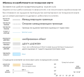
Maps template-ru-temporary file.png 1,250 × 1,500; 257 KB
-
Maps template-ru.svg 1,096 × 1,797; 284 KB
-
Négociation commerciale.jpg 589 × 582; 36 KB
-
Pacific Rim map (Miller cylindrical projection, blank).svg 415 × 330; 2.1 MB
-
Palette pour la cartographie.svg 1,100 × 900; 62 KB
-
Physical map tagged AdobeRGB.jpg 392 × 300; 64 KB
-
Physical map tagged AdobeRGB.png 392 × 300; 125 KB
-
Physical map tagged sRGB.jpg 392 × 300; 70 KB
-
Physical map tagged sRGB.png 392 × 300; 178 KB
-
Positionskartenerstellung - Signaturvorlage bg.svg 553 × 506; 436 KB
-
Positionskartenerstellung - Signaturvorlage ru.svg 482 × 528; 2.04 MB
-
Positionskartenerstellung - Signaturvorlage.png 1,500 × 1,146; 129 KB
-
Positionskartenerstellung - Signaturvorlage.svg 713 × 546; 21 KB
-
Proyecto Cartografía blanco Workaround.svg 512 × 496; 175 KB
-
Proyecto Cartografía blanco.svg 1,960 × 1,900; 259 KB
-
QGis tutorial - layers toolbar.png 800 × 212; 32 KB
-
Rwc15 submission of interest.png 1,480 × 625; 63 KB
-
Rwc19 submission of interest.png 1,480 × 625; 63 KB
-
Scale kilometres miles.svg 400 × 75; 8 KB
-
Scale metres yards.svg 520 × 75; 7 KB
-
Scorpiones distribution.png 1,295 × 628; 54 KB
-
SIC Internacional - Worldwide coverage.svg 2,560 × 1,314; 1.06 MB
-
Slavic World.svg 863 × 443; 1.61 MB
-
SVG labeled maps of administrative divisions - color scheme.svg 1,029 × 990; 3 KB
-
Taiwan Australia Locator.svg 940 × 415; 1.66 MB
-
Taiwan Myanmar Locator.svg 839 × 500; 1.51 MB
-
Taiwan Papua New Guinea Locator.svg 940 × 415; 1.66 MB
-
Taiwan Thailand Locator.svg 940 × 415; 1.66 MB
-
Taiwan Vietnam Locator.svg 940 × 415; 1.66 MB
-
Templat Peta-id.svg 1,100 × 1,500; 274 KB
-
Test outline gradient.svg 800 × 400; 17 KB
-
The Amazing Race 18 map.png 2,000 × 1,027; 212 KB
-
Transparent3x3.gif 3 × 3; 44 bytes
-
Triceros jacksonii distribution.png 600 × 600; 53 KB
-
Tutorial mapas 6.svg 280 × 361; 80 KB
-
Tutorial-cartography (basic).svg 320 × 11,916; 1.64 MB
-
Wikicouple.svg 1,000 × 1,000; 19 KB
-
Wikiman 1m80.svg 1,000 × 1,000; 7 KB
-
Wikipedia-en 2007 map's recommandations.png 723 × 495; 27 KB
-
World map blank-Americas centred.svg 1,100 × 750; 325 KB
-
World Map Blank.svg 2,753 × 1,538; 943 KB
-
World Map of Austrian Post-tarife-zones.svg 2,754 × 1,398; 1.13 MB
-
World Map of Edward Snowden's asylum applications.svg 863 × 443; 1.61 MB
-
WzorMapPL.svg 813 × 744; 571 KB
-
WzorMiastoPL.svg 1,920 × 877; 240 KB


