Category:Grand River (Michigan)
Jump to navigation
Jump to search
| Object location | | View all coordinates using: OpenStreetMap |
|---|
river in Michigan   | |||||
| Upload media | |||||
| Instance of | |||||
|---|---|---|---|---|---|
| Location | Michigan | ||||
| Length |
| ||||
| Mouth of the watercourse | |||||
| Drainage basin |
| ||||
| Tributary |
| ||||
| Lake on watercourse | |||||
 | |||||
- Mouth (Grand Haven)
- ;Headwaters (approximate location S of Jackson) From the English Wikipedia article on the Grand River:
The Grand River is the longest river in the U.S. state of Michigan. It runs 260 miles (420 km) through the cities of Jackson, Lansing, Grand Rapids, and Grand Haven before reaching Lake Michigan.
Subcategories
This category has the following 3 subcategories, out of 3 total.
G
Pages in category "Grand River (Michigan)"
This category contains only the following page.
Media in category "Grand River (Michigan)"
The following 39 files are in this category, out of 39 total.
-
 425 A State Street Dam looking downriver to the State Street Bridge and G.A.R. Island.jpg 1,800 × 1,200; 1.21 MB
-
 Ada MI GrandRiver DSCN9684.JPG 1,600 × 1,200; 375 KB
-
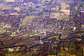 Aerial of Ionia, Michigan (2051982012).jpg 3,504 × 2,336; 7.88 MB
-
 Battle Point Site.JPG 800 × 534; 385 KB
-
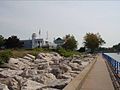
 Bicentennial Park (1).jpg 1,581 × 1,164; 326 KB
-
 Canal Street Park.jpg 4,676 × 1,831; 1.79 MB
-
 Chesapeake and Ohio rail bridge.jpg 2,565 × 1,770; 1.26 MB
-
 Fall along the river.jpg 1,100 × 736; 1.34 MB
-
 Fishing on the Grand River from the G.A.R. Island in EatonRapids, Michigan.jpg 1,800 × 1,200; 1.1 MB
-
 FMIB 38225 Upper wters of Grand River.jpeg 998 × 848; 202 KB
-

-

-

-
 Former Board of Water and Light, Lansing, MI.jpg 1,024 × 768; 295 KB
-
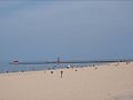
 Grand Haven Harbor 1.jpg 590 × 359; 81 KB
-
 Grand Haven Harbor 2.jpg 548 × 411; 35 KB
-
 Grand Haven Harbor 3.jpg 548 × 409; 18 KB
-
 Grand Haven Harbor 4.jpg 619 × 464; 71 KB
-
 Grand haven lighthouse.jpg 1,024 × 576; 420 KB
-
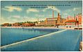
 Grand Haven Michigan harbor.jpg 1,500 × 901; 678 KB
-
 Grand Haven Musical Fountain.jpg 1,560 × 1,105; 349 KB
-
 Grand Rapids USGS River Gaging Station 1.jpg 640 × 480; 74 KB
-
 Grand Rapids USGS River Gaging Station 2.jpg 640 × 480; 67 KB
-
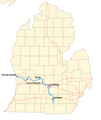
 Grand River (Michigan) map.svg 1,074 × 640; 323 KB
-
-
 Grand River in July 2018 near the fish ladder.jpg 2,591 × 1,789; 1.06 MB
-
 Grand River sign Lansing.jpg 2,081 × 1,944; 886 KB
-
 Grand River, near Lamont, Michigan.jpg 4,000 × 3,000; 4.29 MB
-
 Grand river.png 1,088 × 1,288; 50 KB
-
 Island Park Grand Ledge.jpg 3,214 × 2,139; 6.96 MB
-

-
 North Lansing dam.jpg 3,072 × 1,304; 518 KB
-

-
 Plainfield Township, Kent County, Michigan 2009.jpg 2,970 × 1,537; 1.63 MB
-
 River island at Grand Ravines County Park.jpg 1,822 × 1,822; 699 KB
-
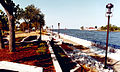
 SpringLakeMIHarbor.JPG 1,094 × 1,015; 91 KB
-
 The Blue Bridge, Grand Rapids, Michigan.jpg 4,000 × 2,250; 2.59 MB
-
 ThornappleRiver MI USGS WaterFeatures.PNG 1,087 × 868; 34 KB
-
 Water tower in Grand Ledge, MI.jpg 1,000 × 750; 407 KB

.jpg)

.jpg)


_map.svg)
.jpg)


,_RP-F-F01195-O.jpg)


