Category:Graffiti in West Yorkshire
Jump to navigation
Jump to search
Subcategories
This category has the following 4 subcategories, out of 4 total.
Media in category "Graffiti in West Yorkshire"
The following 65 files are in this category, out of 65 total.
-
 A new artwork at Salterhebble - geograph.org.uk - 3814143.jpg 1,955 × 1,347; 1.14 MB
-
-
 Barnsley Canal beneath High Bridge - geograph.org.uk - 960386.jpg 427 × 640; 266 KB
-
 St Mary's Church - Pawson Street - geograph.org.uk - 362497.jpg 638 × 471; 46 KB
-
 Calder Canal, Wakefield - geograph.org.uk - 926680.jpg 640 × 480; 70 KB
-
 Central Viaduct, Leeds - geograph.org.uk - 4935901.jpg 1,280 × 720; 594 KB
-
 Cow and Calf rock, Ilkley - geograph.org.uk - 1604571.jpg 640 × 480; 66 KB
-
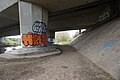
 Cruising under the M1 motorway - geograph.org.uk - 732651.jpg 640 × 383; 67 KB
-
 Decorated building off Riding Lane, Halifax - geograph.org.uk - 5447147.jpg 2,000 × 1,500; 1.21 MB
-
 Disused railway bridge over the canal at Savile Town - geograph.org.uk - 2902793.jpg 3,072 × 2,304; 1.11 MB
-
 Edwardian Graffiti (6097872760).jpg 4,097 × 2,331; 10 MB
-

-

-
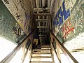
 Footpath 691 in a canyon, Halifax - geograph.org.uk - 5217986.jpg 1,500 × 2,000; 818 KB
-

-
 Graffiti art alongside Footpath 691, Halifax - geograph.org.uk - 5217997.jpg 2,000 × 1,500; 523 KB
-
 Graffiti art near Clay House, Greetland - geograph.org.uk - 3816297.jpg 2,000 × 1,500; 1.09 MB
-
 Graffiti art on a derelict building, Southowram - geograph.org.uk - 6519050.jpg 2,000 × 1,426; 1.12 MB
-
 Graffiti art on a derelict building, Southowram 1 - geograph.org.uk - 6519048.jpg 2,000 × 1,500; 1.08 MB
-
 Graffiti art, Greetland - geograph.org.uk - 3816293.jpg 2,000 × 1,500; 1.01 MB
-

-
 Graffiti by Bradford Beck at Shipley - geograph.org.uk - 1737142.jpg 3,072 × 2,304; 4.25 MB
-
 Graffiti by the Five Rise Locks in Bingley (6th November 2010).jpg 2,099 × 1,399; 3.27 MB
-

-

-
 Graffiti on the cycleway bridge over Mill Street East - geograph.org.uk - 3292305.jpg 2,000 × 1,259; 601 KB
-

-
 Graffiti on the rocks - geograph.org.uk - 671223.jpg 640 × 480; 93 KB
-

-
 Graffitied Wall, Or is it Art^ - geograph.org.uk - 6698154.jpg 1,024 × 577; 141 KB
-
 Graffito on railway footbridge near Low Moor - geograph.org.uk - 6683101.jpg 1,024 × 768; 314 KB
-
 It's a Grim World (6179268856).jpg 2,278 × 3,223; 4.53 MB
-
 Jesus loves you seat - geograph.org.uk - 102633.jpg 640 × 426; 150 KB
-
 M1 goes over the River Calder - geograph.org.uk - 5748421.jpg 1,600 × 1,065; 479 KB
-
 Make the rich pay for the crisis - geograph.org.uk - 737927.jpg 640 × 480; 60 KB
-
 Navigation Road, Halifax - geograph.org.uk - 5307622.jpg 1,280 × 853; 356 KB
-
 North Dean substation - geograph.org.uk - 2227637.jpg 640 × 480; 209 KB
-
 Oxenhope Moor Laboratories, Cock Hill - geograph.org.uk - 1063223.jpg 640 × 426; 103 KB
-
 Poetic graffiti on the Sands Lane viaduct, Dewsbury - geograph.org.uk - 2492429.jpg 2,000 × 1,437; 780 KB
-
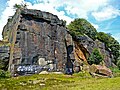
 Quarry face, Strangstry Wood, Rastrick - geograph.org.uk - 723259.jpg 640 × 441; 143 KB
-
 R.I.P. F.H. (5765749978).jpg 3,264 × 2,448; 2.19 MB
-

-

-
 Respect (16664855892).jpg 3,112 × 1,457; 3.72 MB
-

-
 Rock face (2643521102).jpg 2,560 × 1,920; 4.43 MB
-
 Shelter in Clarence Park - geograph.org.uk - 1431805.jpg 640 × 480; 126 KB
-
-

-
 Stile and Graffiti - geograph.org.uk - 585843.jpg 640 × 480; 153 KB
-

-
 Tanks and graffiti - geograph.org.uk - 6378170.jpg 2,000 × 1,227; 859 KB
-
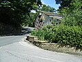
 The bridleway bridge, Thornhill - geograph.org.uk - 966783.jpg 640 × 560; 109 KB
-
 The City Trail information board - geograph.org.uk - 1337561.jpg 640 × 480; 319 KB
-
 The Clash - geograph.org.uk - 3137839.jpg 3,500 × 2,147; 2.73 MB
-
 The Hollin Mill Lane Ghost - geograph.org.uk - 3130980.jpg 1,716 × 2,336; 915 KB
-

-
 The towpath - geograph.org.uk - 563699.jpg 640 × 480; 79 KB
-
 Tour-de France graffiti, Rochdale Road - geograph.org.uk - 4056321.jpg 2,000 × 1,232; 1.03 MB
-
 Trash screen bridge - geograph.org.uk - 959095.jpg 640 × 480; 132 KB
-
 Tunnel ventilating shaft, Crackenedge - geograph.org.uk - 440230.jpg 640 × 427; 156 KB
-
 Underpass Graffiti - geograph.org.uk - 6342669.jpg 4,288 × 3,216; 1.37 MB
-
 Use Your Common Sense (2267610780).jpg 2,560 × 1,417; 3.56 MB
-
 We Want To Live! (9118287147).jpg 2,607 × 1,862; 5.32 MB
-
 Written in Stone (16299416219).jpg 4,000 × 3,000; 9.73 MB


.jpg)


.jpg)


.jpg)


.jpg)

_-_geograph.org.uk_-_133437.jpg)
.jpg)

.jpg)


.jpg)
.jpg)
.jpg)