Category:Grade II listed buildings in Berkshire
Jump to navigation
Jump to search
Ceremonial counties of England: Bedfordshire · Berkshire · Buckinghamshire · Cambridgeshire · Cheshire · Cornwall · Cumbria · Derbyshire · Devon · Dorset · Durham · East Riding of Yorkshire · East Sussex · Essex · Gloucestershire · Greater London · Greater Manchester · Hampshire · Herefordshire · Hertfordshire · Kent · Lancashire · Leicestershire · Lincolnshire · Merseyside · Norfolk · North Yorkshire · Northamptonshire · Northumberland · Nottinghamshire · Oxfordshire · Rutland · Shropshire · Somerset · South Yorkshire · Staffordshire · Suffolk · Surrey · Tyne and Wear · Warwickshire · West Midlands · West Sussex · West Yorkshire · Wiltshire · Worcestershire
City-counties: Bristol · City of London
Former historic counties: Westmorland ·
Other former counties:
City-counties: Bristol · City of London
Former historic counties: Westmorland ·
Other former counties:
Wikimedia category | |||||
| Upload media | |||||
| Instance of | |||||
|---|---|---|---|---|---|
| |||||
Subcategories
This category has the following 42 subcategories, out of 42 total.
1
3
- 30 High Street, Eton (4 F)
A
- Albert Bridge Lodge (3 F)
- Aldermaston Lock (6 F)
B
- Beaumont College Chapel (2 F)
C
- Cambridge Lodge, Windsor (8 F)
- Corn Exchange, Newbury (11 F)
D
- Donnigton Priory (3 F)
- Dreweat's Lock (8 F)
E
- Eton Ex-Serviceman's Club (3 F)
H
- Hamstead Lock (6 F)
I
- Indian Kiosk, Frogmore (3 F)
M
- Market Cross House, Windsor (15 F)
- Mill House, Tidmarsh (5 F)
N
- Newbury Town Hall, Berkshire (15 F)
P
Q
- Queen Victoria's Teahouse (2 F)
S
- Sonning Bridge (74 F)
- Speen Obelisk (3 F)
T
- The King and Castle, Windsor (12 F)
- Theatre Royal, Windsor (14 F)
- Tittenhurst Park (1 F)
W
- West Memorial Hall (6 F)
- Wilder's Folly (32 F)
Media in category "Grade II listed buildings in Berkshire"
The following 82 files are in this category, out of 82 total.
-
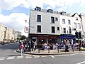 1 Castle Hill, Windsor (view from High St).jpg 4,608 × 3,456; 3.9 MB
-
 12-13 Church St, Windsor.jpg 3,456 × 4,608; 3.72 MB
-
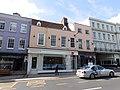 15-17 High St, Windsor.jpg 4,608 × 3,456; 4.06 MB
-
 20-22 The Broadway, Newbury, Berkshire.jpg 1,680 × 1,680; 945 KB
-
 26 The Broadway, Newbury, Berkshire.jpg 2,535 × 1,902; 1.28 MB
-
 4 Oxford Street, Newbury, Berkshire.jpg 2,349 × 1,762; 1.09 MB
-
 49, Northbrook Stree.jpg 2,268 × 4,032; 396 KB
-
 59-61 Victoria St, Windsor.jpg 2,648 × 2,893; 1.34 MB
-
 61A, 63 & 65 Victoria St, Windsor.jpg 2,987 × 2,710; 1.16 MB
-
 67 Victoria St, Windsor.jpg 3,225 × 3,043; 1.54 MB
-
 8 High St, Windsor.jpg 4,608 × 3,456; 4.17 MB
-
 86-87 Peascod St, Windsor.jpg 4,608 × 3,456; 3.85 MB
-
 Aldermaston Wharf - geograph.org.uk - 19835.jpg 640 × 480; 445 KB
-
 AldermastonWharfTouristInformation.JPG 1,224 × 1,632; 565 KB
-
 Atik, 23-25 William St, Windsor.jpg 4,608 × 3,456; 3.49 MB
-
 Avanti (former Wellington), Peascod St, Windsor.jpg 2,573 × 3,450; 1.37 MB
-
 Barn near the church - geograph.org.uk - 2709240.jpg 1,024 × 683; 119 KB
-
 An interesting gable end - geograph.org.uk - 861580.jpg 640 × 427; 86 KB
-
 Bird in the weather vane - geograph.org.uk - 1479210.jpg 426 × 640; 70 KB
-
 Brunsdon Lock and Bridge 06.jpg 4,128 × 3,096; 11.69 MB
-
 Brunsdon Lock and Bridge 08.jpg 3,096 × 4,128; 8.33 MB
-
 Building in the garden - geograph.org.uk - 1479204.jpg 640 × 427; 96 KB
-
 Chequer's Hotel.jpg 4,032 × 2,268; 811 KB
-
 Clarendon House, 44 London Road, Newbury, Berkshire 01.jpg 2,179 × 1,634; 1.12 MB
-
 Clarendon House, 44 London Road, Newbury, Berkshire 02.jpg 1,909 × 2,546; 1.27 MB
-
 Corner of Pound and Argyle Streets, Newbury - geograph.org.uk - 6223.jpg 640 × 480; 372 KB
-
 Dun Mill Lock 03.jpg 4,128 × 3,096; 7.76 MB
-
 Bryar Cottage North Street.jpg 3,072 × 2,304; 2.66 MB
-
 Evergreen Telephone Box - geograph.org.uk - 515658.jpg 480 × 640; 92 KB
-
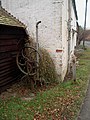
 Forge by the road - geograph.org.uk - 1716188.jpg 1,024 × 683; 129 KB
-
 Former Post Office, Cheap Street, Newbury 01.jpg 3,864 × 5,152; 7.76 MB
-
 Former Post Office, Cheap Street, Newbury 02.jpg 3,864 × 5,152; 7.58 MB
-
 Fowl-House at Bowden Green, Pangbourne, Berkshire, England, 1898.jpg 814 × 1,251; 170 KB
-
 Grade II Listed K1 Telephone Kiosk, Boulters Lock.jpg 2,592 × 3,888; 5.74 MB
-
 Mile stone - geograph.org.uk - 603903.jpg 427 × 640; 108 KB
-
 Lambourn, Entrance to former almshouses - geograph.org.uk - 25914.jpg 640 × 480; 164 KB
-

-
 Milestone along Bath Road, Slough.jpg 3,299 × 4,381; 12.22 MB
-
 Milestone at Streatley - geograph.org.uk - 2029180.jpg 1,024 × 768; 258 KB
-
 Milestone, Old Bath Road, Charvil, Berkshire 01.jpg 1,736 × 2,315; 1.75 MB
-
 Milestone, Old Bath Road, Charvil, Berkshire 02.jpg 1,768 × 2,358; 1.37 MB
-
 Moor Close, Newbold College, Binfield.jpg 2,500 × 1,663; 4.6 MB
-
 Newbury Post Office, 39 Cheap Street, Newbury, West Berkshire.jpg 1,924 × 2,566; 1.15 MB
-
 North Hinksey - The Old Manor House - 20220910140149.jpg 4,000 × 3,000; 2.48 MB
-
 Pound Street and Argyle Road - geograph.org.uk - 1159992.jpg 640 × 427; 177 KB
-
 Queen Victoria's Tea House on the Frogmore Estate - geograph.org.uk - 3503922.jpg 3,072 × 2,304; 1.81 MB
-
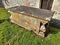
 Rawlinson Tomb, 9 Metres South Of South Porch, St. Swithin's Church, Combe.jpg 4,000 × 3,000; 5.32 MB
-
 41 miles to London... - geograph.org.uk - 649424.jpg 477 × 640; 97 KB
-
 Royal Standard Public House in Colnbrook - panoramio.jpg 3,648 × 2,736; 4.22 MB
-

-
 Shaw House, Berkshire 03.jpg 4,128 × 3,096; 5.56 MB
-
 Shaw-cum-Donnington Church of England Primary School.jpg 5,152 × 3,864; 9.92 MB
-
 Sindlesham House, Sindlesham (geograph 3342674).jpg 640 × 422; 238 KB
-
 St Andew's Church, Boxford, Berkshire 07.jpg 5,152 × 3,864; 7.21 MB
-
 St Crispins School, Wokingham.jpg 2,048 × 1,536; 792 KB
-
 St Mary's Church, Shaw 05.jpg 4,128 × 3,096; 7.16 MB
-
 St Mary's Church, Shaw 06.jpg 4,128 × 3,096; 7.74 MB
-
 St Mary's Church, Shaw 18.jpg 3,864 × 5,152; 3.8 MB
-
 TeaHouse Frogmore.jpg 640 × 480; 114 KB
-
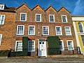
 Terraced Houses, Remenham Hill - geograph.org.uk - 3339820.jpg 1,600 × 1,133; 445 KB
-
 The Chequer's Hotel, 6-8 Oxford Street, Newbury, Berkshire.jpg 2,520 × 1,890; 782 KB
-
 The Lodge Sulham.jpg 3,072 × 2,304; 3.05 MB
-
 The Monument, 57 Northbrook Street, Newbury, Berkshire.jpg 2,555 × 1,916; 1.16 MB
-
 Townsend Tomb, 1 Metre North West Of Rawlinson Tomb, St. Swithin's Church, Combe.jpg 4,000 × 3,000; 5.25 MB
-
 Village lock-up, Pangbourne - geograph.org.uk - 1479204.jpg 266 × 355; 46 KB
-
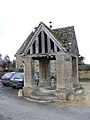 Village Well Head - geograph.org.uk - 307406.jpg 480 × 640; 85 KB
-
 Walls around garden to west of Manor Farm House, Combe, Berkshire.jpg 4,000 × 3,000; 4.74 MB
-
 Allotments, Waltham St Lawrence - geograph.org.uk - 695701.jpg 640 × 480; 195 KB
-
 Waltham St Lawrence - geograph.org.uk - 524865.jpg 640 × 480; 139 KB
-
 Warwicks, 93A and 94 Peascod St, Windsor.jpg 4,608 × 3,456; 3.87 MB
-
-
 Whistler tomb, 1 metre south of south door to chancel, St. Swithin's Church, Combe.jpg 4,000 × 3,000; 5.98 MB
-
 Whistler tomb, 20 metres south of south door of chancel, St. Swithin's Church, Combe.jpg 4,000 × 3,000; 5.61 MB
-
 Whistler tomb, 20 metres south of south door to chancel, St. Swithin's Church, Combe.jpg 4,000 × 3,000; 4.89 MB
-
 Whistler tomb, 3 metres south of south door to chancel, St. Swithin's Church, Combe.jpg 4,000 × 3,000; 4.58 MB
-
 Whistler tomb, 5 metres south of south door to chancel, St. Swithin's Church, Combe.jpg 4,000 × 3,000; 5.53 MB
-
 Wilton House, Hungerford.jpg 4,000 × 3,000; 4.32 MB
-
 37 Market Place, Wokingham (1).jpg 2,560 × 1,920; 2.13 MB
-
 37 Market Place, Wokingham (2).jpg 2,560 × 1,920; 2.07 MB
-
 Wokingham AllSaints TombBeaver 1.jpg 768 × 1,024; 487 KB
-
 Wokingham AllSaints TombBeaver 2.jpg 683 × 1,024; 472 KB
-
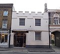
 Ye Olde King's Head, 7 Church St, Windsor.jpg 3,456 × 4,608; 4.12 MB
.jpg)


,_Peascod_St,_Windsor.jpg)


.jpg)


.jpg)
.jpg)


