Category:Goxhill Haven
Jump to navigation
Jump to search
Media in category "Goxhill Haven"
The following 48 files are in this category, out of 48 total.
-
 Derelict farm buildings, Goxhill Haven - geograph.org.uk - 4362474.jpg 640 × 480; 207 KB
-
 Drain at Goxhill Haven - geograph.org.uk - 1041648.jpg 640 × 427; 122 KB
-
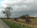
 East Marsh Road - geograph.org.uk - 821957.jpg 640 × 425; 107 KB
-
 East Marsh Road - geograph.org.uk - 879655.jpg 640 × 425; 92 KB
-
 East Marsh Road - geograph.org.uk - 978148.jpg 640 × 480; 113 KB
-

-
 Flood Defence Wall at Goxhill Haven - geograph.org.uk - 770284.jpg 427 × 640; 89 KB
-
 Goxhill Haven (2), aerial 2016 - geograph.org.uk - 4823833.jpg 640 × 427; 62 KB
-
 Goxhill Haven - Flood Defence Bank - geograph.org.uk - 542229.jpg 640 × 480; 152 KB
-
 Goxhill Haven - geograph.org.uk - 310828.jpg 640 × 374; 106 KB
-
 Goxhill Haven foreshore - geograph.org.uk - 4362610.jpg 640 × 426; 209 KB
-
 Goxhill Haven from the Humber Bank - geograph.org.uk - 4700312.jpg 640 × 427; 52 KB
-
 Goxhill Haven in the evening sun - geograph.org.uk - 2001962.jpg 1,024 × 768; 233 KB
-

-
 Goxhill Haven Outfall - geograph.org.uk - 541455.jpg 480 × 640; 116 KB
-
 Goxhill Haven Outfall - geograph.org.uk - 542213.jpg 640 × 480; 113 KB
-
 Goxhill Haven Outfall - geograph.org.uk - 557767.jpg 615 × 640; 116 KB
-
 Goxhill Haven Outfall - geograph.org.uk - 923230.jpg 513 × 640; 116 KB
-
 Goxhill Haven Outfall - geograph.org.uk - 923240.jpg 640 × 480; 48 KB
-
 Goxhill Haven Outfall - Landward Side - geograph.org.uk - 541462.jpg 480 × 640; 148 KB
-
 Goxhill Haven Outfall - Landward Side - geograph.org.uk - 665620.jpg 478 × 640; 106 KB
-
 Goxhill Haven, aerial 2016 - geograph.org.uk - 4823820.jpg 640 × 457; 45 KB
-
 Haven Farm - geograph.org.uk - 562347.jpg 640 × 426; 126 KB
-
 Humber Bank Footpath - geograph.org.uk - 540714.jpg 640 × 480; 108 KB
-
 Humber Bank Footpath - High Tide - geograph.org.uk - 541918.jpg 640 × 426; 136 KB
-
 Humber Foreshore - geograph.org.uk - 581008.jpg 640 × 426; 92 KB
-
 Humber Foreshore at Goxhill Haven - geograph.org.uk - 1562758.jpg 640 × 480; 344 KB
-
 Humber Foreshore at Goxhill Haven - geograph.org.uk - 1562764.jpg 480 × 640; 236 KB
-
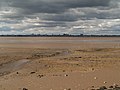
 Humber foreshore at Goxhill Haven - geograph.org.uk - 4362616.jpg 640 × 457; 181 KB
-
 Humber Foreshore at Goxhill Haven - geograph.org.uk - 839478.jpg 640 × 425; 90 KB
-
 Humber Foreshore near Haven Farm - geograph.org.uk - 821925.jpg 640 × 421; 73 KB
-
 Looking Across the Humber - geograph.org.uk - 666757.jpg 640 × 480; 103 KB
-
 Looking towards Kingston Upon Hull - geograph.org.uk - 640047.jpg 640 × 423; 53 KB
-
 Low Tide at Goxhill Haven - geograph.org.uk - 540722.jpg 640 × 480; 104 KB
-
 Old Farm Buildings - geograph.org.uk - 665822.jpg 640 × 478; 100 KB
-
 Old Farm Buildings - geograph.org.uk - 665830.jpg 640 × 480; 107 KB
-
 On East Marsh Road - geograph.org.uk - 665914.jpg 640 × 478; 66 KB
-
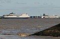 P and O Ferries seen from Goxhill Haven - geograph.org.uk - 542254.jpg 640 × 424; 106 KB
-
 Public Footpath at Goxhill Haven - geograph.org.uk - 839459.jpg 640 × 425; 73 KB
-
 Public Footpath at Goxhill Haven - geograph.org.uk - 869769.jpg 640 × 426; 268 KB
-
 Public footpath at Goxhill Haven. - geograph.org.uk - 1236822.jpg 640 × 480; 60 KB
-
 Saltend Power Station - geograph.org.uk - 924759.jpg 640 × 425; 70 KB
-
 Saltend Power Station seen from Goxhill Haven.jpg 640 × 568; 110 KB
-
 Sheep Grazing near East Marsh Farm - geograph.org.uk - 1127866.jpg 640 × 435; 131 KB
-
 Spot Height 5m (Red) - geograph.org.uk - 200229.jpg 640 × 426; 121 KB
-
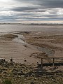
 The Foreshore at Goxhill Haven - geograph.org.uk - 770266.jpg 427 × 640; 96 KB
-
 The Humber at Goxhill Haven - geograph.org.uk - 1236814.jpg 566 × 640; 77 KB
-
 The Humber on Christmas Day 2007 - geograph.org.uk - 639920.jpg 640 × 479; 54 KB


,_aerial_2016_-_geograph.org.uk_-_4823833.jpg)


_-_geograph.org.uk_-_200229.jpg)


