Category:Gowerton
Jump to navigation
Jump to search
village in Wales   | |||||
| Upload media | |||||
| Pronunciation audio | |||||
|---|---|---|---|---|---|
| Instance of | |||||
| Location | Swansea, Wales | ||||
| Population |
| ||||
| Area |
| ||||
 | |||||
Cymraeg: Mae Tre-gŵyr (hefyd: Tregwyr; Saesneg: Gowerton) yn dref a chymuned i'r de o Orseinon yn Sir Abertawe, yn ne-orllewin Cymru. Saif ar lan ogleddol penrhyn Gŵyr.
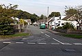
English: The village and community of Gowerton is situated about 4 miles north west of Swansea city centre, Wales. Gowerton is often known as the gateway to Gower. Gowerton's original name was Ffosfelin. The village falls within the Gowerton electoral ward of Swansea.
Polski: Gowerton ( wal. Tre-gŵyr) - północno-zachodnia dzielnica Swansea położona ok. 9 km od centrum miasta. Populacja ok. 5000 mieszkańców. Kiedyś odrębna miejscowość, wcielona w granice administracyjne Swansea w 1996 roku po utworzeniu hrabstwa miejskiego Swansea (ang. City and County of Swansea).
Subcategories
This category has the following 2 subcategories, out of 2 total.
G
- Gowerton railway station (6 F)
Media in category "Gowerton"
The following 157 files are in this category, out of 157 total.
-
 2010 Wales Swansea Community Gowerton map.svg 512 × 472; 632 KB
-
 2024 Wales Swansea Community Gowerton map.svg 512 × 472; 651 KB
-
 A Weak Bridge Over The Afon Llan^ - geograph.org.uk - 4539136.jpg 1,600 × 1,061; 366 KB
-
 Access road to Gowerton Treatment Works - geograph.org.uk - 3679624.jpg 800 × 662; 179 KB
-
 Accommodation arch near Gowerton - geograph.org.uk - 3211026.jpg 1,785 × 1,210; 1.77 MB
-
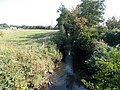
 Afon Llan - geograph.org.uk - 6091815.jpg 3,264 × 2,448; 4.49 MB
-
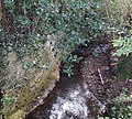
 Afon Llan, Gowerton - geograph.org.uk - 3679135.jpg 800 × 600; 204 KB
-
 Afon Lliw - geograph.org.uk - 4967688.jpg 6,000 × 4,000; 3.98 MB
-
 Afon Lliw - geograph.org.uk - 4967751.jpg 6,000 × 4,000; 4.2 MB
-
 Afon Lliw looking upstream - geograph.org.uk - 5588009.jpg 1,600 × 1,200; 530 KB
-

-
 Allt-wen Wood - geograph.org.uk - 3012378.jpg 3,968 × 2,976; 2.92 MB
-
 Aunty Ivy's Day Nursery, Gowerton - geograph.org.uk - 3679028.jpg 800 × 563; 140 KB
-
 B4295 at Berth-Lwyd-Uchaf - geograph.org.uk - 4139820.jpg 640 × 481; 55 KB
-
 B4295 at Clos Helyg - geograph.org.uk - 4139834.jpg 640 × 480; 60 KB
-
 B4295-Cefn Stylle Road junction - geograph.org.uk - 4139827.jpg 640 × 480; 63 KB
-
 B4296 junction with Sterry Road - geograph.org.uk - 3955365.jpg 3,589 × 2,427; 1.21 MB
-
 Bethel Chapel, Gowerton - geograph.org.uk - 5487974.jpg 1,600 × 1,200; 617 KB
-
 Bike path to Gowerton - geograph.org.uk - 4965324.jpg 6,000 × 4,000; 7.65 MB
-
 Bryn Close Gowerton - geograph.org.uk - 3673465.jpg 800 × 546; 137 KB
-
 Bryn y Môr - geograph.org.uk - 3100405.jpg 690 × 518; 192 KB
-
 Bus stop on Victoria Road, Gowerton - geograph.org.uk - 4966738.jpg 6,000 × 4,000; 4.86 MB
-

-
 Caravan Site - Gowerton - geograph.org.uk - 3981514.jpg 1,218 × 883; 223 KB
-
 Cefnstyle Road, Gowerton - geograph.org.uk - 5826669.jpg 1,600 × 1,203; 770 KB
-
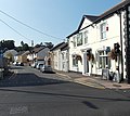
 Church Street houses, Gowerton - geograph.org.uk - 3678420.jpg 800 × 586; 146 KB
-
 Colourful bank edge in Gowerton - geograph.org.uk - 4615180.jpg 800 × 665; 139 KB
-
 Common land near Gowerton - geograph.org.uk - 429207.jpg 640 × 480; 64 KB
-

-

-
 Corwydd Road looking east - geograph.org.uk - 4139848.jpg 640 × 480; 80 KB
-
 Cwrs hen gamlas - former canal route - geograph.org.uk - 3892971.jpg 640 × 480; 103 KB
-

-

-
 Dhoniya Indian Takeaway Gowerton - geograph.org.uk - 3677987.jpg 800 × 575; 137 KB
-

-
 Directions sign, Station Road, Gowerton - geograph.org.uk - 4615486.jpg 800 × 665; 115 KB
-
 Dismantled railway line stops at the River Llan - geograph.org.uk - 2370379.jpg 1,536 × 1,152; 337 KB
-
 Disused farm bridge over River Llan - geograph.org.uk - 2370377.jpg 1,024 × 768; 203 KB
-
 Elba Flooring in Gowerton - geograph.org.uk - 3679022.jpg 800 × 567; 95 KB
-
 Elba Street Gowerton - geograph.org.uk - 3679034.jpg 800 × 540; 126 KB
-

-
 Entrance to Gowerton Caravan Club Site - geograph.org.uk - 4967663.jpg 6,000 × 4,000; 3.96 MB
-
 Entrance to Gowerton RFC - geograph.org.uk - 3679127.jpg 640 × 595; 90 KB
-
 Esso filling station and Tesco Express store, Gowerton - geograph.org.uk - 5826663.jpg 1,600 × 1,200; 819 KB
-
 Estuary marshland near Gowerton - geograph.org.uk - 4967654.jpg 6,000 × 4,000; 3.39 MB
-
 Fairwood Terrace, Gowerton - geograph.org.uk - 6891495.jpg 1,600 × 1,200; 374 KB
-

-
 Former access tunnel underneath railway - geograph.org.uk - 6891492.jpg 1,200 × 1,600; 725 KB
-
 Former Gowerton post office - geograph.org.uk - 3677827.jpg 800 × 631; 141 KB
-

-
 Free car park in Gowerton - geograph.org.uk - 4615192.jpg 800 × 583; 116 KB
-
 Fringe of the marshland - geograph.org.uk - 5585813.jpg 1,600 × 1,200; 561 KB
-
 From Gowerton to Waunarlwydd - geograph.org.uk - 3673448.jpg 800 × 681; 130 KB
-
-
 Gorwydd Road at Waunarlwydd boundary - geograph.org.uk - 4139858.jpg 640 × 480; 69 KB
-
 Gorwydd Road bungalows in Gowerton - geograph.org.uk - 3673475.jpg 800 × 570; 126 KB
-

-
-
 Gorwydd Road, Gowerton - geograph.org.uk - 4615169.jpg 800 × 600; 138 KB
-
 Gower Dog Grooming, Gowerton - geograph.org.uk - 3678238.jpg 800 × 608; 148 KB
-
 Gower Golf Club 4th green - geograph.org.uk - 3955604.jpg 3,648 × 2,736; 1.79 MB
-
 Gower Golf Club clubhouse - geograph.org.uk - 3955373.jpg 3,648 × 2,736; 1.91 MB
-
 Gower, Gowerton - geograph.org.uk - 3679012.jpg 640 × 426; 69 KB
-
 Gowerton (North) railway station, Glamorgan - geograph.org.uk - 4646578.jpg 1,600 × 1,200; 517 KB
-
 Gowerton Conservative Club - geograph.org.uk - 3678165.jpg 800 × 688; 139 KB
-
 Gowerton DNO supply cubicle - geograph.org.uk - 4618801.jpg 743 × 800; 234 KB
-
 Gowerton Library - geograph.org.uk - 3678991.jpg 800 × 599; 139 KB
-
 Gowerton Post Office - geograph.org.uk - 3677783.jpg 800 × 653; 132 KB
-
 Gowerton Primary School, Gowerton - geograph.org.uk - 3678986.jpg 800 × 587; 156 KB
-
 Gowerton railway station - geograph.org.uk - 4615120.jpg 800 × 609; 136 KB
-
 Gowerton railway station car park - geograph.org.uk - 4615123.jpg 800 × 548; 99 KB
-

-
 Gowerton railway station from the NW - geograph.org.uk - 3677732.jpg 800 × 600; 189 KB
-
 Gowerton station - geograph.org.uk - 3444009.jpg 1,984 × 1,488; 718 KB
-
 Gowerton Station - geograph.org.uk - 6091813.jpg 3,264 × 2,448; 2.81 MB
-
 Gowerton Telephone Exchange - geograph.org.uk - 3673587.jpg 800 × 551; 107 KB
-

-
 Grassland and hedges - geograph.org.uk - 6197201.jpg 3,167 × 2,376; 2.85 MB
-
 Grazing Sheep Near Gowerton - geograph.org.uk - 4541536.jpg 1,600 × 1,188; 315 KB
-
 Green space by Oakwood Drive - geograph.org.uk - 4966560.jpg 6,000 × 4,000; 6.12 MB
-
 Heol y Gwartheg Gowerton - geograph.org.uk - 3673489.jpg 800 × 600; 120 KB
-
 Houses on the edge of Gowerton - geograph.org.uk - 1041231.jpg 640 × 427; 74 KB
-
 Killan Colliery tip - geograph.org.uk - 4954140.jpg 2,023 × 1,319; 1.18 MB
-
 Lane From Gowerton To Loughor - geograph.org.uk - 4541547.jpg 1,600 × 1,039; 420 KB
-

-
 Llwybr Bevexe Fach - Bexexe Fach path - geograph.org.uk - 4313802.jpg 640 × 480; 146 KB
-

-
 Llwybr Dyfnant - Dunvant Path - geograph.org.uk - 4313820.jpg 640 × 480; 140 KB
-
 Llwybr Tregwyr - Gowerton Path - geograph.org.uk - 3889561.jpg 640 × 480; 147 KB
-

-

-
 Maes y Gwaelod Garden Centre - geograph.org.uk - 6152036.jpg 3,264 × 2,448; 3.65 MB
-
 Mansel Workmen's Club, Gowerton - geograph.org.uk - 3678988.jpg 800 × 508; 108 KB
-
 Mill Street, Gowerton - geograph.org.uk - 3156720.jpg 1,932 × 1,449; 921 KB
-
 Ming Fai, Gowerton - geograph.org.uk - 3677794.jpg 800 × 799; 181 KB
-
 Mount Street Gowerton - geograph.org.uk - 3679014.jpg 800 × 711; 141 KB
-
 Narrow bridge on Pont-y-Cob Road - geograph.org.uk - 4967678.jpg 6,000 × 4,000; 4.41 MB
-
 Narrow bridge on Pont-y-cob road - geograph.org.uk - 6928903.jpg 1,600 × 900; 665 KB
-
 Nisa Local, Gowerton - geograph.org.uk - 4615530.jpg 800 × 571; 113 KB
-
 No tipping notice in Gowerton - geograph.org.uk - 4615195.jpg 800 × 464; 112 KB
-
 Oakwood Drive, Gowerton - geograph.org.uk - 3156628.jpg 2,288 × 1,712; 1.28 MB
-
 Ordnance Survey Cut Mark - geograph.org.uk - 4006843.jpg 480 × 640; 91 KB
-
 Ordnance Survey Cut Mark - geograph.org.uk - 4763936.jpg 480 × 640; 109 KB
-
 Ordnance Survey Cut Mark - geograph.org.uk - 4763941.jpg 480 × 640; 125 KB
-
 Ordnance Survey Flush Bracket (11185) - geograph.org.uk - 4766706.jpg 480 × 640; 109 KB
-
 Ordnance Survey Flush Bracket (G3823) - geograph.org.uk - 4006240.jpg 480 × 640; 100 KB
-
 Park land by the B4295 - geograph.org.uk - 4966744.jpg 6,000 × 4,000; 7.35 MB
-

-
 Part of Gowerton's cyclepath network - geograph.org.uk - 6891494.jpg 1,200 × 1,600; 461 KB
-
 Path on the edge of Gowerton - geograph.org.uk - 4965328.jpg 6,000 × 4,000; 6.49 MB
-
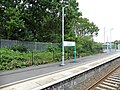
 Platform 1 at Gowerton railway station - geograph.org.uk - 3673629.jpg 800 × 600; 149 KB
-
 Platform 1, Gowerton railway station - geograph.org.uk - 4618895.jpg 800 × 600; 168 KB
-
 Pont-y-cob Road - geograph.org.uk - 4966757.jpg 6,000 × 4,000; 5.03 MB
-
 Pont-y-cob Road - geograph.org.uk - 4967659.jpg 6,000 × 4,000; 6.04 MB
-

-
 Premier store - geograph.org.uk - 6195774.jpg 3,264 × 2,448; 2.11 MB
-

-

-
 Rechabite Community Hall, Gowerton - geograph.org.uk - 3678985.jpg 800 × 551; 158 KB
-

-
 Rush pasture near Gowerton - geograph.org.uk - 3156775.jpg 2,288 × 1,712; 1.27 MB
-
 SE boundary of Gowerton - geograph.org.uk - 3673434.jpg 800 × 600; 133 KB
-
 Site of a former chapel in Gowerton - geograph.org.uk - 4966570.jpg 6,000 × 4,000; 3.41 MB
-
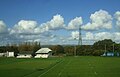 Sports fields, Gowerton - geograph.org.uk - 6309698.jpg 800 × 511; 71 KB
-
 St James Funeral Home, Gowerton - geograph.org.uk - 3673568.jpg 800 × 517; 115 KB
-
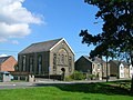
 St John's Church, Gowerton - geograph.org.uk - 3678270.jpg 800 × 696; 129 KB
-
 Station Road houses, Gowerton - geograph.org.uk - 3673585.jpg 800 × 772; 161 KB
-

-
 Station Road, Gowerton - geograph.org.uk - 4615503.jpg 800 × 736; 118 KB
-
 Sterry Road shops and a church, Gowerton - geograph.org.uk - 4615544.jpg 800 × 624; 114 KB
-
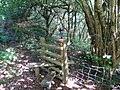 Sticil Alltwen Stile - geograph.org.uk - 3100142.jpg 690 × 518; 264 KB
-
 Sunday morning cyclists in Gowerton - geograph.org.uk - 3678990.jpg 800 × 664; 139 KB
-
 Swansea UK ward location - Gowerton.png 800 × 768; 143 KB
-
-

-
 Telephone exchange in Gowerton - geograph.org.uk - 4966609.jpg 6,000 × 4,000; 3.27 MB
-
 Temple URC Gowerton - geograph.org.uk - 3677818.jpg 800 × 580; 114 KB
-
 The 'Up' platform, Gowerton railway station - geograph.org.uk - 5511527.jpg 1,024 × 768; 272 KB
-
 The Commercial, Gowerton - geograph.org.uk - 3673577.jpg 800 × 600; 124 KB
-
 The Contented Sole, Gowerton - geograph.org.uk - 3678118.jpg 800 × 600; 121 KB
-

-
 The Rake and Riddle - geograph.org.uk - 5586776.jpg 1,600 × 1,200; 518 KB
-
 Train to Manchester arriving at Gowerton - geograph.org.uk - 4966622.jpg 6,000 × 4,000; 4.55 MB
-
-

-
 Ty Seren - geograph.org.uk - 6195775.jpg 3,264 × 2,448; 2.2 MB
-
 Vodafone mobile phone mast, Gowerton - geograph.org.uk - 4615127.jpg 584 × 800; 91 KB
-
 Welcome to Gower PH - geograph.org.uk - 5585793.jpg 1,600 × 1,200; 327 KB
-

-
 Western end of Church Street Gowerton - geograph.org.uk - 3679015.jpg 764 × 800; 152 KB
-
 Western end of Mansel Street, Gowerton - geograph.org.uk - 3678993.jpg 800 × 673; 148 KB
-
 Woodlands, Gowerton - geograph.org.uk - 4966577.jpg 6,000 × 4,000; 4.44 MB
-
 Gowerton, Church Street - geograph.org.uk - 184787.jpg 640 × 427; 183 KB
-

-

-
 Pentre'r Ardd. Garden Village. - geograph.org.uk - 405519.jpg 640 × 480; 82 KB


_railway_station,_Glamorgan_-_geograph.org.uk_-_4646578.jpg)


_-_geograph.org.uk_-_4766706.jpg)
_-_geograph.org.uk_-_4006240.jpg)


_pub,_Gowerton_-_geograph.org.uk_-_3678076.jpg)


