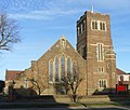
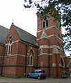
Category:Gothic Revival church towers in East Sussex
Jump to navigation
Jump to search
Ceremonial counties of England: Bedfordshire · Berkshire · Buckinghamshire · Cambridgeshire · Cheshire · Cornwall · Cumbria · Derbyshire · Devon · Dorset · Durham · East Riding of Yorkshire · East Sussex · Essex · Gloucestershire · Greater London · Greater Manchester · Hampshire · Herefordshire · Hertfordshire · Isle of Wight · Kent · Lancashire · Leicestershire · Lincolnshire · Merseyside · Norfolk · North Yorkshire · Northamptonshire · Northumberland · Nottinghamshire · Oxfordshire · Shropshire · Somerset · South Yorkshire · Staffordshire · Suffolk · Surrey · Tyne and Wear · Warwickshire · West Sussex · West Yorkshire · Wiltshire · Worcestershire
City-counties: Bristol ·
Former historic counties:
Other former counties:
City-counties: Bristol ·
Former historic counties:
Other former counties:
Subcategories
This category has only the following subcategory.
S
Media in category "Gothic Revival church towers in East Sussex"
The following 124 files are in this category, out of 124 total.
-
Bell tower of Church of St John - geograph.org.uk - 2350740.jpg 427 × 640; 85 KB
-
St Mary Magdalene's RC Church, Bexhill (NHLE Code 1352844).JPG 2,400 × 1,600; 1.15 MB
-
St Stephen's Church, Bexhill.JPG 2,400 × 1,800; 1.16 MB
-
Church of the Good Shepherd, Dyke Road, Brighton (February 2014).JPG 2,600 × 2,200; 1.17 MB
-
Church of the Good Shepherd, Dyke Road, Brighton.jpg 580 × 480; 124 KB
-
St Mary Magdalen's RC Church, Upper North Street, Brighton (NHLE Code 1381058).JPG 1,900 × 2,500; 1.13 MB
-
St Matthias Church, Ditchling Road, Brighton 03.JPG 1,800 × 1,500; 1.04 MB
-
St Matthias Church, Ditchling Road, Hollingdean.JPG 1,944 × 2,400; 1.41 MB
-
Brighton-StPaul-TowerDoorway-fromEast-01.jpg 686 × 1,024; 697 KB
-
Brighton - panoramio (11).jpg 4,000 × 3,000; 3.52 MB
-
Brighton, St Peter's Church - geograph.org.uk - 4362064.jpg 1,840 × 1,232; 789 KB
-
St Mary the Virgin Church, Buxted.JPG 2,600 × 2,100; 871 KB
-
Buxted Church - geograph.org.uk - 1751287.jpg 640 × 428; 102 KB
-
Former Methodist Church, Catsfield - geograph.org.uk - 1008732.jpg 419 × 640; 98 KB
-
Former Methodist Church, Catsfield - geograph.org.uk - 890679.jpg 455 × 640; 187 KB
-
Church of St Helen - geograph.org.uk - 5831054.jpg 1,024 × 823; 352 KB
-
Church of St Johns, St Leonards - geograph.org.uk - 2350728.jpg 480 × 640; 63 KB
-
Church of St Johns, St Leonards - geograph.org.uk - 2350772.jpg 640 × 480; 84 KB
-
Church of St Peter - geograph.org.uk - 3649716.jpg 640 × 430; 65 KB
-
All Saints Church, Danehill.JPG 2,400 × 1,800; 1.13 MB
-
All Saints Church, Eastbourne (IoE Code 293540).JPG 1,800 × 2,200; 809 KB
-
Christ Church - geograph.org.uk - 1333620.jpg 480 × 640; 92 KB
-
Christ Church Eastbourne - geograph.org.uk - 1360288.jpg 480 × 640; 66 KB
-
Christ Church View - geograph.org.uk - 1333606.jpg 517 × 640; 73 KB
-
Christ Church, Seaside, Eastbourne (IoE Code 293599).JPG 1,800 × 2,400; 869 KB
-
Holy Trinity Parish Church, Eastbourne - geograph.org.uk - 1278434.jpg 640 × 480; 114 KB
-
Holytrinity1.jpg 1,280 × 960; 471 KB
-
St John the Evangelist's Church, Meads, Eastbourne.JPG 2,200 × 1,800; 841 KB
-
St Michael and All Angels Church, Eastbourne (IoE Code 293636).jpg 2,500 × 1,800; 1.08 MB
-
Church of Our Lady of Ransom, Eastbourne (IoE Code 471324).jpg 1,800 × 2,400; 1,016 KB
-
EastBourne01.JPG 768 × 955; 279 KB
-
St. Andrew's, Fairlight, East Sussex - geograph.org.uk - 1625011.jpg 480 × 640; 60 KB
-
Christ Church at Fairwarp - geograph.org.uk - 20982.jpg 640 × 480; 140 KB
-
St Augustine of Canterbury's Church, Flimwell (NHLE Code 1222404).JPG 2,200 × 1,800; 1,006 KB
-
St Augustine's, Flimwell - geograph.org.uk - 333949.jpg 640 × 480; 149 KB
-
Holy Trinity Church, Forest Row.JPG 2,500 × 1,800; 1.21 MB
-
Forest Row centre.jpg 640 × 480; 76 KB
-
St Alban's Church, Frant (IoE Code 296213).JPG 2,400 × 1,800; 1.27 MB
-
Frant church - geograph.org.uk - 4206471.jpg 480 × 640; 49 KB
-
St Stephen's Church, Hammerwood.jpg 1,200 × 1,600; 773 KB
-
St Stephens church, Hammerwood - East Sussex - panoramio.jpg 3,500 × 2,343; 4.5 MB
-
Christ Church, Blacklands, Hastings (IoE Code 293983).jpg 2,200 × 1,900; 944 KB
-
Church, London Rd - geograph.org.uk - 1190251.jpg 640 × 430; 71 KB
-
Former St Leonards United Reformed Church, St Leonards, Hastings (IoE Code 491240).JPG 1,600 × 2,200; 728 KB
-
Former St Leonards-on-Sea United Reformed Church, St Leonards-on-Sea (from East).JPG 2,400 × 1,600; 1.2 MB
-
Emmanuel Church, Vicarage Rd (2) - geograph.org.uk - 1354472.jpg 430 × 640; 64 KB
-
Emmanuel Church, Vicarage Rd - geograph.org.uk - 1354449.jpg 640 × 430; 69 KB
-
Emmanuel Church, West Hill, Hastings.jpg 1,800 × 2,400; 1.05 MB
-
St Mary Magdalene's Church (Greek Orthodox), St Leonards (from East).JPG 2,200 × 1,800; 893 KB
-
St Mary Magdalene's Church (Greek Orthodox), St Leonards (from Southeast).JPG 2,400 × 1,800; 1.04 MB
-
St Mary Magdalene's Church (Greek Orthodox), St Leonards (IoE Code 294069).jpg 1,900 × 2,400; 995 KB
-
Historic Church - geograph.org.uk - 3216301.jpg 427 × 640; 81 KB
-
Holy Trinity Church, Blatchington Road, Hove (from West).JPG 2,400 × 1,600; 1.16 MB
-
Holy Trinity Church, Blatchington Road, Hove 01.JPG 1,200 × 1,600; 472 KB
-
Holy Trinity Church, Blatchington Road, Hove.JPG 1,900 × 2,200; 820 KB
-
Hove StJohnBaptist 2010.jpg 3,240 × 4,320; 3.87 MB
-
Clock, Netherfield church - geograph.org.uk - 1192895.jpg 640 × 527; 160 KB
-
The Church Clock at Netherfield - geograph.org.uk - 305671.jpg 480 × 640; 129 KB
-
The Church Tower at Netherfield - geograph.org.uk - 305676.jpg 480 × 640; 120 KB
-
Netherfield Church - geograph.org.uk - 1032402.jpg 480 × 640; 103 KB
-
Netherfield Church - geograph.org.uk - 1192891.jpg 640 × 424; 84 KB
-
Netherfield Church - geograph.org.uk - 170520.jpg 461 × 640; 99 KB
-
St Peter's Church - geograph.org.uk - 1097145.jpg 479 × 640; 99 KB
-
St Peter's Church, Offham (Geograph Image 1012551 35904fe5).jpg 480 × 640; 94 KB
-
Offham Church 2.JPG 3,248 × 2,426; 1.64 MB
-
Offham Church.JPG 2,400 × 3,200; 1.07 MB
-
St Helen's Church (Ore Parish Church), The Ridge, Hastings.jpg 1,800 × 2,000; 874 KB
-
Parish Church of St Alban, Frant - geograph.org.uk - 3261667.jpg 430 × 640; 49 KB
-
Pett Church - geograph.org.uk - 1307729.jpg 640 × 424; 66 KB
-
St Mary & St Peter Church Pett East Sussex.jpeg 640 × 480; 144 KB
-
Pett Church, 1952 - geograph.org.uk - 1574487.jpg 440 × 640; 51 KB
-
All Saints Church - geograph.org.uk - 1546398.jpg 480 × 640; 95 KB
-
Plumpton Green Church 3.JPG 2,400 × 3,200; 1.77 MB
-
Plumpton Green Church 7.JPG 2,396 × 3,198; 1.23 MB
-
Plumpton Green Church lych gate.JPG 3,234 × 2,408; 1.45 MB
-
St John the Evangelist's Church, St Leonards, Hastings (IoE Code 294099).JPG 2,400 × 1,800; 1.03 MB
-
St John the Evangelist's Church, St Leonards-on-Sea (Tower).JPG 1,800 × 2,500; 1.05 MB
-
St Alban's church, Frant - geograph.org.uk - 3039175.jpg 2,256 × 1,496; 891 KB
-
St Alban, Frant - geograph.org.uk - 3870581.jpg 640 × 427; 95 KB
-
St John the Baptist church - geograph.org.uk - 2733254.jpg 1,200 × 1,600; 333 KB
-
St John the Baptist Church, Hove - geograph.org.uk - 3284324.jpg 1,200 × 1,600; 383 KB
-
St John the Baptist Netherfield 1 (4910444173).jpg 4,218 × 3,150; 6.84 MB
-
St John the Baptist, Hove - geograph.org.uk - 6058680.jpg 2,448 × 3,264; 3.98 MB
-
St John's Church, Netherfield (NHLE Code 1278194).JPG 1,800 × 2,000; 1.01 MB
-
St John's Church, St Leonards on Sea - geograph.org.uk - 2759610.jpg 2,816 × 2,112; 1.71 MB
-
St Johns Church, St Leonards - geograph.org.uk - 886422.jpg 640 × 424; 74 KB
-
St Peter's Church - geograph.org.uk - 2681764.jpg 640 × 480; 61 KB
-
St Peters Church Brighton - geograph.org.uk - 3145013.jpg 4,000 × 3,000; 1.87 MB
-
St. John the Evangelist, St. Leonards - geograph.org.uk - 2971362.jpg 1,388 × 1,600; 432 KB
-
St. Peter's Church, Brighton - geograph.org.uk - 2466787.jpg 1,199 × 1,600; 394 KB
-
St. Peter's Church, Brighton - geograph.org.uk - 2682379.jpg 1,199 × 1,600; 412 KB
-
Stanmer Church - geograph.org.uk - 1217627.jpg 640 × 427; 64 KB
-
Stanmer Church - geograph.org.uk - 48394.jpg 640 × 479; 195 KB
-
Stanmer Church 04.JPG 464 × 451; 105 KB
-
Stanmer Church, Stanmer Park, near Brighton (April 2013) (1).JPG 1,800 × 2,400; 879 KB
-
Stanmer Church, Stanmer Park, near Brighton (April 2013) (2).JPG 1,900 × 2,400; 1.29 MB
-
Stanmer Church, Stanmer Park, near Brighton (April 2013) (3).JPG 2,400 × 1,800; 1.12 MB
-
Stanmer Church, Stanmer Park, near Brighton (April 2013) (4).JPG 2,000 × 1,700; 906 KB
-
Stanmer church.jpg 722 × 606; 190 KB
-
Stanmer village - geograph.org.uk - 1267624.jpg 480 × 640; 122 KB
-
The Annunciation, Brighton - geograph.org.uk - 5465973.jpg 631 × 900; 272 KB
-
Tower of St John's Church - geograph.org.uk - 2572267.jpg 1,620 × 2,148; 2.66 MB
-
Tower, St. Peter's, Brighton - geograph.org.uk - 3376043.jpg 511 × 600; 99 KB
-
Holy Cross Church, Uckfield.JPG 2,500 × 2,100; 766 KB
-
St Mary Magdalene's Church, Whatlington (June 2006).jpg 2,816 × 2,112; 1.31 MB
-
Whatlington Church - geograph.org.uk - 1040920.jpg 640 × 427; 112 KB
-
WhatlingtonChurch.JPG 2,816 × 2,112; 1.02 MB


