Category:Gosberton Clough
Jump to navigation
Jump to search
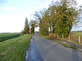
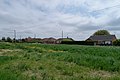
Gosberton Clough is a village in the civil parish of Gosberton and the South Holland district of Lincolnshire, England. It is 30 miles (50 km) southeast from the city and county town of Lincoln, 5 miles (8 km) north from the nearest large town of Spalding, and 3 miles (5 km) west-southwest from parish village of Gosberton.
village in Gosberton, South Holland, Lincolnshire, England | |||||
| Upload media | |||||
| Instance of | |||||
|---|---|---|---|---|---|
| Location | Gosberton, South Holland, Lincolnshire, East Midlands, England | ||||
 | |||||
Subcategories
This category has the following 2 subcategories, out of 2 total.
Media in category "Gosberton Clough"
The following 26 files are in this category, out of 26 total.
-
 Allens Bridge over Risegate Eau (geograph 2743106).jpg 1,178 × 863; 912 KB
-
 Beck Bank, Gosberton Clough (geograph 2692060).jpg 4,000 × 3,000; 4.17 MB
-
 Beck Bank, Gosberton Clough (geograph 2692072).jpg 4,000 × 3,000; 4.14 MB
-
 Bungalow in Gosberton Clough (geograph 4970569).jpg 6,000 × 4,000; 7.64 MB
-
 Clough Bridge (geograph 4970544).jpg 5,000 × 3,333; 7.65 MB
-
 Clough Bridge, Gosberton Clough, Lincs - geograph.org.uk - 259146.jpg 640 × 480; 397 KB
-
 Clough Road (B1397) heading west (geograph 2922562).jpg 640 × 480; 75 KB
-
 Date plaque on Clough Bridge (geograph 4970550).jpg 5,400 × 3,600; 7.99 MB
-
 Drain beside Clough Road (geograph 2922561).jpg 640 × 480; 103 KB
-
 Fenland View (geograph 4970574).jpg 5,400 × 3,600; 7.7 MB
-
 Fenland view (geograph 4970577).jpg 5,600 × 3,733; 8 MB
-
 Fenland view (geograph 4970579).jpg 5,400 × 3,600; 7.39 MB
-
 Firm opinion - geograph.org.uk - 4970596.jpg 5,400 × 3,600; 7.3 MB
-

-

-
 Gosberton Fen.JPG 960 × 720; 178 KB
-
 Houses in a landscape (geograph 4970587).jpg 5,200 × 3,467; 6.79 MB
-
 Isolated shed (geograph 4970599).jpg 6,000 × 4,000; 7.5 MB
-
 Long Drove - geograph.org.uk - 1032844.jpg 640 × 427; 82 KB
-

-
 Primitive Gait (geograph 4970526).jpg 5,800 × 3,867; 7.94 MB
-
 Risegate Eau from Clough bridge (geograph 4970540).jpg 5,000 × 3,333; 6.25 MB
-
 Road junction (geograph 4649068).jpg 640 × 471; 60 KB
-
 Scrapyard and former bus depot (geograph 4970529).jpg 6,000 × 4,000; 7.69 MB
-
 Signpost near Clough Bridge (geograph 4970564).jpg 5,000 × 3,333; 7.63 MB
-
 The Triangle (geograph 4970566).jpg 6,000 × 4,000; 7.22 MB
.jpg)
.jpg)
.jpg)
.jpg)
.jpg)

_heading_west_(geograph_2922562).jpg)
.jpg)
.jpg)
.jpg)
.jpg)
.jpg)

-_aerial_2014_(geograph_4059047).jpg)


.jpg)
.jpg)


.jpg)
.jpg)
.jpg)
.jpg)
.jpg)
.jpg)