Category:Gooderstone
Jump to navigation
Jump to search
English: Gooderstone is a village situated in the Breckland District of Norfolk and covers an area of south west from Swaffham.
village in the United Kingdom  | |||||
| Upload media | |||||
| Instance of | |||||
|---|---|---|---|---|---|
| Location | Breckland, Norfolk, East of England, England | ||||
| Population |
| ||||
| Area |
| ||||
| Said to be the same as | Gooderstone (Wikimedia duplicated page, civil parish) | ||||
 | |||||
Subcategories
This category has the following 2 subcategories, out of 2 total.
G
- Gooderstone War Memorial (1 F)
Media in category "Gooderstone"
The following 94 files are in this category, out of 94 total.
-
 "Darmera Peltata", Gooderstone Water Garden - geograph.org.uk - 5547871.jpg 1,600 × 1,067; 777 KB
-
 A Kingfisher at Gooderstone Water Gardens - geograph.org.uk - 3546028.jpg 1,130 × 1,008; 154 KB
-
 A Moorhen and Chicks - geograph.org.uk - 4524936.jpg 753 × 435; 40 KB
-
 A watery sun - geograph.org.uk - 4460027.jpg 1,024 × 768; 242 KB
-
 Barley crop field near Cockley Cley - geograph.org.uk - 4459961.jpg 640 × 480; 310 KB
-
 Barley crop field near Foulden - geograph.org.uk - 4460756.jpg 584 × 640; 425 KB
-
 Bullsmire Drove - geograph.org.uk - 5392030.jpg 640 × 480; 69 KB
-
 Bullsmire Drove, a farm track - geograph.org.uk - 4460015.jpg 1,024 × 768; 481 KB
-
 Chalk Row Lane - geograph.org.uk - 4555953.jpg 640 × 480; 80 KB
-
 Chalkrow Lane - geograph.org.uk - 3749146.jpg 2,592 × 1,944; 1.75 MB
-
 Conifers in Russel's Plantation - geograph.org.uk - 4460748.jpg 640 × 480; 418 KB
-
 Country lane - geograph.org.uk - 709534.jpg 480 × 640; 105 KB
-
 Country road towards Mundford - geograph.org.uk - 5392026.jpg 640 × 480; 102 KB
-
 Country road towards Mundford - geograph.org.uk - 5392034.jpg 640 × 480; 117 KB
-
 Crop field east of Gooderstone - geograph.org.uk - 5392020.jpg 640 × 480; 71 KB
-
 Crop field off Watermill Lane - geograph.org.uk - 5391995.jpg 640 × 480; 49 KB
-
 Crop field towards Top Plantation - geograph.org.uk - 5391998.jpg 640 × 480; 55 KB
-
 Crop field, Gooderstone Common - geograph.org.uk - 4556553.jpg 640 × 480; 99 KB
-
 Crop fields beside Bullsmire Drove - geograph.org.uk - 4460752.jpg 640 × 480; 354 KB
-
 Crop fields by Field Barn - geograph.org.uk - 4459952.jpg 640 × 480; 402 KB
-
 Crop fields near Foulden - geograph.org.uk - 4460754.jpg 640 × 480; 312 KB
-
 Fallen pine tree - geograph.org.uk - 4460030.jpg 1,024 × 768; 525 KB
-
 Fallen pine tree in the shelter belt - geograph.org.uk - 4460033.jpg 1,024 × 768; 513 KB
-
 Farm track alongside a strip of pine trees - geograph.org.uk - 4460026.jpg 1,024 × 768; 300 KB
-
 Farm track into fields - geograph.org.uk - 4459955.jpg 640 × 480; 427 KB
-
 Farm track near Foulden - geograph.org.uk - 4556562.jpg 640 × 480; 86 KB
-
 Farm track near Oxborough - geograph.org.uk - 4555935.jpg 640 × 480; 79 KB
-
 Farm track near Top Plantation - geograph.org.uk - 5392002.jpg 640 × 480; 72 KB
-
 Farm track south of Gooderstone - geograph.org.uk - 4556557.jpg 640 × 480; 87 KB
-
 Farmland near Cockley Cley - geograph.org.uk - 3749059.jpg 2,592 × 1,944; 1.45 MB
-
 Farmland near Gooderstone - geograph.org.uk - 3749116.jpg 2,592 × 1,944; 1.38 MB
-
 Flowering broom - geograph.org.uk - 4460750.jpg 640 × 535; 594 KB
-
 Gooderstone St. George's church - geograph.org.uk - 4353794.jpg 1,024 × 768; 392 KB
-
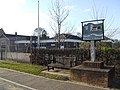
 Gooderstone village sign - geograph.org.uk - 6804066.jpg 2,788 × 2,788; 2.39 MB
-
 Gooderstone village sign - geograph.org.uk - 6804070.jpg 4,608 × 3,072; 5.95 MB
-
 Gooderstone War Memorial - geograph.org.uk - 5798601.jpg 2,592 × 3,456; 3.2 MB
-
 Gooderstone Water Garden - geograph.org.uk - 5547855.jpg 1,600 × 1,067; 693 KB
-
 Gooderstone Water Garden - geograph.org.uk - 5547877.jpg 1,600 × 1,067; 746 KB
-
 Gooderstone Water Gardens - geograph.org.uk - 3564727.jpg 1,350 × 898; 257 KB
-
 Gooderstone Water Gardens - geograph.org.uk - 4524916.jpg 1,258 × 895; 244 KB
-

-
 Gooderstone, St George - geograph.org.uk - 6363008.jpg 4,608 × 3,456; 4.03 MB
-
 Gooderstone, St. George's Church - geograph.org.uk - 5069545.jpg 4,455 × 2,945; 6.88 MB
-
 Gooderstone, St. George's Church - geograph.org.uk - 5069555.jpg 3,678 × 2,456; 5.22 MB
-
 Gooderstone, St. George's Church - geograph.org.uk - 5069565.jpg 3,679 × 2,455; 5.82 MB
-

-

-

-
 Gooderstone, St. George's Church, Wheeled bier - geograph.org.uk - 5069571.jpg 3,678 × 2,456; 4.33 MB
-
 Gooderstone, The Swan PH - geograph.org.uk - 5069560.jpg 3,678 × 2,456; 5.67 MB
-
 Grazing south of Cockley Cley - geograph.org.uk - 5392017.jpg 640 × 480; 52 KB
-
 Heading south east towards Foulden - geograph.org.uk - 4556551.jpg 640 × 480; 76 KB
-
 High House Farm, Gooderstone - geograph.org.uk - 3749133.jpg 2,592 × 1,944; 1.45 MB
-
 In Gooderstone village - geograph.org.uk - 3749137.jpg 2,592 × 1,944; 1.96 MB
-
 Kingfisher (Alcedo atthis) on a branch (3713529937).jpg 1,332 × 990; 800 KB
-

-
 Minor road east of Gooderstone - geograph.org.uk - 5392005.jpg 640 × 480; 64 KB
-
 Minor road towards Cockley Cley - geograph.org.uk - 5392011.jpg 640 × 480; 108 KB
-
 Minor road towards Foulden - geograph.org.uk - 4555948.jpg 640 × 480; 75 KB
-
 Minor road towards Foulden - geograph.org.uk - 4556549.jpg 640 × 480; 62 KB
-
 Minor road towards Foulden - geograph.org.uk - 4556563.jpg 640 × 480; 77 KB
-
 Minor road towards Gooderstone - geograph.org.uk - 4556558.jpg 640 × 480; 62 KB
-
 On the edge of Russel's Plantation - geograph.org.uk - 4460035.jpg 640 × 480; 413 KB
-
 Permitted path towards Rowley Corner - geograph.org.uk - 5392008.jpg 640 × 480; 126 KB
-
 Pig farm off Chalk Row Lane - geograph.org.uk - 4555940.jpg 640 × 480; 92 KB
-
 Pig farming near Oxborough - geograph.org.uk - 4555930.jpg 640 × 480; 96 KB
-

-

-
 Potato crop near Foulden - geograph.org.uk - 4556560.jpg 640 × 480; 101 KB
-

-

-
 River Gadder from the bridge on Gooderstone Road - geograph.org.uk - 6801201.jpg 4,608 × 3,072; 5.49 MB
-
 River Gadder from the bridge on Gooderstone Road - geograph.org.uk - 6801205.jpg 4,608 × 3,072; 6.21 MB
-
 Sign of the Swan Inn but no sign of the swan - geograph.org.uk - 5799333.jpg 2,592 × 3,456; 2.95 MB
-
 St George's church, Gooderstone - geograph.org.uk - 3749128.jpg 2,592 × 1,944; 1.6 MB
-
 St George's Gooderstone - geograph.org.uk - 4440424.jpg 4,320 × 3,240; 4.61 MB
-
 Straight road lined with pollarded trees - geograph.org.uk - 4440397.jpg 4,320 × 3,240; 5.03 MB
-
 The Cockley Cley Pig Unit - geograph.org.uk - 3749065.jpg 2,592 × 1,944; 1.68 MB
-
 The River Gadder - geograph.org.uk - 4440461.jpg 4,320 × 3,240; 5.59 MB
-
 The Street Gooderstone - geograph.org.uk - 4440415.jpg 4,320 × 3,240; 6.37 MB
-
 The Swan Inn, Gooderstone, from the churchyard - geograph.org.uk - 5799332.jpg 3,456 × 2,592; 3.88 MB
-
 The Swan, Gooderstone - geograph.org.uk - 4440451.jpg 4,320 × 3,240; 3.06 MB
-
 The Swan, Gooderstone - geograph.org.uk - 518366.jpg 640 × 480; 89 KB
-
 Watermill Lane - geograph.org.uk - 5391996.jpg 640 × 480; 104 KB
-
 Bullsmire drove - geograph.org.uk - 709705.jpg 640 × 480; 102 KB
-
 Contented cattle - geograph.org.uk - 397697.jpg 640 × 480; 95 KB
-
 Corner of Russell's Plantation - geograph.org.uk - 396487.jpg 640 × 480; 69 KB
-
-
 Gooderstone West End - geograph.org.uk - 397676.jpg 640 × 480; 75 KB
-
 Old concrete trough - geograph.org.uk - 709673.jpg 480 × 640; 163 KB
-
 Road junction - geograph.org.uk - 709712.jpg 640 × 480; 117 KB
-
 Road to Langwade Green - geograph.org.uk - 396453.jpg 640 × 480; 61 KB
-
 Spot the hare^ - geograph.org.uk - 397723.jpg 640 × 480; 97 KB
-
 View from Watermill Lane - geograph.org.uk - 396470.jpg 640 × 480; 97 KB


_on_a_branch_(3713529937).jpg)


