Category:Golant
Jump to navigation
Jump to search
village in United Kingdom | |||||
| Upload media | |||||
| Instance of | |||||
|---|---|---|---|---|---|
| Location | St Sampson, Cornwall, South West England, England | ||||
 | |||||
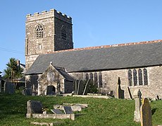
English: Golant is a small village in the parish of St Sampson on the banks of the Fowey estuary in Cornwall, England, UK. It is roughly in between St Austell and Polperro and is a short drive away from Bodmin. Its church is dedicated to St. Sampson.
Kernowek: Golant yw village byghan.
Simple English: Golant is a small village in Cornwall, England. It is located in the parish of St Sampson on the banks of the Fowey estuary. It is between St. Austell and Polperro. The church in the villiage is dedicated to St. Sampson.
Subcategories
This category has the following 3 subcategories, out of 3 total.
Media in category "Golant"
The following 29 files are in this category, out of 29 total.
-
A Drag on the Hillside - geograph.org.uk - 109502.jpg 640 × 443; 75 KB
-
Altarnun, Golant.jpg 3,325 × 2,836; 3.42 MB
-
Castledore - geograph.org.uk - 434068.jpg 640 × 480; 111 KB
-
Fowey Estuary at Golant - geograph.org.uk - 9090.jpg 640 × 480; 97 KB
-
Fowey estuary at Golant.JPG 3,264 × 2,448; 1.54 MB
-
Fowey Estuary from St Winnow Point - geograph.org.uk - 223260.jpg 640 × 480; 77 KB
-
Golant - panoramio.jpg 2,576 × 1,712; 1.14 MB
-
Golant - river Fowey - panoramio.jpg 2,576 × 1,712; 1.18 MB
-
Golant 001.JPG 1,600 × 1,050; 431 KB
-
Golant Youth Hostel - geograph.org.uk - 307649.jpg 640 × 480; 86 KB
-
Hendra, Golant (side view).jpg 4,032 × 3,024; 4.2 MB
-
Hendra, Golant (Top of the hill).jpg 4,032 × 3,024; 4.92 MB
-
Houses on the Hillside - geograph.org.uk - 735188.jpg 640 × 480; 118 KB
-
Kiln Cottage - panoramio.jpg 525 × 351; 37 KB
-
Kissing Gate above Colvithick Wood - geograph.org.uk - 109914.jpg 640 × 482; 171 KB
-
Orchard Cottage, Golant, grade II listed building.jpg 2,382 × 1,547; 1.66 MB
-
River Fowey - geograph.org.uk - 1938.jpg 640 × 395; 32 KB
-
River Fowey - geograph.org.uk - 1939.jpg 640 × 395; 44 KB
-
River House, Golant, front.jpg 3,857 × 1,701; 1.85 MB
-
River House, Golant, side view.jpg 4,032 × 2,299; 3.53 MB
-
The Holy Well of Saint Sampson - geograph.org.uk - 733939.jpg 480 × 640; 118 KB
-
Bodmin Pill, A Muddy Creek - geograph.org.uk - 109877.jpg 640 × 480; 134 KB
-
Confluence of Rivers Lerryn and Fowey - geograph.org.uk - 329982.jpg 427 × 640; 172 KB
-
Entrance to grounds of Golant YH - geograph.org.uk - 307658.jpg 640 × 480; 111 KB
-
Fields near Wringford Farm - geograph.org.uk - 733916.jpg 640 × 480; 149 KB
-
Horses by the Footpath - geograph.org.uk - 733927.jpg 640 × 480; 124 KB
-
Mixed Farmland and Farm Junk - geograph.org.uk - 217255.jpg 640 × 427; 115 KB
-
The Brow of the Hill - geograph.org.uk - 109471.jpg 640 × 480; 123 KB
-
Woodland Waterfall - geograph.org.uk - 109907.jpg 640 × 478; 147 KB


