Category:Godstone
Jump to navigation
Jump to search
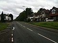
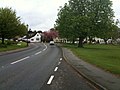
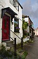
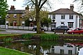
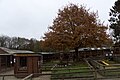
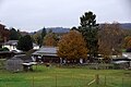
English: Godstone is a village in the county of Surrey, England. It is located approximately six miles east of Reigate at the junction of the A22 and A25 major roads, and near the M25 motorway.
village in Surrey, United Kingdom .jpg) | |||||
| Upload media | |||||
| Instance of | |||||
|---|---|---|---|---|---|
| Location | Tandridge, Surrey, South East England, England | ||||
| Population |
| ||||
| Area |
| ||||
| Said to be the same as | Godstone (Wikimedia duplicated page, civil parish) | ||||
| official website | |||||
 | |||||
Subcategories
This category has the following 10 subcategories, out of 10 total.
B
- B2236 road (England) (2 F)
- The Bell, Godstone (5 F)
G
- Godstone Baptist Church (4 F)
- Godstone railway station (20 F)
- Godstone War Memorial (6 F)
S
W
- White Hart, Godstone (6 F)
Media in category "Godstone"
The following 200 files are in this category, out of 622 total.
(previous page) (next page)-
 'The Bell' at Godstone - geograph.org.uk - 3127406.jpg 755 × 1,024; 122 KB
-
 102-106 High Street - geograph.org.uk - 2244440.jpg 640 × 426; 99 KB
-
 31-33 High Street - geograph.org.uk - 3166347.jpg 640 × 425; 282 KB
-
 37 - 43 High Street - geograph.org.uk - 3166336.jpg 640 × 425; 293 KB
-
 45 - 47 High Street - geograph.org.uk - 3166331.jpg 640 × 425; 306 KB
-
 61 - 69 High Street - geograph.org.uk - 3166304.jpg 640 × 425; 321 KB
-
 61 - 69 High Street - geograph.org.uk - 3355165.jpg 640 × 424; 358 KB
-

-
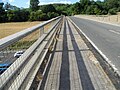
 A public right of way goes over the M25 - geograph.org.uk - 3024087.jpg 800 × 600; 102 KB
-
 A stream at Danemore Lane - geograph.org.uk - 3693984.jpg 800 × 532; 236 KB
-
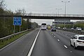
 A22 approaching Godstone interchange - geograph.org.uk - 6303460.jpg 1,024 × 768; 116 KB
-
 A22 at J6 of the M25 - geograph.org.uk - 3514608.jpg 640 × 430; 72 KB
-
 A22 Godstone By-Pass - geograph.org.uk - 6303454.jpg 1,024 × 768; 117 KB
-
 A22 Junction - geograph.org.uk - 5199951.jpg 800 × 600; 72 KB
-
 A22 near Hartsridge - geograph.org.uk - 3231279.jpg 1,600 × 1,064; 457 KB
-

-
 A22 roundabout with the M25, Godstone - geograph.org.uk - 2868331.jpg 1,600 × 1,200; 550 KB
-
 A22, Godstone Bypass - geograph.org.uk - 2406862.jpg 640 × 430; 82 KB
-
 A22, Godstone Bypass - south - geograph.org.uk - 2406866.jpg 640 × 430; 108 KB
-
 A22, northbound - geograph.org.uk - 3514617.jpg 640 × 430; 51 KB
-
 A22, South Godstone - geograph.org.uk - 3369234.jpg 640 × 430; 73 KB
-
 A22, South Godstone - geograph.org.uk - 3945675.jpg 640 × 430; 77 KB
-
 A22, South Godstone - geograph.org.uk - 3962554.jpg 640 × 430; 75 KB
-
 A22, South Godstone - geograph.org.uk - 4792690.jpg 640 × 426; 71 KB
-
 A22, South Godstone - geograph.org.uk - 5419769.jpg 640 × 426; 64 KB
-
 A25 east of Godstone - geograph.org.uk - 2702462.jpg 640 × 430; 58 KB
-
 A25 Oxted Road leaving Godstone - geograph.org.uk - 3449502.jpg 640 × 427; 66 KB
-
 Abandoned car by footpath 119 - geograph.org.uk - 2240575.jpg 640 × 480; 183 KB
-
 Acton House, Godstone Green Road - geograph.org.uk - 3355187.jpg 640 × 424; 283 KB
-
 Animal pens at Godstone Farm - geograph.org.uk - 5603746.jpg 1,024 × 683; 199 KB
-

-
 Approaching Church Town - geograph.org.uk - 2086392.jpg 2,816 × 2,112; 1.77 MB
-
 Approaching the M25 on the A22 in Godstone - geograph.org.uk - 2459543.jpg 1,600 × 1,200; 589 KB
-
 Bad Light Stopped Play - geograph.org.uk - 3007332.jpg 4,592 × 3,056; 6.69 MB
-

-
 Bannisters Bakery, Blindley Heath - geograph.org.uk - 2606997.jpg 3,581 × 2,383; 7.7 MB
-
 Barn at Blackgrove Farm - geograph.org.uk - 2100739.jpg 3,264 × 2,448; 2.73 MB
-
 Barn at Comforts Place Farm - geograph.org.uk - 4673097.jpg 2,304 × 1,728; 852 KB
-
 Barn by Station Rd, South Godstone - geograph.org.uk - 2265434.jpg 640 × 399; 82 KB
-
 Bay Pond - geograph.org.uk - 4591200.jpg 1,600 × 1,064; 590 KB
-
 Bench in Horse Shaw - geograph.org.uk - 2949087.jpg 4,288 × 3,216; 4.83 MB
-
 Bench overlooking Godstone - geograph.org.uk - 6303544.jpg 1,024 × 768; 143 KB
-
 Bletchingley Road, Godstone - geograph.org.uk - 1838149.jpg 2,048 × 1,536; 975 KB
-
 Bletchingley Road, Godstone - geograph.org.uk - 1838153.jpg 2,048 × 1,536; 1.28 MB
-
 Bletchingley Road, Godstone - geograph.org.uk - 1838159.jpg 2,048 × 1,536; 1.16 MB
-
 Britannia, Sandersteads - geograph.org.uk - 2949122.jpg 4,288 × 3,216; 4.67 MB
-
 Buildings on West side of High Street, Godstone (June 2013).JPG 2,500 × 1,500; 1,001 KB
-
 Bungalow on Tandridge Lane - geograph.org.uk - 4667770.jpg 2,304 × 1,728; 843 KB
-
 Bungalow on Tilburstow Hill Road - geograph.org.uk - 5254437.jpg 2,238 × 1,636; 968 KB
-
 Burial ground, Godstone - geograph.org.uk - 5987828.jpg 1,024 × 768; 410 KB
-
 Bus stop on a wet A25, Godstone - geograph.org.uk - 2589560.jpg 1,600 × 1,200; 578 KB
-
 Bus stop on Eastbourne Road, Blindley Heath - geograph.org.uk - 4670837.jpg 2,278 × 1,694; 1.22 MB
-
 By the A22 - geograph.org.uk - 2978017.jpg 4,592 × 3,056; 6.79 MB
-
 Byers Lane - geograph.org.uk - 2100726.jpg 640 × 427; 96 KB
-
 Byers Lane - geograph.org.uk - 2758435.jpg 640 × 439; 100 KB
-
 Car park at Godstone Farm - geograph.org.uk - 5603705.jpg 1,024 × 683; 256 KB
-
 Car park on Rabies Heath Road, Godstone - geograph.org.uk - 5254440.jpg 2,304 × 1,728; 897 KB
-
 Caver's entrance to disused underground quarries - geograph.org.uk - 6205346.jpg 768 × 1,024; 605 KB
-
 Chestnut Cottage - geograph.org.uk - 1942182.jpg 1,025 × 1,600; 455 KB
-
 Church End and Potters Cottage - geograph.org.uk - 2242662.jpg 640 × 426; 127 KB
-
 Church House - geograph.org.uk - 2242751.jpg 640 × 426; 129 KB
-

-
 Church Lane - geograph.org.uk - 5154528.jpg 1,000 × 662; 841 KB
-
 Church Lane - geograph.org.uk - 5170222.jpg 1,000 × 662; 1,007 KB
-
 Church Lane, Godstone, Surrey - geograph.org.uk - 578744.jpg 640 × 480; 100 KB
-
 Church Town, Godstone (geograph 7159964).jpg 4,185 × 2,343; 1.43 MB
-

-
 Climbing Tilburstow Hill - geograph.org.uk - 2404151.jpg 640 × 430; 123 KB
-
 Coach House Restaurant, Godstone - geograph.org.uk - 1160748.jpg 640 × 427; 93 KB
-
 Coach House, Godstone.jpg 2,816 × 1,880; 1.4 MB
-
 Coppiced trees by The Greensand Way - geograph.org.uk - 2405343.jpg 640 × 430; 142 KB
-
 Cottage, Eastbourne Rd - geograph.org.uk - 2405357.jpg 640 × 430; 102 KB
-
 Cottage, Hart's Lane - geograph.org.uk - 2404131.jpg 640 × 518; 135 KB
-
 Cottages - geograph.org.uk - 1939363.jpg 665 × 1,024; 246 KB
-
 Cottages by Comforts Place Farm - geograph.org.uk - 4673099.jpg 2,304 × 1,728; 1.14 MB
-
 Cottages by the pond, Godstone - geograph.org.uk - 3449505.jpg 640 × 427; 103 KB
-
 Countryside by Tilburstow Hill Rd - geograph.org.uk - 2404122.jpg 640 × 430; 64 KB
-
 Countryside near South Godstone - geograph.org.uk - 2265436.jpg 640 × 430; 107 KB
-
-
 Crowhurst Mead - geograph.org.uk - 4749803.jpg 800 × 530; 477 KB
-
 Crowhurst Mead - geograph.org.uk - 4749804.jpg 530 × 800; 426 KB
-
 D D Services - geograph.org.uk - 3166253.jpg 640 × 425; 308 KB
-
 Datestone on St Stephen's church - geograph.org.uk - 2397014.jpg 640 × 480; 182 KB
-
 Depression in Dialbank Wood - geograph.org.uk - 6204982.jpg 1,024 × 768; 673 KB
-
 Dewlands, Godstone - geograph.org.uk - 6303431.jpg 1,024 × 768; 124 KB
-
 Disused electricity substation - geograph.org.uk - 6205335.jpg 1,024 × 768; 734 KB
-
 Divers Cove - geograph.org.uk - 4982257.jpg 4,288 × 2,864; 3.25 MB
-
 Drive to Woldingham School - geograph.org.uk - 2382971.jpg 1,024 × 768; 420 KB
-
 Eastbourne Rd - geograph.org.uk - 2405354.jpg 640 × 430; 113 KB
-
 Eastbourne Road (B2236), Godstone - geograph.org.uk - 2410081.jpg 816 × 612; 115 KB
-

-
 Eastbourne Road - geograph.org.uk - 5107860.jpg 1,000 × 662; 920 KB
-
 Eastbourne Road - geograph.org.uk - 5109127.jpg 1,000 × 662; 958 KB
-
 Eastbourne Road at the junction with Miles Lane - geograph.org.uk - 4673107.jpg 2,304 × 1,728; 859 KB
-
 Eastbourne Road, (A22) Blindley Heath - geograph.org.uk - 2338289.jpg 4,320 × 3,240; 3.93 MB
-
 Eastbourne Road, (A22) Blindley Heath - geograph.org.uk - 2338297.jpg 4,320 × 3,240; 3.76 MB
-
 Eastbourne Road, (A22) Blindley Heath - geograph.org.uk - 2338322.jpg 4,320 × 3,240; 4.45 MB
-
 Eastbourne Road, (A22) Blindley Heath - geograph.org.uk - 2338325.jpg 4,320 × 3,240; 3.95 MB
-
 Eastbourne Road, Blindley Heath - geograph.org.uk - 4670842.jpg 2,304 × 1,728; 1.28 MB
-
 Eastbourne Road, Godstone - geograph.org.uk - 2045895.jpg 2,048 × 1,536; 1.14 MB
-
 Eastbourne Road, Godstone - geograph.org.uk - 4670821.jpg 2,304 × 1,728; 834 KB
-
 Eastbourne Road, Godstone - geograph.org.uk - 4670822.jpg 2,304 × 1,728; 1.38 MB
-
 Eastbourne Road, Godstone - geograph.org.uk - 4673605.jpg 2,304 × 1,728; 1,005 KB
-
 Eastbourne Road, Godstone - geograph.org.uk - 4674106.jpg 2,276 × 1,690; 788 KB
-
 Eastbourne Road, South Godstone - geograph.org.uk - 4670825.jpg 2,258 × 1,666; 1.07 MB
-
 Eastbourne Road, South Godstone - geograph.org.uk - 5254378.jpg 2,304 × 1,728; 865 KB
-
 Egyptian Goose (Alopochen aegyptiacus) - geograph.org.uk - 3355258.jpg 424 × 640; 378 KB
-
 Electricity substation, Roman Road - geograph.org.uk - 6204967.jpg 1,024 × 768; 657 KB
-
 En route to one-way system - geograph.org.uk - 1939335.jpg 1,041 × 1,600; 471 KB
-
 Endeavour, The Green, Godstone - geograph.org.uk - 3690664.jpg 800 × 532; 220 KB
-
 Entrance to S.K. Camping, Blindley Heath - geograph.org.uk - 3334137.jpg 1,024 × 746; 126 KB
-

-
 Entrance to White Gate Farm - geograph.org.uk - 2404126.jpg 640 × 430; 77 KB
-

-
 Exit from Godstone Station - geograph.org.uk - 5340047.jpg 640 × 426; 64 KB
-
 Exit, Godstone Station - geograph.org.uk - 3962565.jpg 640 × 430; 67 KB
-
 Exit, Godstone Station - geograph.org.uk - 4792696.jpg 640 × 426; 52 KB
-
 Fallow Deer in Hanging Wood - geograph.org.uk - 2949011.jpg 3,003 × 2,126; 3.28 MB
-
 Farm junkyard - geograph.org.uk - 6210450.jpg 1,024 × 768; 573 KB
-
 Farmland and trees - geograph.org.uk - 3373679.jpg 640 × 430; 43 KB
-
 Farmland east of the A22 - geograph.org.uk - 5193917.jpg 1,024 × 756; 136 KB
-
 Farmland near Godstone - geograph.org.uk - 3678650.jpg 640 × 430; 45 KB
-
 Farmland north of the railway line - geograph.org.uk - 2934832.jpg 640 × 430; 57 KB
-
 Farmland north of the railway line - geograph.org.uk - 3948546.jpg 640 × 430; 53 KB
-
 Fayreholme - geograph.org.uk - 2243310.jpg 640 × 426; 118 KB
-
 Featherstone, Blindley Heath - geograph.org.uk - 2338311.jpg 4,320 × 3,240; 4.04 MB
-
 Featherstone, Blindley Heath - geograph.org.uk - 2338314.jpg 4,320 × 3,240; 3.82 MB
-
 Featherstone, Blindley Heath - geograph.org.uk - 2338319.jpg 4,320 × 3,240; 4.52 MB
-
 Featherstone, Blindley Heath - geograph.org.uk - 4113314.jpg 4,896 × 3,672; 5.38 MB
-
 Features in Winders Wood - geograph.org.uk - 6203264.jpg 1,024 × 768; 703 KB
-
 Features in Winders Wood - geograph.org.uk - 6203272.jpg 1,024 × 768; 595 KB
-
-
 Field and wood near Flint Hall Farm - geograph.org.uk - 6074177.jpg 2,780 × 1,461; 453 KB
-
 Field near Tyler's Green - geograph.org.uk - 1976959.jpg 640 × 426; 87 KB
-
 Field north of M25 - geograph.org.uk - 5987953.jpg 1,024 × 768; 234 KB
-
 Fishing Lake, near Godstone - geograph.org.uk - 57915.jpg 640 × 480; 126 KB
-
 Flinthall Farm by Flower Lane, Godstone - geograph.org.uk - 4308119.jpg 2,560 × 1,920; 1.99 MB
-
 Flower Farm Pick Your Own - geograph.org.uk - 2242767.jpg 640 × 426; 80 KB
-
 Flower Lane Bridge, A22 - geograph.org.uk - 2702461.jpg 640 × 430; 49 KB
-
 Flower Lane Bridge, Clockwise M25 - geograph.org.uk - 3732133.jpg 640 × 480; 263 KB
-
 Flower Lane Bridge, M25 - geograph.org.uk - 2609003.jpg 640 × 430; 43 KB
-
 Flower Lane Bridge, M25 - geograph.org.uk - 4510070.jpg 640 × 426; 51 KB
-
 Flower Lane Bridge, M25 - geograph.org.uk - 5034459.jpg 640 × 426; 44 KB
-
 Flower Lane Bridge, M25 - geograph.org.uk - 5107062.jpg 640 × 426; 63 KB
-
 Flower Lane Bridge, M25 - geograph.org.uk - 5719433.jpg 640 × 388; 45 KB
-
 Flower Lane Bridge, M25 - geograph.org.uk - 5844174.jpg 1,024 × 681; 112 KB
-
 Flower Lane crossing the M25 - geograph.org.uk - 5842462.jpg 2,048 × 1,536; 1.57 MB
-
 Flower Lane overbridge - geograph.org.uk - 2033799.jpg 640 × 430; 73 KB
-

-
 Footbridge at J6, M25 - geograph.org.uk - 5107060.jpg 640 × 473; 56 KB
-
 Footbridge at junction 6, M25 - geograph.org.uk - 2428102.jpg 640 × 430; 31 KB
-

-
 Footbridge over the M25 - geograph.org.uk - 4510076.jpg 640 × 426; 54 KB
-
 Footbridge over the M25 near Godstone - geograph.org.uk - 3731973.jpg 640 × 480; 240 KB
-
 Footbridge, Godstone Station - geograph.org.uk - 2402252.jpg 640 × 430; 78 KB
-
 Footbridge, M25 - geograph.org.uk - 5034462.jpg 640 × 426; 53 KB
-
 Footbridge, M25 - geograph.org.uk - 5844176.jpg 1,024 × 648; 118 KB
-
 Footbridge, Stratton Brook - geograph.org.uk - 2405361.jpg 640 × 430; 111 KB
-
 Footpath and ditch heading south - geograph.org.uk - 2265429.jpg 640 × 430; 103 KB
-
 Footpath by the railway - geograph.org.uk - 2402282.jpg 640 × 430; 112 KB
-

-
 Footpath junction in Fosterdown Wood - geograph.org.uk - 2949930.jpg 4,288 × 3,216; 7.42 MB
-
 Footpath junction near Winders Hill Wood - geograph.org.uk - 2949117.jpg 4,288 × 3,216; 7.17 MB
-
-
 Footpath near Godstone - geograph.org.uk - 6303492.jpg 1,024 × 768; 202 KB
-
 Footpath off Eastbourne Rd - geograph.org.uk - 2405351.jpg 640 × 430; 103 KB
-
 Footpath to Court Road - geograph.org.uk - 3166285.jpg 640 × 425; 456 KB
-
 Footpath to Godstonecorner Wood - geograph.org.uk - 2949939.jpg 4,288 × 3,216; 6.97 MB
-
 Footpath to South Godstone - geograph.org.uk - 2402280.jpg 640 × 430; 132 KB
-
 Footpath, Winders Hill - geograph.org.uk - 6498371.jpg 1,024 × 768; 642 KB
-
 Footpath, Winders Hill - geograph.org.uk - 6498498.jpg 1,024 × 768; 727 KB
-
 Ford at Godstone - geograph.org.uk - 3742575.jpg 3,872 × 2,592; 4.44 MB
-
 Ford on the Greensand Way, Leigh Place - geograph.org.uk - 2405359.jpg 640 × 430; 109 KB
-

-
 Former Church School - geograph.org.uk - 2242738.jpg 640 × 426; 101 KB
-
 Fox and Hounds - geograph.org.uk - 2404137.jpg 640 × 430; 43 KB
-
 Fungi in a field, Godstone - geograph.org.uk - 6303418.jpg 1,024 × 768; 237 KB
-
 G29TGW - Godstone.jpg 6,016 × 4,000; 10.47 MB
-
 Galyers Cottage, Godstone - geograph.org.uk - 2955541.jpg 4,288 × 3,216; 2.53 MB
-
 Gangers Hill (lane) - geograph.org.uk - 2949045.jpg 4,288 × 3,216; 6.23 MB
-
 Gangers Hill - geograph.org.uk - 5988157.jpg 1,024 × 768; 473 KB
-
 Gangers Hill, Godstone - geograph.org.uk - 4307539.jpg 2,560 × 1,920; 2.06 MB
-
 Gangers Hill, near Godstone - geograph.org.uk - 6303502.jpg 1,024 × 768; 287 KB
-
 Gate on Eastbourne Road, South Godstone - geograph.org.uk - 4667570.jpg 2,304 × 1,728; 803 KB
-
 Gate to Woldingham School - geograph.org.uk - 2949097.jpg 4,288 × 3,216; 6.46 MB
-
 Gateway near Godstone - geograph.org.uk - 6303570.jpg 1,024 × 768; 191 KB
-
 Glebe Water - geograph.org.uk - 2086399.jpg 2,816 × 2,112; 1.88 MB
-
 Glebe Water, Godstone, Surrey - geograph.org.uk - 589348.jpg 640 × 549; 148 KB
-
 Glebe Water, Godstone, Surrey - geograph.org.uk - 880488.jpg 640 × 480; 92 KB
-
 Goat at Godstone Farm - geograph.org.uk - 5603741.jpg 1,024 × 683; 132 KB
-

-
 Godstone - geograph.org.uk - 1767624.jpg 1,280 × 856; 244 KB
-

-
 Godstone church - geograph.org.uk - 5987819.jpg 1,024 × 768; 266 KB
-
 Godstone church - geograph.org.uk - 5987832.jpg 1,024 × 768; 324 KB
-
 Godstone Club, The Green, Godstone - geograph.org.uk - 3690653.jpg 800 × 532; 229 KB
-
 Godstone corner roundabout - geograph.org.uk - 3104624.jpg 800 × 447; 91 KB
-
 Godstone Farm - geograph.org.uk - 5603743.jpg 1,024 × 683; 187 KB
-
 Godstone Farm - geograph.org.uk - 5603745.jpg 1,024 × 683; 161 KB
-
 Godstone fire station - geograph.org.uk - 472268.jpg 640 × 427; 262 KB


.JPG)


.jpg)


,_Godstone_-_geograph.org.uk_-_2410081.jpg)
_across_the_pond,_Godstone_-_geograph.org.uk_-_2410100.jpg)


_Blindley_Heath_-_geograph.org.uk_-_2338289.jpg)
_Blindley_Heath_-_geograph.org.uk_-_2338297.jpg)
_Blindley_Heath_-_geograph.org.uk_-_2338322.jpg)
_Blindley_Heath_-_geograph.org.uk_-_2338325.jpg)


_-_geograph.org.uk_-_3355258.jpg)


,_now_Nicky_C_Lifestyle_-_geograph.org.uk_-_3127303.jpg)


_-_geograph.org.uk_-_2949045.jpg)


