Category:Glyn Tarell
Jump to navigation
Jump to search
community in the county of Powys, Wales | |||||
| Upload media | |||||
| Pronunciation audio | |||||
|---|---|---|---|---|---|
| Instance of | |||||
| Location | Powys, Wales | ||||
| Population |
| ||||
| Area |
| ||||
 | |||||
Subcategories
This category has the following 15 subcategories, out of 15 total.
A
- Afon Tarell (12 F)
B
- Blaen Taf Fawr (15 F)
C
F
- Fan Fawr (53 F)
- Fan Frynych (32 F)
- Ffrwdgrech Falls (5 F)
L
- Llyn Cwm Llwch (17 F)
P
- Pont-ar-Daf Stop Line (46 F)
S
- Storey Arms, Brecon Beacons (14 F)
Y
- Y Gyrn, Powys (10 F)
Media in category "Glyn Tarell"
The following 200 files are in this category, out of 1,080 total.
(previous page) (next page)-
50 on the A470 in Libanus, Powys - geograph.org.uk - 6119288.jpg 1,006 × 1,024; 255 KB
-
A bend in the A470, Brecon Beacons - geograph.org.uk - 3604723.jpg 668 × 800; 140 KB
-
A Breconshire farm view - geograph.org.uk - 7103082.jpg 3,024 × 4,032; 7.02 MB
-
A broken spectre - geograph.org.uk - 6988654.jpg 1,600 × 1,069; 160 KB
-
A gate on the path to Corn Du - geograph.org.uk - 3945433.jpg 640 × 480; 77 KB
-
A view from Mynydd Illtud Common - geograph.org.uk - 5189434.jpg 640 × 480; 203 KB
-
A4059 cattle grid ahead - geograph.org.uk - 2223976.jpg 640 × 480; 64 KB
-
A4059 road junction with A470 - geograph.org.uk - 3131458.jpg 640 × 436; 73 KB
-
A4059 south of Beacons Reservoir - geograph.org.uk - 3166504.jpg 640 × 445; 90 KB
-
A4215 at Blaenclyn - geograph.org.uk - 6046662.jpg 800 × 512; 103 KB
-
A4215 junction near Tyrhos - geograph.org.uk - 3132104.jpg 640 × 431; 125 KB
-
A470 4 miles SW of Brecon - geograph.org.uk - 3615651.jpg 800 × 712; 148 KB
-
A470 above Glyn Tarrell - geograph.org.uk - 1993657.jpg 640 × 480; 62 KB
-
A470 above Glyn Tarrell - geograph.org.uk - 1993662.jpg 640 × 480; 63 KB
-
A470 across Glyn Tarell - geograph.org.uk - 2631313.jpg 640 × 409; 58 KB
-
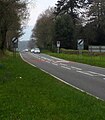
A470 at Glyn Tarell - geograph.org.uk - 2224008.jpg 640 × 480; 77 KB
-
A470 at Pont Ar Daf - geograph.org.uk - 3131791.jpg 640 × 417; 46 KB
-
A470 at Storey Arms - geograph.org.uk - 2631495.jpg 640 × 480; 82 KB
-
A470 Brecon Beacons - geograph.org.uk - 4067373.jpg 960 × 720; 95 KB
-
A470 crossing the Nant y Gerdinen - geograph.org.uk - 6047272.jpg 800 × 594; 166 KB
-
A470 direction signs in Libanus, Powys - geograph.org.uk - 6134750.jpg 1,024 × 691; 192 KB
-
A470 Distance Sign Brecon Beacons - geograph.org.uk - 4067393.jpg 720 × 540; 80 KB
-
A470 entering Libanus - geograph.org.uk - 3132107.jpg 640 × 482; 105 KB
-
A470 from entrance to Bolgoed - geograph.org.uk - 3132118.jpg 640 × 433; 50 KB
-
A470 from Libanus towards Brecon - geograph.org.uk - 6112653.jpg 1,024 × 786; 182 KB
-
A470 from opposite Storey Arms - geograph.org.uk - 2223985.jpg 640 × 480; 38 KB
-
A470 heading north from Storey Arms - geograph.org.uk - 2223990.jpg 640 × 480; 46 KB
-
A470 in the Brecon Beacons - geograph.org.uk - 6047237.jpg 800 × 494; 101 KB
-
A470 layby at the edge of Libanus, Powys - geograph.org.uk - 6112635.jpg 1,024 × 849; 158 KB
-
A470 layby near Coed Tŷ Mawr - geograph.org.uk - 3615449.jpg 800 × 600; 127 KB
-
A470 looking north - geograph.org.uk - 2223997.jpg 640 × 480; 66 KB
-
A470 looking north - geograph.org.uk - 3285325.jpg 640 × 480; 41 KB
-
A470 looking north - geograph.org.uk - 3285333.jpg 640 × 480; 55 KB
-
A470 near Bolgoed looking north east - geograph.org.uk - 2224029.jpg 640 × 480; 77 KB
-
A470 near Gwaun Crew - geograph.org.uk - 5896179.jpg 1,024 × 755; 139 KB
-
A470 near Nant-Ddu - geograph.org.uk - 1993571.jpg 640 × 480; 82 KB
-
A470 near Pentrewaen - geograph.org.uk - 3285327.jpg 640 × 480; 53 KB
-
A470 near Rhydwernen Cottage - geograph.org.uk - 3285329.jpg 640 × 481; 55 KB
-
A470 north from layby - geograph.org.uk - 3132082.jpg 640 × 480; 53 KB
-
A470 towards Brecon - geograph.org.uk - 1993699.jpg 640 × 480; 77 KB
-
A470 towards Libanus - geograph.org.uk - 1993676.jpg 640 × 480; 76 KB
-
A470- April snow showers at Storey Arms, Brecon Beacons, Wales (26261285991).jpg 5,184 × 3,456; 9.96 MB
-
A470-A4059 junction - geograph.org.uk - 2223981.jpg 640 × 480; 78 KB
-
A470-A4215 junction - geograph.org.uk - 2224012.jpg 640 × 480; 46 KB
-
Abandoned Building at Beacons Reservoir - geograph.org.uk - 3503953.jpg 640 × 478; 107 KB
-
Above Glyn Tarell - geograph.org.uk - 4924003.jpg 1,067 × 1,600; 472 KB
-
Above Nant yr Eira - geograph.org.uk - 4321788.jpg 4,000 × 3,000; 3.75 MB
-
Access from the Nant Cwm Llwch car park - geograph.org.uk - 2952600.jpg 4,000 × 3,000; 4.68 MB
-
Access Land boundary - geograph.org.uk - 2022950.jpg 2,272 × 1,704; 2.25 MB
-
Access lane to Pentwyn south of Libanus - geograph.org.uk - 3615472.jpg 800 × 600; 174 KB
-
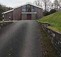
Access road to Libanus URC chapel, Powys - geograph.org.uk - 6112898.jpg 1,024 × 965; 252 KB
-
Access to Y Gyrn - geograph.org.uk - 7136128.jpg 1,536 × 2,048; 1.26 MB
-
Across Glyn Tarell - geograph.org.uk - 2631329.jpg 640 × 449; 78 KB
-
Across Traeth Mawr - geograph.org.uk - 5342832.jpg 4,320 × 2,550; 2.25 MB
-
Afon Tarell - geograph.org.uk - 6843468.jpg 1,536 × 2,048; 1.81 MB
-
Afon Tarell - geograph.org.uk - 6843649.jpg 960 × 1,280; 772 KB
-
Afon Tarell - geograph.org.uk - 7159381.jpg 1,536 × 2,048; 2.04 MB
-
Afon Tarrell - geograph.org.uk - 2608278.jpg 800 × 600; 412 KB
-
Afon Tarrell - geograph.org.uk - 2743052.jpg 640 × 480; 136 KB
-
Allt Ddu - geograph.org.uk - 2021745.jpg 2,272 × 1,704; 1.75 MB
-
Ancient track - geograph.org.uk - 7135466.jpg 2,048 × 1,536; 1.38 MB
-
Approaching Corn Du and Pen y Fan - geograph.org.uk - 7138909.jpg 4,032 × 3,024; 3.49 MB
-
Approaching Fan Fawr - geograph.org.uk - 4321831.jpg 4,000 × 2,520; 2.62 MB
-
Approaching the A470 and A4059 junction - geograph.org.uk - 4192233.jpg 678 × 1,024; 111 KB
-
Approaching the bridge at Pontrhydybetws - geograph.org.uk - 2953967.jpg 4,000 × 3,000; 4.59 MB
-
Approaching the Storey Arms - geograph.org.uk - 2631485.jpg 480 × 640; 118 KB
-
ARAF-SLOW on the A470, Libanus, Powys - geograph.org.uk - 6118612.jpg 1,024 × 719; 188 KB
-
Ascending Cefn yr Henriw towards Fan Fawr - geograph.org.uk - 4321798.jpg 3,874 × 2,906; 4.81 MB
-
Ascending Craig Cwm Llwch - geograph.org.uk - 2952655.jpg 4,000 × 3,000; 2.69 MB
-
Ash twig and waterfall - geograph.org.uk - 6847196.jpg 704 × 939; 372 KB
-
Bales of bracken - geograph.org.uk - 6686811.jpg 4,032 × 3,024; 4.25 MB
-
Bases of buildings near to car park - geograph.org.uk - 3911468.jpg 1,500 × 1,125; 2.38 MB
-
Beacons Reservoir - geograph.org.uk - 4321928.jpg 3,866 × 2,899; 2.55 MB
-
Beacons Reservoir - geograph.org.uk - 5867415.jpg 1,600 × 1,200; 806 KB
-
Beacons Reservoir - geograph.org.uk - 6416025.jpg 2,048 × 1,536; 958 KB
-
Beacons Reservoir - geograph.org.uk - 6416128.jpg 2,048 × 1,536; 820 KB
-
Beacons Reservoir - geograph.org.uk - 6420731.jpg 3,804 × 2,853; 3.17 MB
-
Beacons reservoir - geograph.org.uk - 7092674.jpg 2,048 × 1,536; 1.02 MB
-
Beacons Reservoir and Cefn Crew - geograph.org.uk - 6416032.jpg 2,048 × 1,536; 849 KB
-
Beacons Reservoir and Fan Fawr - geograph.org.uk - 4794243.jpg 4,000 × 3,000; 2.41 MB
-
Beacons Reservoir dam - geograph.org.uk - 4321933.jpg 3,954 × 2,965; 4.07 MB
-
Beacons Reservoir dam, spillway and valve tower - geograph.org.uk - 4321935.jpg 4,000 × 3,000; 3.15 MB
-
Beacons reservoir from Cefn Crew - geograph.org.uk - 7092788.jpg 2,048 × 1,536; 826 KB
-
Beacons Way near Craig Cerrig-gleisiad - geograph.org.uk - 2755754.jpg 4,000 × 3,000; 2.51 MB
-
Beacons Way on Craig Cerrig-gleisiad - geograph.org.uk - 2755751.jpg 4,000 × 3,000; 2.4 MB
-
Beacons Way stile on Fan Frynych - geograph.org.uk - 2755746.jpg 4,000 × 3,000; 2.56 MB
-
Below the cloud level - geograph.org.uk - 2021753.jpg 2,272 × 1,704; 1.69 MB
-
Big sky above the Brecon Beacons - geograph.org.uk - 6562442.jpg 2,048 × 1,536; 434 KB
-
Bilingual name sign, Libanus, Powys - geograph.org.uk - 6126578.jpg 1,024 × 721; 254 KB
-
Blaen Taf Fawr - geograph.org.uk - 4551793.jpg 640 × 443; 89 KB
-
Blaen Taf Fawr - geograph.org.uk - 4820700.jpg 3,072 × 2,048; 6.68 MB
-
Blaen Taf Fawr - geograph.org.uk - 6136336.jpg 1,024 × 768; 234 KB
-
Blaen Taf Fawr - geograph.org.uk - 6197871.jpg 2,048 × 1,536; 1.43 MB
-
Blaen Taf Fawr - geograph.org.uk - 6891446.jpg 1,600 × 1,111; 759 KB
-
Blaen Taf Fawr - geograph.org.uk - 6891580.jpg 1,600 × 1,200; 656 KB
-
Blaen Taf Fawr Footbridge - geograph.org.uk - 6891595.jpg 1,024 × 768; 210 KB
-
Blaenglyn Farm - geograph.org.uk - 7159400.jpg 2,048 × 1,536; 1.28 MB
-
Blaenglyn Farm - geograph.org.uk - 7159407.jpg 2,048 × 1,536; 868 KB
-
Bleak landscape - geograph.org.uk - 7136341.jpg 4,032 × 3,024; 4.44 MB
-
Blocks placed by nature and by man - geograph.org.uk - 4337836.jpg 1,024 × 768; 301 KB
-
Bracket fungus - geograph.org.uk - 7159416.jpg 1,536 × 2,048; 1.46 MB
-
Brecon Beacons - 1979 - geograph.org.uk - 2457550.jpg 2,272 × 1,515; 1.18 MB
-
Brecon Beacons - 1979 - geograph.org.uk - 2457553.jpg 2,272 × 1,515; 802 KB
-
Brecon Beacons - 1979 - geograph.org.uk - 2457556.jpg 1,515 × 2,272; 501 KB
-
Brecon Beacons - 1979 - geograph.org.uk - 2457559.jpg 640 × 428; 91 KB
-
Brecon Beacons - 1979 - geograph.org.uk - 2457562.jpg 2,272 × 1,521; 1.09 MB
-
Brecon Beacons - geograph.org.uk - 1538983.jpg 640 × 480; 81 KB
-
Brecon Beacons - geograph.org.uk - 6803109.jpg 4,032 × 3,024; 2.51 MB
-
Brecon Beacons in the mist - geograph.org.uk - 2755719.jpg 4,000 × 3,000; 2.47 MB
-
Brecon Beacons National Park Visitor Centre - geograph.org.uk - 5529301.jpg 1,280 × 851; 516 KB
-
Brecon Beacons panorama - geograph.org.uk - 7038009.jpg 1,280 × 468; 192 KB
-
Brecon Beacons Panorama - geograph.org.uk - 895463.jpg 640 × 137; 28 KB
-
Brecon Estate Office - Dan-y-Gyrn - geograph.org.uk - 7159415.jpg 1,536 × 2,048; 1.49 MB
-
Breconshire landscape - geograph.org.uk - 7139838.jpg 3,875 × 2,906; 3.53 MB
-
Breconshire landscape - geograph.org.uk - 7159374.jpg 2,048 × 1,536; 1.04 MB
-
Brest y Gelli - geograph.org.uk - 6840519.jpg 2,048 × 1,536; 1.22 MB
-
Bridge over Afon Tarell - geograph.org.uk - 6840517.jpg 1,536 × 2,048; 1.98 MB
-
Bridge over Nant Byddegai - geograph.org.uk - 6843586.jpg 2,048 × 1,536; 1.88 MB
-
Bridge over Nant Cwm Llwch - geograph.org.uk - 2023566.jpg 2,272 × 1,704; 3.35 MB
-
Bridge over Nant Gwdi - geograph.org.uk - 6840780.jpg 2,048 × 1,536; 1.64 MB
-
Bridge over the Taf Fawr - geograph.org.uk - 1169671.jpg 640 × 427; 127 KB
-
Bryn Du Mountainside - geograph.org.uk - 2175190.jpg 800 × 600; 111 KB
-
Bungalows above Cae'r Afallen, Libanus, Powys - geograph.org.uk - 6118459.jpg 1,022 × 1,024; 234 KB
-
Burger van next left, Brecon Beacons - geograph.org.uk - 3600410.jpg 800 × 600; 107 KB
-
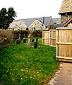
Burial ground, Glan Tarrell, Libanus, Powys - geograph.org.uk - 6198038.jpg 1,355 × 1,600; 621 KB
-
Bwlch Duwynt - geograph.org.uk - 5065467.jpg 640 × 480; 64 KB
-
Bwlch Duwynt and Craig Gwaun Taf as seen from Corn Du - geograph.org.uk - 6506512.jpg 1,799 × 1,199; 262 KB
-
Cairn at Corn Du - geograph.org.uk - 6197780.jpg 2,048 × 1,536; 1.06 MB
-
Cairn at Fan Fawr - geograph.org.uk - 6418947.jpg 2,048 × 1,536; 1.12 MB
-
Cairn on summit of Pen y Fan - geograph.org.uk - 6987658.jpg 1,600 × 1,069; 241 KB
-
Cairn on the summit of Y Gyrn - geograph.org.uk - 7136249.jpg 3,642 × 2,731; 4.48 MB
-
Cantref Reservoir - geograph.org.uk - 7092790.jpg 2,048 × 1,536; 767 KB
-
Car park near the Storey Arms - geograph.org.uk - 1116342.jpg 640 × 426; 67 KB
-
Carno - geograph.org.uk - 2630665.jpg 640 × 480; 96 KB
-
Cars and houses, Cae'r Afallen, Libanus, Powys - geograph.org.uk - 6118586.jpg 1,024 × 907; 191 KB
-
Cascade of water - geograph.org.uk - 6847185.jpg 1,536 × 2,048; 1.16 MB
-
Cattle grid on road to Mynydd Illtyd - geograph.org.uk - 7135506.jpg 1,536 × 2,048; 1.68 MB
-
Cattle near Llwyncelin-fawr - geograph.org.uk - 2630195.jpg 640 × 447; 65 KB
-
Cattle near Penstar - geograph.org.uk - 2629980.jpg 640 × 468; 97 KB
-
Caught unawares - geograph.org.uk - 6418996.jpg 2,048 × 1,536; 1.08 MB
-
Cefn Crew - geograph.org.uk - 4727319.jpg 1,600 × 1,200; 437 KB
-
Cefn Crew - geograph.org.uk - 4727330.jpg 1,600 × 1,200; 486 KB
-
Cefn Crew - geograph.org.uk - 7092654.jpg 2,048 × 1,536; 1.41 MB
-
Cefn Crew - geograph.org.uk - 7092983.jpg 2,048 × 1,536; 1.28 MB
-
Cefn Crew and the Beacons Reservoir - geograph.org.uk - 3510192.jpg 4,432 × 1,184; 2.71 MB
-
Cefn Crew in the evening sun - geograph.org.uk - 7093100.jpg 2,048 × 1,536; 986 KB
-
Cefn Cwm Llwch - geograph.org.uk - 2676780.jpg 640 × 480; 85 KB
-
Cefn Cwm Llwch - geograph.org.uk - 6197293.jpg 1,538 × 2,044; 718 KB
-
Cefn Cwm Llwch - geograph.org.uk - 6201748.jpg 3,193 × 2,393; 1.82 MB
-
Cefn Cwm Llwch as seen from Pen y Fan - geograph.org.uk - 6506524.jpg 1,799 × 1,199; 355 KB
-
Cefn Cwm Llwch from Pen y Fan - geograph.org.uk - 3422071.jpg 4,000 × 3,000; 3.14 MB
-
Cefn Cwm Llwych - geograph.org.uk - 6618271.jpg 5,152 × 2,544; 4.06 MB
-
Cefn Cwm Llwych - geograph.org.uk - 6618285.jpg 5,152 × 3,864; 6.49 MB
-
Cefn Cwm Llwych - geograph.org.uk - 6618290.jpg 5,152 × 3,864; 6.05 MB
-
Cefn Cwm Llwych - geograph.org.uk - 6619377.jpg 3,864 × 5,152; 5.84 MB
-
Cefn yr Henriw - geograph.org.uk - 2896859.jpg 4,608 × 3,440; 3.8 MB
-
Cerddwyr ar Fan Fawr - Walkers on Fan Fawr - geograph.org.uk - 5892703.jpg 1,024 × 768; 144 KB


