Category:Glarus Nord
Jump to navigation
Jump to search
Esperanto: Glaruso Nordo estas politika komunumo en Kantono Glaruso, kiu estiĝis kun efiko de la 1-a de januaro 2011 per kunigo de la ĝis tiamaj malnovaj politikaj komunumoj Bilten, Filzbach, Näfels, Niederurnen, Mollis, Mühlehorn, Oberurnen kaj Obstalden.
municipality in Switzerland | |||||
| Upload media | |||||
| Instance of |
| ||||
|---|---|---|---|---|---|
| Location | Glarus, Switzerland | ||||
| Located in or next to body of water | |||||
| Official language | |||||
| Head of government |
| ||||
| Inception |
| ||||
| Population |
| ||||
| Area |
| ||||
| Elevation above sea level |
| ||||
| Replaces |
| ||||
| official website | |||||
 | |||||
Subcategories
This category has the following 19 subcategories, out of 19 total.
A
B
E
- Escherkanal (58 F)
F
H
L
- Linthkolonie (5 F)
M
N
S
- Schwarzstöckli (1 F)
W
- Wageten (5 F)
- Weisswand-Ofeneck Tunnel (16 F)
Media in category "Glarus Nord"
The following 34 files are in this category, out of 34 total.
-
CHE Glarus Nord COA.svg 512 × 625; 5 KB
-
Glarus Nord-coat of arms.svg 603 × 763; 9 KB
-
GW-GL-Glarus Nord.png 184 × 220; 11 KB
-
Wappen der Gemeinde Glarus Nord.svg 175 × 210; 28 KB
-
2022-Oberurnen-Kapelle.jpg 1,280 × 1,920; 2.68 MB
-
5-Escherkanal-Keller.jpg 1,575 × 1,181; 2.21 MB
-
6-Linthkanal-Jud.jpg 1,575 × 1,051; 1.34 MB
-
8-Flussfahrt-Tremp.jpg 1,575 × 1,051; 2.12 MB
-
A3 Bilten, map OSM 2022.png 390 × 414; 127 KB
-
A3 Mühlehorn, map OSM 2022.png 172 × 65; 13 KB
-
A3 Weesen, map OSM 2022.png 658 × 320; 88 KB
-
C1630-080.png 80 × 80; 5 KB
-
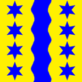
CHE Glarus Nord Flag.svg 512 × 512; 104 KB
-
Combat du pont de Noeffels 25 Sept 1799 (leicht beschnitten).jpg 2,151 × 1,434; 1.24 MB
-
Flag of Glarus Nord.png 216 × 216; 12 KB
-
Glarus Nord - Unknown Shelter (50999649879).jpg 5,200 × 3,467; 11.56 MB
-
Glarus Nord - Unknown Shelter (51084668992).jpg 5,200 × 3,466; 11.13 MB
-
Glarus Nord von Amden.JPG 4,912 × 3,264; 5.47 MB
-
Höchnase und Wiggis.jpg 960 × 720; 174 KB
-
Johann Konrad Escher Steg zwischen Näfels und Mollis.jpg 1,698 × 961; 404 KB
-
Johann Konrad Escher Steg zwischen Näfels und Mollis.jpg (kräftiger).jpg 1,696 × 962; 455 KB
-
Karte Gemeinde Glarus Nord 2011.png 1,476 × 1,992; 520 KB
-
Kerenzertunnel.einfahrt.weesen.jpg 2,048 × 1,529; 365 KB
-
Le général Molitor bataille de Naefels 1799 (détail).jpg 1,018 × 727; 151 KB
-
Le général Molitor bataille de Naefels 1799.jpg 2,698 × 1,612; 681 KB
-
Leistchamm aus Linthebene von Westen.jpg 1,300 × 879; 161 KB
-
Obersee Glarus.JPG 3,888 × 2,592; 3.52 MB
-
Oberurnen Glarus Nord.jpg 7,413 × 2,141; 13.29 MB
-
SBB Cargo Re 620 066 (53441540172).jpg 3,000 × 1,999; 4.79 MB
-
Speer Blick ins Glarnerland.JPG 4,912 × 3,264; 6.25 MB
-
Stadt Glarus Nord 2021.png 7,796 × 6,609; 13.67 MB
-
Vorderglärnisch nach Norden.jpg 1,200 × 900; 328 KB
-
Walensee (112033807).jpeg 2,048 × 1,252; 1.06 MB
-
Zwischen Schilt und Roterd, Kanton Glarus.jpg 11,699 × 3,485; 42.25 MB


