Category:Girton, Cambridgeshire
Jump to navigation
Jump to search
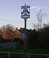
Deutsch: miniatur|Girton, St. Andrews
English: Girton is a village of about 1,600 households, and 4,500 people in Cambridgeshire, England. It lies about two miles to the northwest of Cambridge, and is the home of Cambridge University's Girton College, which was moved there from a previous site in Hertfordshire in 1872. Girton has a long history as a village — people were living there before Saxon times. The old name for Girton was Gretton, meaning 'village on the gravel', so called because the settlement grew up along a gravel ridge. The three oldest parts of the village are found by St Andrews Church, at Duck End and by Huntingdon Road. The village is also home to a rare variant of the grey squirrel — the black squirrel.
Nederlands: Girton is een dorp (village en civil parish) in het Engelse graafschap Cambridgeshire. Het dorp ligt in het district South Cambridgeshire en telt 3752 inwoners.
village in Cambridgeshire, England | |||||
| Upload media | |||||
| Instance of | |||||
|---|---|---|---|---|---|
| Location | South Cambridgeshire, Cambridgeshire, East of England, England | ||||
| Population |
| ||||
| Said to be the same as | Girton (Wikimedia duplicated page, civil parish) | ||||
| official website | |||||
 | |||||
Subcategories
This category has the following 3 subcategories, out of 3 total.
A
G
Media in category "Girton, Cambridgeshire"
The following 200 files are in this category, out of 319 total.
(previous page) (next page)-
3-7 Duck End, Girton.jpg 4,032 × 3,024; 2.54 MB
-
8 Duck End, Girton.jpg 4,032 × 3,024; 6.73 MB
-
9 Duck End, Girton.jpg 4,032 × 3,024; 5.48 MB
-
A mature tree on the Sports Ground by the A1307 - geograph.org.uk - 3535760.jpg 2,736 × 3,648; 2.27 MB
-
A shared driveway access - geograph.org.uk - 3535770.jpg 3,648 × 2,736; 2.15 MB
-
A1307, Roman Road - geograph.org.uk - 5151269.jpg 640 × 472; 68 KB
-
A14 - geograph.org.uk - 5151519.jpg 640 × 426; 64 KB
-
A14 - geograph.org.uk - 5151520.jpg 640 × 426; 60 KB
-
A14 approaching junction with M11 - geograph.org.uk - 5950370.jpg 1,024 × 583; 52 KB
-
A14 approaching junction with M11 - geograph.org.uk - 5950371.jpg 1,024 × 560; 78 KB
-
A14 from Girton - geograph.org.uk - 3094380.jpg 1,600 × 1,200; 620 KB
-
A14 fully open - geograph.org.uk - 6745675.jpg 1,600 × 1,067; 282 KB
-
A14 near Girton - geograph.org.uk - 3185423.jpg 1,600 × 1,200; 608 KB
-
A14 near Girton - geograph.org.uk - 5995664.jpg 1,600 × 1,200; 303 KB
-
A14 near Girton - geograph.org.uk - 6423396.jpg 1,600 × 1,057; 289 KB
-
A14 north of Cambridge - geograph.org.uk - 3185400.jpg 1,600 × 1,200; 694 KB
-
A14 start of average speed check - geograph.org.uk - 3458821.jpg 1,836 × 1,081; 826 KB
-
A14 westbound - geograph.org.uk - 5982342.jpg 640 × 480; 57 KB
-
A14 widening - geograph.org.uk - 4039986.jpg 1,600 × 1,200; 562 KB
-
A14 widening - geograph.org.uk - 4136588.jpg 1,600 × 1,200; 598 KB
-
A14 widening - geograph.org.uk - 4136592.jpg 1,600 × 1,246; 777 KB
-
A14 widening - geograph.org.uk - 4136597.jpg 1,600 × 1,200; 427 KB
-
A14 widening - geograph.org.uk - 4442856.jpg 1,600 × 1,200; 509 KB
-
A14 widening - geograph.org.uk - 4442883.jpg 1,600 × 1,200; 590 KB
-
A14 widening - geograph.org.uk - 4442909.jpg 1,600 × 1,200; 618 KB
-
A14 works - geograph.org.uk - 6226097.jpg 1,600 × 1,067; 334 KB
-
A14 works - geograph.org.uk - 6226100.jpg 1,600 × 1,067; 448 KB
-
A14, Girton Interchange - geograph.org.uk - 3842084.jpg 640 × 480; 281 KB
-
A14-A1307 Junction (Huntingdon Road) - geograph.org.uk - 3842093.jpg 640 × 480; 305 KB
-
A14-A428-M11 junction - geograph.org.uk - 3185387.jpg 1,600 × 1,200; 536 KB
-
A14-A428-M11 junction - geograph.org.uk - 6774319.jpg 5,472 × 3,648; 2.5 MB
-
A428 - geograph.org.uk - 3664464.jpg 2,349 × 1,842; 543 KB
-
Abbeyfield, Girton Green - geograph.org.uk - 3154159.jpg 1,600 × 1,200; 618 KB
-
Anglia Ruskin playing field off Whitehouse Lane - geograph.org.uk - 4502279.jpg 1,600 × 1,200; 611 KB
-
Anglia Ruskin sports pavilion off Whitehouse Lane - geograph.org.uk - 4502275.jpg 1,600 × 1,200; 435 KB
-
Approaching Girton - geograph.org.uk - 4807649.jpg 1,024 × 1,024; 1.38 MB
-
Back entrance to Girton College - geograph.org.uk - 5151518.jpg 640 × 353; 72 KB
-
Binfield, Girton.jpg 640 × 426; 62 KB
-
Bird on a wire, Cambridge - geograph.org.uk - 4449347.jpg 446 × 640; 193 KB
-
BP Filling Station, Girton - geograph.org.uk - 3536623.jpg 3,648 × 2,736; 1.26 MB
-
BP Garage, Huntingdon Road - geograph.org.uk - 1849525.jpg 640 × 480; 87 KB
-
Brook Leys - geograph.org.uk - 6146384.jpg 4,608 × 3,456; 4.95 MB
-
Brook Leys at Eddington - geograph.org.uk - 6146350.jpg 4,608 × 3,456; 3.95 MB
-
Brook Leys, Eddington - geograph.org.uk - 5931398.jpg 1,600 × 1,200; 332 KB
-
BT Premises in Girton - geograph.org.uk - 3536621.jpg 3,648 × 2,736; 1.8 MB
-
Camboro Business Park entrance - geograph.org.uk - 4908712.jpg 1,600 × 1,200; 659 KB
-
Cambridge Academy of English - geograph.org.uk - 5151638.jpg 640 × 426; 66 KB
-
Cambridge Rd, Girton - St Andrew's Church tower - geograph.org.uk - 5362444.jpg 5,456 × 3,632; 7 MB
-
Cambridge Road, Girton - geograph.org.uk - 6844851.jpg 5,472 × 3,648; 6.98 MB
-
Cambridge Self-Service Storage - geograph.org.uk - 4908709.jpg 1,600 × 1,200; 670 KB
-
Cambridge University Farm - geograph.org.uk - 4136613.jpg 1,600 × 1,200; 984 KB
-
Cambridge University Farm - geograph.org.uk - 4442899.jpg 1,600 × 1,200; 498 KB
-
Cambridge University Farm planning notice - geograph.org.uk - 3363580.jpg 3,000 × 4,000; 2.31 MB
-
Catch Hall cottages - geograph.org.uk - 6226104.jpg 1,600 × 1,067; 305 KB
-
Changing rooms for the Playing Fields - geograph.org.uk - 3535703.jpg 1,824 × 1,368; 616 KB
-
Church at Girton - geograph.org.uk - 6592739.jpg 4,608 × 3,456; 3.7 MB
-
Church Lane - geograph.org.uk - 5151526.jpg 640 × 426; 86 KB
-
Churchfield Court - geograph.org.uk - 5159938.jpg 640 × 426; 68 KB
-
Churchfield Court - geograph.org.uk - 5159941.jpg 640 × 485; 87 KB
-
Churchfield Court - geograph.org.uk - 660732.jpg 640 × 459; 69 KB
-
Cmglee Girton Golden Goose sculpture.jpg 4,096 × 3,072; 4.89 MB
-
Co-op, Girton - geograph.org.uk - 4442858.jpg 1,600 × 1,200; 553 KB
-
Cockerton Rd - geograph.org.uk - 5151643.jpg 640 × 426; 69 KB
-
Cottage in Girton - geograph.org.uk - 5159945.jpg 640 × 451; 53 KB
-
Cottage, Cambridge Rd - geograph.org.uk - 5151529.jpg 640 × 426; 83 KB
-
Cottages, Cambridge Rd - geograph.org.uk - 5151528.jpg 640 × 426; 56 KB
-
Cottages, Cambridge Rd - geograph.org.uk - 5151634.jpg 640 × 426; 69 KB
-
Cottontails pre-school - geograph.org.uk - 5151527.jpg 640 × 426; 62 KB
-
Criterion audio, Camboro Business park - geograph.org.uk - 4908741.jpg 1,600 × 1,200; 692 KB
-
Cycling to Eddington - geograph.org.uk - 6317738.jpg 1,024 × 732; 720 KB
-
Darwin Green starting eventually - geograph.org.uk - 6217805.jpg 1,600 × 1,067; 339 KB
-
Dodford Lane - geograph.org.uk - 5151665.jpg 640 × 426; 76 KB
-
Dodford Lane, Girton - geograph.org.uk - 4098543.jpg 1,600 × 1,200; 644 KB
-
Eastbound A14 at Girton Interchange - geograph.org.uk - 3842089.jpg 640 × 427; 248 KB
-
Eddington expanding - geograph.org.uk - 5942733.jpg 1,024 × 1,024; 1.17 MB
-
Eddington from Ridgeway - geograph.org.uk - 6317745.jpg 1,024 × 683; 884 KB
-
Eddington to Girton - geograph.org.uk - 5840715.jpg 1,024 × 768; 877 KB
-
Eddington, at the corner of Turing Way and Cartwright Avenue - geograph.org.uk - 5711309.jpg 1,024 × 1,024; 1.09 MB
-
Eddington, building continues - geograph.org.uk - 6578762.jpg 1,024 × 819; 1 MB
-
Eddington, cranes and Athena - geograph.org.uk - 5537885.jpg 819 × 1,024; 946 KB
-
Eddington, new flats and a mature tree - geograph.org.uk - 6578745.jpg 1,024 × 768; 1.04 MB
-
Eddington, on Walton Way - geograph.org.uk - 6365797.jpg 1,024 × 1,024; 1.19 MB
-
End of Thornton Way - geograph.org.uk - 3154128.jpg 1,600 × 1,200; 861 KB
-
Fallow field on the edge of Girton - geograph.org.uk - 4908671.jpg 1,600 × 1,200; 620 KB
-
Fallow football pitches - geograph.org.uk - 4839203.jpg 2,560 × 1,920; 1.38 MB
-
Farm buildings by Huntingdon Road - geograph.org.uk - 3185413.jpg 1,600 × 1,200; 651 KB
-
Farm Track near Berk Brook Farm - geograph.org.uk - 4951305.jpg 3,264 × 1,840; 2.54 MB
-
Farm track north of A428 - geograph.org.uk - 3976085.jpg 1,600 × 1,200; 945 KB
-
Fata Morgana Tea House - geograph.org.uk - 5532774.jpg 1,600 × 1,200; 354 KB
-
Field by A14 - geograph.org.uk - 4440530.jpg 1,600 × 1,200; 744 KB
-
Field by Girton - geograph.org.uk - 3185356.jpg 1,600 × 1,200; 675 KB
-
Field by in the A14-M11-A428-A1307 junction - geograph.org.uk - 4440501.jpg 1,600 × 1,200; 717 KB
-
Field by Washpit Road - geograph.org.uk - 6774300.jpg 5,472 × 3,648; 4.35 MB
-
Field in Girton - geograph.org.uk - 6742213.jpg 1,600 × 1,067; 373 KB
-
Field near Beck Brook Farm - geograph.org.uk - 4951290.jpg 3,264 × 1,840; 2.17 MB
-
Field near Bulls Close - geograph.org.uk - 4951281.jpg 3,264 × 1,840; 2.28 MB
-
Footbridge over A14 - geograph.org.uk - 3185395.jpg 1,600 × 1,200; 591 KB
-
Footpath from end of Thornton Close - geograph.org.uk - 3154124.jpg 1,200 × 1,600; 1.22 MB
-
Footpath past Manor Farm - geograph.org.uk - 5159386.jpg 640 × 426; 103 KB
-
Footpath to A14 - geograph.org.uk - 4440519.jpg 1,600 × 1,200; 610 KB
-
Footpath to A14 - geograph.org.uk - 4440525.jpg 1,600 × 1,200; 857 KB
-
Footpath to Girton - geograph.org.uk - 4136593.jpg 1,600 × 1,200; 912 KB
-
Footpath to Histon - geograph.org.uk - 4908698.jpg 1,600 × 1,200; 669 KB
-
Footpath under M11 - geograph.org.uk - 6766952.jpg 1,024 × 768; 240 KB
-
Girton Baptist Church - geograph.org.uk - 3951036.jpg 1,600 × 1,200; 599 KB
-
Girton Baptist Church - geograph.org.uk - 5151670.jpg 640 × 426; 79 KB
-
Girton Baptist Church - geograph.org.uk - 5230993.jpg 1,024 × 683; 922 KB
-
Girton Church - geograph.org.uk - 4179334.jpg 851 × 1,280; 248 KB
-
Girton College entrance - geograph.org.uk - 6766997.jpg 768 × 1,024; 266 KB
-
Girton Glebe Primary School.jpg 4,032 × 3,024; 4.29 MB
-
Girton Post Office - geograph.org.uk - 667054.jpg 640 × 480; 63 KB
-
Girton Road Bridge, Westbound A14 - geograph.org.uk - 3874843.jpg 640 × 480; 275 KB
-
Girton Village Sign - geograph.org.uk - 660742.jpg 539 × 640; 82 KB
-
Girton village sign.JPG 2,112 × 2,816; 1.43 MB
-
Girton war memorial - geograph.org.uk - 3096336.jpg 1,600 × 1,200; 892 KB
-
Girton war memorial - geograph.org.uk - 3096340.jpg 1,011 × 1,600; 556 KB
-
Girton war memorial - geograph.org.uk - 3096344.jpg 1,200 × 1,600; 841 KB
-
Girton war memorial - geograph.org.uk - 3096347.jpg 1,200 × 1,600; 683 KB
-
Girton war memorial - geograph.org.uk - 3096351.jpg 1,200 × 1,600; 731 KB
-
Girton, a house on the corner - geograph.org.uk - 5230730.jpg 1,024 × 731; 966 KB
-
Girton, a sunny corner - geograph.org.uk - 4807641.jpg 1,024 × 682; 860 KB
-
Girton, a winter afternoon - geograph.org.uk - 4762855.jpg 1,024 × 732; 881 KB
-
Girton, a winter morning - geograph.org.uk - 4807645.jpg 1,024 × 732; 1.05 MB
-
Girton, allotments - geograph.org.uk - 3799759.jpg 1,200 × 895; 1.31 MB
-
Girton, at the edge of the Fens - geograph.org.uk - 5230987.jpg 1,024 × 731; 965 KB
-
Girton, Beck Brook and cloud clearing - geograph.org.uk - 4763177.jpg 1,024 × 732; 1.03 MB
-
Girton, Church Lane and St Andrew's Church - geograph.org.uk - 3799764.jpg 1,024 × 1,024; 1.55 MB
-
Girton, church, war memorial and bus stop - geograph.org.uk - 3350907.jpg 1,200 × 1,200; 1.75 MB
-
Girton, Dodford Lane - geograph.org.uk - 4763171.jpg 1,024 × 731; 855 KB
-
Girton, footpath to Duck End - geograph.org.uk - 4762773.jpg 1,024 × 732; 1.03 MB
-
Girton, footpath to Huntingdon Road - geograph.org.uk - 4762759.jpg 1,024 × 731; 973 KB
-
Girton, golf club and Dodford Lane - geograph.org.uk - 4763173.jpg 1,024 × 732; 988 KB
-
Girton, hedging and ditching - geograph.org.uk - 5230998.jpg 1,024 × 732; 1.1 MB
-
Girton, hedging at Manor Farm - geograph.org.uk - 3350910.jpg 1,200 × 900; 1.47 MB
-
Girton, new thatch at Duck End - geograph.org.uk - 4762777.jpg 1,024 × 1,024; 1.18 MB
-
Girton, over the gate from Washpit Road - geograph.org.uk - 4762858.jpg 1,024 × 731; 850 KB
-
Girton, playground and church - geograph.org.uk - 2857231.jpg 1,024 × 709; 918 KB
-
Girton, Remembrance Sunday - geograph.org.uk - 6317735.jpg 1,024 × 768; 1.06 MB
-
Girton, scarifying in autumn - geograph.org.uk - 5962263.jpg 1,024 × 768; 651 KB
-
Girton, St Andrew - geograph.org.uk - 5625563.jpg 819 × 1,024; 1.24 MB
-
Girton, sunlit field gate on Washpit Road - geograph.org.uk - 4763111.jpg 1,024 × 1,024; 1.5 MB
-
Girton, the widened A14 near Junction 14 - geograph.org.uk - 4762753.jpg 1,024 × 682; 836 KB
-
Girton, towards Grange Farm - geograph.org.uk - 4762959.jpg 1,024 × 732; 1.02 MB
-
Girton, under the junction - geograph.org.uk - 4593785.jpg 1,024 × 732; 1.09 MB
-
Girton, Washpit Road - geograph.org.uk - 4763120.jpg 1,024 × 1,024; 1.75 MB
-
Girton, Woodlands Park - geograph.org.uk - 4763170.jpg 1,024 × 1,024; 1.3 MB
-
Graffiti under M11 - geograph.org.uk - 5267115.jpg 1,600 × 1,067; 643 KB
-
Grange Farm - geograph.org.uk - 6774302.jpg 5,472 × 3,648; 4.03 MB
-
Gretton School - geograph.org.uk - 5159378.jpg 640 × 426; 90 KB
-
Gretton School - geograph.org.uk - 5159382.jpg 640 × 426; 80 KB
-
Gretton School, Girton - geograph.org.uk - 4908695.jpg 1,600 × 1,200; 430 KB
-
Hicks Lane - geograph.org.uk - 4994719.jpg 3,648 × 2,736; 2.72 MB
-
Hicks Lane - geograph.org.uk - 5151523.jpg 640 × 426; 61 KB
-
High St - geograph.org.uk - 5151641.jpg 640 × 426; 66 KB
-
High Street, Girton, Cambs - geograph.org.uk - 90049.jpg 640 × 480; 354 KB
-
House and Garden, Thornton Road - geograph.org.uk - 1436633.jpg 640 × 480; 95 KB
-
House on Girton Rd - geograph.org.uk - 5151521.jpg 640 × 426; 67 KB
-
Houses by the A14 - geograph.org.uk - 685617.jpg 640 × 480; 69 KB
-
Houses on Girton Road - geograph.org.uk - 1849506.jpg 640 × 480; 89 KB
-
Housing development, Eddington - geograph.org.uk - 6146361.jpg 4,608 × 3,456; 3.86 MB
-
Howe's Close Sports Ground - geograph.org.uk - 3535693.jpg 1,824 × 1,368; 652 KB
-
Howe's Farm - geograph.org.uk - 3025450.jpg 1,024 × 768; 884 KB
-
Howe's Farm - geograph.org.uk - 3363560.jpg 1,600 × 1,200; 655 KB
-
Howe's Farm - geograph.org.uk - 3363585.jpg 1,600 × 1,200; 709 KB
-
Howe's Farm - geograph.org.uk - 3363590.jpg 1,600 × 1,200; 583 KB
-
Howe's Farm - geograph.org.uk - 6766949.jpg 1,024 × 768; 174 KB
-
Howes Close closed - geograph.org.uk - 4839196.jpg 2,560 × 1,745; 1.15 MB
-
Huntingdon Road - geograph.org.uk - 3185401.jpg 1,600 × 1,200; 704 KB
-
Huntingdon Road at sunset - geograph.org.uk - 5343321.jpg 3,872 × 2,592; 3.06 MB
-
Huntingdon Road scene - geograph.org.uk - 1849583.jpg 1,024 × 768; 242 KB
-
Huntingdon Road to A14 slip road - geograph.org.uk - 4440496.jpg 1,600 × 1,200; 621 KB
-
Huntingdon Road to A14 slip road - geograph.org.uk - 4440509.jpg 1,600 × 1,167; 575 KB
-
In Girton woods - geograph.org.uk - 6379693.jpg 1,024 × 684; 303 KB
-
Ivy clad barn - geograph.org.uk - 5151669.jpg 640 × 426; 70 KB
-
K6 phone box on Cambridge Road, Girton - geograph.org.uk - 903288.jpg 640 × 480; 104 KB
-
Lake at Eddington - geograph.org.uk - 6761238.jpg 1,600 × 1,067; 410 KB
-
Lake at Eddington - geograph.org.uk - 6761240.jpg 1,600 × 1,067; 439 KB
-
Lake at Eddington - geograph.org.uk - 6761246.jpg 1,600 × 1,067; 460 KB
-
Lake at Eddington - geograph.org.uk - 6761249.jpg 1,600 × 1,067; 419 KB
-
Lake at Eddington - geograph.org.uk - 6761252.jpg 1,600 × 1,067; 377 KB
-
Local access road - geograph.org.uk - 6226106.jpg 1,600 × 1,039; 361 KB
-
Local access road - geograph.org.uk - 6226107.jpg 1,600 × 1,067; 248 KB
-
Local access road and A14 bridge - geograph.org.uk - 6226089.jpg 1,600 × 1,067; 210 KB
-
Local access road near Madingley - geograph.org.uk - 6402135.jpg 1,024 × 683; 586 KB
-
Looking towards Howe's Farm - geograph.org.uk - 3363562.jpg 1,600 × 1,200; 644 KB
-
Looking under the M11 - geograph.org.uk - 5343183.jpg 3,872 × 2,592; 2.72 MB
-
M11 by Eddington - geograph.org.uk - 6761242.jpg 1,600 × 1,067; 294 KB
-
M11 by Eddington - geograph.org.uk - 6761244.jpg 1,600 × 1,067; 422 KB
-
M11 from Brook Leys - geograph.org.uk - 5931425.jpg 1,600 × 1,129; 403 KB
-
M11 merges with A14 - geograph.org.uk - 2641540.jpg 640 × 428; 94 KB
-
M11 northbound - geograph.org.uk - 5982337.jpg 640 × 480; 60 KB
-
M11, south of J14 - geograph.org.uk - 4811598.jpg 640 × 426; 28 KB
-
M11, southbound - geograph.org.uk - 4811597.jpg 640 × 320; 22 KB
-
M11, southbound - geograph.org.uk - 4811600.jpg 640 × 332; 25 KB
-
Manor Farm - geograph.org.uk - 5159384.jpg 640 × 426; 71 KB
-
Manor Farm Rd - geograph.org.uk - 5159379.jpg 640 × 426; 79 KB
-
National Grid gas compound by A14 - geograph.org.uk - 4442919.jpg 1,600 × 1,200; 981 KB


