Category:German-language maps showing history
Jump to navigation
Jump to search
Subcategories
This category has the following 4 subcategories, out of 4 total.
E
H
M
Media in category "German-language maps showing history"
The following 81 files are in this category, out of 81 total.
-
AlterOrient2.png 1,394 × 1,118; 1.67 MB
-
Altes Reich.png 438 × 670; 55 KB
-
JadeWeser-arngast.png 478 × 476; 19 KB
-
Assam 1960.svg 600 × 675; 51 KB
-
Baltische Stämme um 1200.png 1,980 × 2,180; 473 KB
-
Baltische Stämme um 1200.svg 988 × 1,088; 447 KB
-
Bataver69x.png 5,968 × 2,728; 3.51 MB
-
Caucasus 1213 AD map de.png 3,000 × 2,332; 3.59 MB
-
Central Europe End 5th Century German.jpg 1,088 × 763; 519 KB
-
Danzig 1939.png 695 × 597; 77 KB
-
Deutsches Reich 1925 b.png 945 × 762; 70 KB
-
Deutsches Reich 2.png 1,280 × 1,288; 1.01 MB
-
Deutsches Reich1.png 3,236 × 2,986; 2.34 MB
-
Deutsches Reich2.png 3,248 × 2,949; 2.64 MB
-
Diadochen1.png 2,000 × 961; 2.39 MB
-
Doggerland3er.png 2,166 × 1,212; 1.5 MB
-
Duernkrut3.jpg 722 × 773; 193 KB
-
Egypt and Syria 1768 to 1774 map de.png 2,792 × 2,172; 874 KB
-
Expedition Cabeza de Vaca Karte borderless.png 1,990 × 895; 2.28 MB
-
Falklandschlacht.jpg 536 × 938; 476 KB
-
Finnische abgetretene Gebiete 1940.png 619 × 800; 33 KB
-
Finnische abgetretene Gebiete 1944.png 619 × 800; 86 KB
-
First Indochina War map 1947 de.png 996 × 1,414; 904 KB
-
Franken259x.png 5,960 × 2,728; 5.54 MB
-
Frankreich-1429 1-800x600.png 800 × 600; 66 KB
-
Fruchtbarer Halbmond map deutsch.png 2,481 × 3,508; 786 KB
-
GermanHamletsSince15th.jpg 2,797 × 2,095; 1,020 KB
-
Germania70rev.png 1,994 × 1,604; 1.45 MB
-
Griechische-Offensive11.png 330 × 355; 20 KB
-
Großfürstentum Litauen 13.–15. Jh.png 1,379 × 1,533; 517 KB
-
Holy Roman Empire 1000 map-de.png 1,000 × 1,227; 640 KB
-
HolyRomanEmpire 1618.png 4,005 × 3,964; 3.69 MB
-
HRR 10Jh.jpg 1,492 × 1,777; 888 KB
-
Ice Age glacial lakes of Siberia and Central Asia - de.svg 1,238 × 1,046; 3.79 MB
-
Indien 1670.jpg 546 × 709; 201 KB
-
Italien zur Langobardenzeit.jpg 2,036 × 2,584; 1.31 MB
-
JadeWeser.png 3,365 × 3,231; 655 KB
-
Jamnaja-Kultur.svg 939 × 733; 1.08 MB
-
Julian vs Persien.png 1,600 × 984; 1.81 MB
-
Karte Adams-Onís-Vertrag.png 800 × 654; 130 KB
-
Karte Chaco-Krieg.png 1,882 × 1,933; 751 KB
-
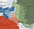
Karte polnischeteilungen4.jpg 1,344 × 1,149; 932 KB
-
Karte Tripel-Allianz-Krieg - nach dem Krieg.png 1,882 × 1,933; 738 KB
-
Karte Tripel-Allianz-Krieg - vor dem Krieg.png 1,882 × 1,933; 775 KB
-
Karte Tripel-Allianz-Krieg - während des Krieges.png 1,882 × 1,933; 812 KB
-
Karte Tripel-Allianz-Krieg.png 1,882 × 1,933; 504 KB
-
Karte Verteilung der Reichsdörfer.png 2,853 × 1,747; 1.31 MB
-
KarthIWG.jpg 1,341 × 709; 356 KB
-
Kastelle SK und Hadrianswall 2. Jhdt..png 1,987 × 1,159; 707 KB
-
Kesik Beli-Karawanenroute.jpg 764 × 1,051; 282 KB
-
Kievan-rus-1015-1113-(de).png 2,193 × 2,686; 539 KB
-
Kongo 1964 map de.png 2,108 × 2,008; 907 KB
-
Migration der Hutterer in Europa.png 1,840 × 1,012; 649 KB
-
NATO und Warschauer Pakt - Truppenstärke - (1973).png 1,165 × 1,200; 352 KB
-
NeanderFrankreich55.png 1,320 × 1,176; 2.27 MB
-
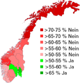
Norwegen-Referendum 1994 Anteile.png 588 × 614; 89 KB
-
Palaestina1920.png 675 × 542; 40 KB
-
Pariisin rauha de.png 619 × 800; 29 KB
-
Partage de la Cilice entre l'Empire Séleucides et Ptolémaïque.jpg 1,174 × 850; 380 KB
-
Portugal Colonial War 1970.jpg 360 × 480; 182 KB
-
Positionskarte EE + LV 1260.png 794 × 861; 120 KB
-
Prussia 1806 map - DE.svg 712 × 547; 1.89 MB
-
RoteHalleGrundrissTempel.png 1,618 × 794; 151 KB
-
SaaleWeichsel x.png 1,464 × 1,171; 1.36 MB
-
Schlacht bei mollwitz 1741.jpg 636 × 513; 32 KB
-
Second Congo War Africa map de.png 1,525 × 1,440; 418 KB
-
Südwestafrika 1915.jpg 1,193 × 1,351; 160 KB
-
Sprachen Deutsches Reich 1900.png 1,169 × 827; 130 KB
-
Stedinger Bauernrepublik DE.png 428 × 644; 43 KB
-
Suedpfalz.png 1,400 × 2,000; 3.02 MB
-
Sultanat von Delhi Tughluq-Dynastie.png 432 × 347; 14 KB
-
Sykes-Picot-1916 german.gif 677 × 876; 33 KB
-
Sächsische-Herzogtümer 1235.png 702 × 544; 782 KB
-
Theatre of operations around Suakin during Mahdist War.png 3,342 × 2,703; 782 KB
-
Trianon Karte Dt verbessert.PNG 651 × 497; 47 KB
-
USA Gebietsansprüche und -abtretungen 1782–1802.png 747 × 782; 194 KB
-
Venezianische Kolonien.png 1,189 × 843; 161 KB
-
Weg der Armada.gif 415 × 756; 82 KB
-
Yolda MeerX.png 1,994 × 2,716; 1.21 MB
-
Zweiter Burenkrieg Karte.png 1,900 × 1,532; 466 KB
-
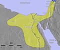
Ägyptens größte Ausdehnung.jpg 757 × 630; 213 KB


