Category:German-language SVG maps
Jump to navigation
Jump to search
Subcategories
This category has the following 4 subcategories, out of 4 total.
Media in category "German-language SVG maps"
The following 200 files are in this category, out of 752 total.
(previous page) (next page)-
1949 Taiwan de.svg 808 × 1,049; 70 KB
-
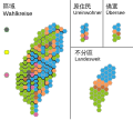
1991ROCNA-cartogram de.svg 850 × 744; 113 KB
-
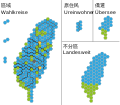
2004 ROCLY cartogram-de.svg 694 × 620; 89 KB
-
2008ROCLY-cartogram-de.svg 1,417 × 1,240; 54 KB
-
2011 Syria protests de.svg 922 × 762; 662 KB
-
2012ROCLY-cartogram-de.svg 1,417 × 1,240; 53 KB
-
2016 20대 총선 지역구 de.svg 1,190 × 1,141; 205 KB
-
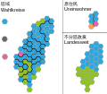
2016ROCLY-cartogram-de.svg 590 × 525; 39 KB
-
2020 New Zealand general election - Results de.svg 1,214 × 774; 468 KB
-
2020 Polish presidential election - 1st round results de.svg 758 × 730; 148 KB
-
2020 Polish presidential election - 2nd round results de.svg 758 × 730; 150 KB
-
2020ROCLY-cartogram-de.svg 512 × 448; 21 KB
-
2021 April Bulgarian parliamentary election - Results de.svg 512 × 261; 483 KB
-
2021 Hungarian opposition primary - Constituencies de.svg 1,427 × 734; 618 KB
-
2021 July Bulgarian parliamentary election - Results de.svg 512 × 261; 484 KB
-
2022 Latvian election results de.svg 2,020 × 957; 266 KB
-
2022 ROC Referendum C01-de.svg 700 × 850; 1,004 KB
-
2022 Russian invasion of Ukraine - de.svg 1,449 × 974; 1.95 MB
-
2022 Russian invasion of Ukraine.svg 2,199 × 1,478; 4.36 MB
-
2022 Russian invasion of Ukraine; 31 December 2023.svg 2,199 × 1,478; 3.68 MB
-
2023 Czech Presidential election, 1st round de.svg 1,162 × 567; 274 KB
-
2023 Czech Presidential election, 2nd round de.svg 1,162 × 567; 488 KB
-
A13 Swiss Highway-de.svg 1,052 × 744; 234 KB
-
Abchaz people de.svg 972 × 922; 259 KB
-
Abgeordnete nach Provinzen Afghanistan.svg 980 × 715; 518 KB
-
Abkhazia map-de.svg 945 × 737; 2.14 MB
-
Abortion Map Portugal 1998 de.svg 744 × 1,052; 210 KB
-
Abortion Map Portugal 2007 de.svg 744 × 1,052; 210 KB
-
Abzockerinitiative 2013.svg 1,105 × 720; 259 KB
-
Aegean Sea map-de.svg 3,750 × 4,560; 2.28 MB
-
Afghanistan Ethnien.svg 786 × 858; 235 KB
-
Afghanistan insurgency 2017.svg 1,026 × 778; 799 KB
-
Afghanistan women participation 2018 election.svg 1,014 × 716; 626 KB
-
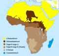
African language families de.svg 600 × 650; 52 KB
-
African continent-de.svg 1,525 × 1,440; 749 KB
-
Afro-Asiatic de.svg 763 × 721; 243 KB
-
Afsharid (1736-1802)-de.svg 420 × 325; 612 KB
-
AHV plus-Initiative 2016.svg 1,092 × 727; 255 KB
-
Al-Shabaab in Somalia November 2016.svg 776 × 700; 215 KB
-
Albaner in Nordmazedonien 2002.svg 558 × 436; 300 KB
-
Albania map-de.svg 1,880 × 3,850; 6.17 MB
-
Albanian dialects de.svg 782 × 657; 128 KB
-
Albanians in Macedonia 2002.svg 850 × 732; 279 KB
-
Alcohol belts of Europe (actual consumption in 2010) de.svg 1,005 × 776; 291 KB
-
Alcohol consumption 2005.svg 1,199 × 705; 470 KB
-
Alegeri prezidentiale 2014 turul 2 DE.svg 2,003 × 1,414; 1.79 MB
-
Alemannic-Dialects-Map-German.svg 1,400 × 1,000; 472 KB
-
Alemannic language location map in 1950-de.svg 1,400 × 1,000; 284 KB
-
Alianta Moldova Noastra 2009 de.svg 1,223 × 1,472; 617 KB
-
Alphabetisierungsraten Indien 2011.svg 967 × 1,134; 538 KB
-
Alps-Mediterranean Euroregion map-de.svg 1,465 × 1,126; 228 KB
-
Alsace Lorraine departments evolution map-de.svg 600 × 450; 390 KB
-
Altstadt Jerusalem Übersicht.svg 1,048 × 715; 169 KB
-
Amundsen.Südpol.Plano.svg 1,220 × 1,343; 94 KB
-
Anaximander world map-de.svg 1,063 × 1,063; 14 KB
-
Andorra topographic map-de.svg 1,625 × 1,300; 1.58 MB
-
Anser anser migration map-de.svg 843 × 805; 734 KB
-
Antarctica de.svg 907 × 906; 4.6 MB
-
AntarktisEisdrift.svg 1,050 × 1,100; 104 KB
-
Anti-Einwanderungsinitiative 2014.svg 1,092 × 727; 259 KB
-
Appalachen-Karte.svg 612 × 792; 54 KB
-
Appalachian map de.svg 402 × 556; 49 KB
-
Arctic de.svg 1,049 × 1,301; 3.58 MB
-
Augenfarbe.svg 2,435 × 2,011; 189 KB
-
Aurignacian culture map-de.svg 720 × 540; 417 KB
-
AUSCHWITZ-BIRKENAU.svg 2,400 × 2,000; 499 KB
-
Auslandseinsätze der Bundeswehr 2011.svg 863 × 443; 1.25 MB
-
Auslandseinsätze der Bundeswehr.2013-03-07.svg 1,245 × 979; 2.84 MB
-
Auslandseinsätze der Bundeswehr.2014-07-14.svg 1,277 × 979; 1.14 MB
-
Auslandseinsätze der Bundeswehr.2015-01-19.svg 1,277 × 979; 1.11 MB
-
Auslandseinsätze der Bundeswehr.svg 1,222 × 900; 1.24 MB
-
Ausschaffungsinitiative 2010 de.svg 1,105 × 720; 799 KB
-
Australia map de.svg 1,631 × 1,505; 244 KB
-
Austria 1945-55.svg 1,400 × 542; 138 KB
-
Austria Occupation Zones 1945-55.svg 1,355 × 750; 167 KB
-
Austroasiatic-de.svg 540 × 615; 240 KB
-
Austronesian Languages Usage Map of Taiwan de.svg 960 × 1,300; 1.39 MB
-
Autobahnen und Schnellstraßen in Österreich 2016.svg 1,950 × 1,200; 309 KB
-
Autobahnen und Schnellstraßen in Österreich.svg 512 × 315; 174 KB
-
Autonome Distrikte Assam.svg 1,005 × 660; 396 KB
-
Autriche hydro-de.svg 711 × 399; 164 KB
-
Azerbaijan topographic map-de-neu.svg 757 × 502; 3.07 MB
-
Azerbaijan topographic map-de.svg 757 × 502; 3.14 MB
-
Baarle-Nassau - Baarle-Hertog-de.svg 1,700 × 1,700; 259 KB
-
BaffinIsland de.svg 668 × 536; 368 KB
-
Balearic Islands map-de.svg 1,503 × 955; 2.87 MB
-
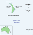
Ball's Pyramid and Lord Howe Island map v2.svg 512 × 553; 94 KB
-
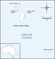
Ball's Pyramid and Lord Howe Island map.svg 512 × 553; 124 KB
-
BalticStatesBorders-de.svg 747 × 593; 230 KB
-
BalticStatesBorders-hu.svg 747 × 593; 178 KB
-
Bangladesch Parlamentswahl 2008 Karte.svg 1,541 × 1,881; 4.5 MB
-
Bangladesch Parlamentswahl 2014 Karte (2).svg 1,541 × 1,881; 4.51 MB
-
Bangladesch Parlamentswahl 2014 Karte.svg 1,541 × 1,881; 4.48 MB
-
Bangladesch Parlamentswahl 2018 Karte.svg 1,541 × 1,881; 5.64 MB
-
Banlamgu de.svg 754 × 747; 19 KB
-
Battle of Poitiers 1356 map-de.svg 1,704 × 1,467; 1.65 MB
-
Battle of Quiberon Bay - 1759 - Tracks map-de.svg 670 × 912; 118 KB
-
Battle of the Gebora-de.svg 1,450 × 1,185; 172 KB
-
Battle of Zama, 202 BC.svg 512 × 362; 18 KB
-
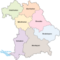
Bayern Regierungsbezirke.svg 1,227 × 1,236; 156 KB
-
Bayern-Regierungsbezirke.svg 1,227 × 1,236; 164 KB
-
BD Map admin de.svg 779 × 1,077; 271 KB
-
Belgien Parlamentswahl 2019.svg 1,400 × 720; 1.29 MB
-
Belgien Parlamentswahl 2024.svg 1,400 × 720; 3.22 MB
-
Bengalisch-Assamesische Schrift Verbreitung.svg 576 × 625; 401 KB
-
Bermuda Triangle map (de).svg 1,000 × 731; 289 KB
-
Bevoelkerungsdichte - Oesterreich.svg 1,052 × 744; 311 KB
-
Bevölkerungsdichte Pakistans nach Distrikten 2010.svg 1,156 × 743; 9.64 MB
-
Bezirksvertretungswahlkarte Wien 1996.svg 780 × 615; 228 KB
-
BIP-Weltkarte-2006-de.svg 940 × 477; 1.76 MB
-
Bjornoya Location Map-de.svg 1,010 × 1,267; 238 KB
-
Bjørnøya map-de.svg 2,195 × 2,653; 1.73 MB
-
Blank map world gmt (more simplified).svg 2,395 × 1,772; 3.3 MB
-
Bochum - Eingemeindung.svg 957 × 747; 164 KB
-
Borneo admin map-de.svg 1,063 × 1,183; 138 KB
-
Boundaries in the Arctic - map-de.svg 1,335 × 1,335; 943 KB
-
Landkreise Brandenburg.svg 825 × 826; 115 KB
-
Landkreise Brandenburg BIP-NUTS-Regionen.svg 1,000 × 1,000; 183 KB
-
Breuschstellung-map-de.svg 1,047 × 1,167; 497 KB
-
BritNed.svg 571 × 342; 68 KB
-
Budapest Metro map.svg 783 × 530; 67 KB
-
Bulgaria after unification political map-de.svg 1,131 × 904; 2.43 MB
-
Bulgaria-geographic map-de.svg 2,483 × 1,642; 4.59 MB
-
Bundespräsidentenwahl Österreich 2016 Wiederholung 2. Runde Dez 2016.svg 1,217 × 660; 1.79 MB
-
Bundestag 2009 FDP.svg 1,836 × 1,930; 1.28 MB
-
Bundestagswahl2009 Zweitstimmen.svg 1,680 × 2,050; 1.26 MB
-
Bylot Island de.svg 668 × 536; 369 KB
-
Cadiz Bay Local Train - de.svg 735 × 979; 61 KB
-
Cahsr map de.svg 586 × 541; 335 KB
-
Cambodia ethnic map-de.svg 673 × 709; 711 KB
-
Capljina-Zelenika Karte.svg 1,200 × 983; 104 KB
-
Carnac Island map de.svg 536 × 731; 59 KB
-
Carte-ORTF de.svg 875 × 686; 211 KB
-
Catholic dioceses of Taiwan de.svg 1,199 × 831; 279 KB
-
Caucasus-ethnic de.svg 866 × 984; 232 KB
-
Caucasus-political de.svg 972 × 922; 377 KB
-
Caucasus-political-Tschetschenien-emphasized de.svg 972 × 922; 377 KB
-
Cayman Islands UN map June 2016-de.svg 903 × 671; 2.34 MB
-
Bundestag 2009 CDU-CSU.svg 1,962 × 1,969; 1.91 MB
-
Census-2000-Data-Top-US-Ancestries-by-County-german.svg 727 × 539; 2.82 MB
-
Chatham-Islands map topo de.svg 1,669 × 1,425; 665 KB
-
Chianan Plain and Choshui River de.svg 623 × 753; 113 KB
-
Chief Minister 1967.svg 985 × 1,185; 339 KB
-
Chief Minister 1968.svg 985 × 1,185; 339 KB
-
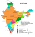
Chief Minister Indien 01-01-2019.svg 751 × 800; 743 KB
-
Chief Minister Indien 01-05-2014.svg 751 × 800; 753 KB
-
Chief Minister Indien 01-05-2015.svg 751 × 800; 750 KB
-
Chief Minister Indien 01-05-2016.svg 751 × 800; 750 KB
-
Chief Minister Indien 01-05-2017.svg 751 × 800; 750 KB
-
Chief Minister Indien 01-05-2018.svg 751 × 800; 747 KB
-
Chilika de.svg 746 × 839; 1.47 MB
-
China Eastern Airlines Flight 5735 flight path de.svg 1,588 × 945; 1.87 MB
-
China linguistic map de.svg 930 × 1,009; 2.52 MB
-
China national high speed rail grid 8 8 de status Jan 2022.svg 1,000 × 850; 215 KB
-
China national high speed rail grid 8 8 de.svg 1,000 × 850; 195 KB
-
Chinese Eastern Railway.svg 852 × 743; 43 KB
-
Chios topographic map-de.svg 1,580 × 1,150; 1.35 MB
-
Climate-tipping-points-de.svg 2,479 × 1,409; 420 KB
-
Climate-tipping-points-interactions-de.svg 2,030 × 1,398; 373 KB
-
Constantinople map German.svg 995 × 1,279; 1,000 KB
-
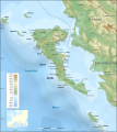
Corfu topographic map-de.svg 2,100 × 2,345; 2.43 MB
-
Corrections eau jura-3-de.svg 677 × 619; 24 KB
-
Crete relief map-de.svg 3,370 × 1,599; 1.13 MB
-
Curzon line de.svg 563 × 513; 37 KB
-
Cyclone Sidr Track map-de.svg 917 × 683; 278 KB
-
Cyprus 1973 ethnic de.svg 1,088 × 713; 44 KB
-
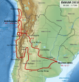
Dakar Rally 2010 map-de.svg 1,513 × 1,584; 3.53 MB
-
Densidades de población en España (1930) de.svg 734 × 497; 1.24 MB
-
Density of Hong Kong by Districts de.svg 1,091 × 812; 107 KB
-
Deutschland aus Berliner Sicht.svg 596 × 842; 445 KB
-
Deutschland um das Jahr 1000.svg 5,247 × 4,115; 4.92 MB
-
Devon Island de.svg 668 × 536; 534 KB
-
Die sieben Hügel Roms de.svg 654 × 624; 27 KB
-
Dima Hasao und Karbi Anglong Distrikte.svg 1,005 × 660; 416 KB
-
Disputed territory between Belize and Guatemala de.svg 504 × 700; 78 KB
-
Distrikt Vadodara 2011.svg 595 × 439; 211 KB
-
Distrikte von Assam.svg 765 × 633; 81 KB
-
Distrikte von Sri Lanka.svg 680 × 750; 192 KB
-
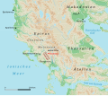
Dodona in Epirus.svg 975 × 862; 1.52 MB
-
DonestkAirportBattlemap.svg 1,352 × 817; 346 KB
-
Durchsetzungsinitiative 2016.svg 1,092 × 727; 257 KB
-
EARS-Net MRSA 2012.svg 528 × 462; 207 KB
-
EARSS MRSA 2008.svg 533 × 465; 117 KB
-
East Timor map 2 de.svg 596 × 641; 81 KB
-
Easter Island map-de.svg 1,750 × 1,245; 856 KB
-
Galapagos Islands topographic map-de.svg 2,160 × 2,160; 2.62 MB
-
EDKR map.svg 5,137 × 2,281; 58 KB
-
Einflussbereiche Asien.svg 600 × 328; 335 KB
-
Elam Map-de.svg 555 × 480; 474 KB
-
Ellesmere Island de.svg 668 × 536; 368 KB
-
Enclave de.svg 256 × 200; 27 KB
-
Entwurf-PNG-Grosser Garten Dresden OSM-Karte - 2017-08-16.png 2,215 × 1,712; 1.44 MB
-
Eratosthenes world map (German text) SVG.svg 1,040 × 610; 338 KB
-
Ethiopialanguages.svg 1,000 × 952; 29 KB
-
Ethnien in Pakistan 1980.svg 920 × 891; 263 KB
-
Ethnische Gruppen in Indonesien.svg 1,538 × 639; 6.7 MB
-
Ethnolinguistic map of Burma 1972 de.svg 882 × 1,656; 98 KB

