Category:Geotop Felsaufschlüsse am Bahnhof Cham
Jump to navigation
Jump to search
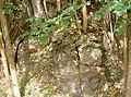
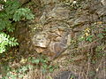
Deutsch: Die Felsaufschlüsse am Bahnhof Cham sind geologische Aufschlüsse Landkreis Cham in der Oberpfalz in Bayern. Sie sind als Geotop (372A095) ausgewiesen.
Geotop in Landkreis Cham in Bavaria, Germany  | |||||
| Upload media | |||||
| Instance of | |||||
|---|---|---|---|---|---|
| Location | Cham, Upper Palatinate, Bavaria, Germany | ||||
| Width |
| ||||
| Length |
| ||||
| Area |
| ||||
| Elevation above sea level |
| ||||
| official website | |||||
 | |||||
Media in category "Geotop Felsaufschlüsse am Bahnhof Cham"
The following 17 files are in this category, out of 17 total.
-
 ChamBahnhofGeotop 01.JPG 2,304 × 1,704; 912 KB
-
 ChamBahnhofGeotop 02.JPG 2,304 × 1,704; 879 KB
-
 ChamBahnhofGeotop 03.JPG 2,304 × 1,704; 855 KB
-
 ChamBahnhofGeotop 04.JPG 2,304 × 1,704; 874 KB
-
 ChamBahnhofGeotop 05.JPG 2,304 × 1,704; 901 KB
-
 ChamBahnhofGeotop 06.JPG 2,304 × 1,704; 886 KB
-
 ChamBahnhofGeotop 07.JPG 2,304 × 1,704; 937 KB
-
 ChamBahnhofGeotop 08.JPG 2,304 × 1,704; 887 KB
-
 ChamBahnhofGeotop 09.JPG 2,304 × 1,704; 883 KB
-
 ChamBahnhofGeotop 10.JPG 2,304 × 1,704; 941 KB
-
 ChamBahnhofGeotop 11.JPG 2,304 × 1,704; 940 KB
-
 ChamBahnhofGeotop 12.JPG 2,304 × 1,704; 941 KB
-
 ChamBahnhofGeotop 13.JPG 2,304 × 1,704; 854 KB
-
 ChamBahnhofGeotop 14.JPG 2,304 × 1,704; 903 KB
-
 ChamBahnhofGeotop 15.JPG 2,304 × 1,704; 825 KB
-
 ChamBahnhofGeotop 16.JPG 2,304 × 1,704; 934 KB
-
 ChamBahnhofGeotop 17.JPG 2,304 × 1,704; 922 KB


