Category:Georgia State Route 165
Jump to navigation
Jump to search
 | number: | (one hundred sixty-five) |
|---|---|---|
| State highways in Georgia (U.S. state): | 147 · 149 · 150 · 154 · 155 · 156 · 157 · 158 · 159 · 165 · 166 · 168 · 169 · 177 · 178 · 180 · 181 · 183 · 185 |
highway in Georgia  | |||||
| Upload media | |||||
| Instance of | |||||
|---|---|---|---|---|---|
| Location | Georgia | ||||
| Transport network | |||||
| Owned by | |||||
| Maintained by | |||||
| Length |
| ||||
| |||||
English: State Route 165 (SR 165) is a state highway that runs south-to-north, with a west-to-east middle section, through portions of Telfair, Dodge, and Laurens counties in the central part of the U.S. state of Georgia.
Media in category "Georgia State Route 165"
The following 8 files are in this category, out of 8 total.
-
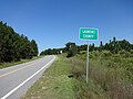
 Chauncey City limit, GA165SB.JPG 4,608 × 3,456; 5.4 MB
-
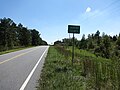
 Dodge County limit, GA165NB.JPG 4,608 × 3,456; 5.43 MB
-
 Dodge County limit, GA165SB.JPG 4,608 × 3,456; 4.24 MB
-
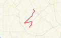 Georgia state route 165 map.png 438 × 279; 43 KB
-
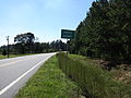
 Laurens County limit, GA165NB.JPG 4,608 × 3,456; 5.17 MB
-
 Laurens County limit, GA165SB.JPG 4,608 × 3,456; 5.5 MB
-
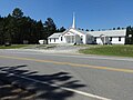 Rock Branch Baptist Church, GA165, Dodge County.JPG 4,608 × 3,456; 5.2 MB
-
 Ryals Cemetery, GA165, Laurens County, Georgia.JPG 4,608 × 3,456; 5.53 MB


