Category:Georgia State Route 130
Jump to navigation
Jump to search
 | number: | (one thirty-) |
|---|---|---|
| State highways in Georgia (U.S. state): | 110 · 111 · 112 · 113 · 114 · 115 · 116 · 117 · 119 · 120 · 121 · 122 · 124 · 125 · 126 · 127 · 128 · 129 · 130 · 132 · 133 · 135 · 136 · 138 · 139 · 140 · 141 · 144 · 147 · 149 · 150 |
highway in Georgia | |||||
| Upload media | |||||
| Instance of | |||||
|---|---|---|---|---|---|
| Location | Georgia | ||||
| Transport network | |||||
| Owned by | |||||
| Maintained by | |||||
| Length |
| ||||
| |||||
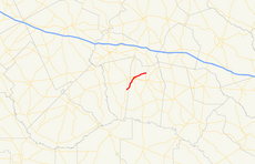
English: State Route 130 (SR 130) is a state highway that runs southwest-to-northeast through portions of Montgomery and Toombs counties in the east-central part of the U.S. state of Georgia.
閩南語 / Bân-lâm-gú:Chiu Lō͘-sòaⁿ 130 ( Eng-bûn: ; SR 130) sī chi̍t tiâu tī Bí-kok Georgia Chiu ê chiu-kip kong-lō͘.
Media in category "Georgia State Route 130"
The following 3 files are in this category, out of 3 total.
-
Montgomery County border GA130SB.JPG 5,152 × 3,864; 7.81 MB
-
Toombs County border GA130NB.JPG 5,152 × 3,864; 7.83 MB
-
Vidalia City Limit GA130EB.JPG 5,152 × 3,864; 7.8 MB


