Category:Geophysical survey
Jump to navigation
Jump to search
systematic collection of geophysical data for spatial studies | |||||
| Upload media | |||||
| Subclass of | |||||
|---|---|---|---|---|---|
| Facet of |
| ||||
| |||||

Subcategories
This category has the following 12 subcategories, out of 12 total.
*
E
- Electrical survey (11 F)
- Electromagnetic survey (2 F)
G
L
- Lia (ship, 2004) (1 F)
M
- Muon tomography (5 F)
R
S
- Seismic refraction (12 F)
- Seismic tests (8 F)
W
- Well logging (5 F)
Media in category "Geophysical survey"
The following 51 files are in this category, out of 51 total.
-
 3030-mag.jpg 516 × 466; 23 KB
-

-
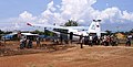 AN-2 Geophysics@Vietnam2005.jpg 773 × 394; 129 KB
-
 Badania magnetometrem transduktorowym.jpg 1,536 × 2,048; 792 KB
-
 Badania metodą elektrooporową.jpg 1,536 × 2,048; 368 KB
-
 Badania metodą ERT.jpg 1,536 × 2,048; 598 KB
-
 Contamination Studies 1, Keffi, Nigeria.jpg 2,048 × 1,536; 1.14 MB
-
 Contamination Studies 2, Keffi, Nigeria.jpg 2,048 × 1,536; 917 KB
-
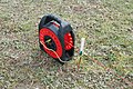 Elektroda.jpg 1,024 × 681; 334 KB
-
 Engin autonome Epaulard.jpg 552 × 833; 422 KB
-
 Engin remorqué RAIE2.jpg 737 × 465; 286 KB
-
 Explosion In MudHole.jpg 676 × 500; 83 KB
-
 Geophys heli bird.jpg 175 × 602; 10 KB
-

-
 Learning resistivity.jpg 2,448 × 3,264; 2.65 MB
-
 Miloš Karous, Geoelektrické metody průzkumu, SNLT-ALFA, Praha, 1989.jpg 1,536 × 2,048; 252 KB
-
 P4150425.tif 4,032 × 3,024; 34.89 MB
-
 PhasedArrayRepresentation.JPG 818 × 275; 22 KB
-
 Pomiary magnetometrem transduktorowym.jpg 960 × 720; 147 KB
-
 Pomiary metodą elektrooporową.jpg 1,536 × 2,048; 578 KB
-
 Pomiary metodą ERT.jpg 1,536 × 2,048; 549 KB
-
 Przygotowania do badań geofizycznych.jpg 2,048 × 1,536; 753 KB
-
 Przygotowania do pomiarów geofizycznych.jpg 1,536 × 2,048; 628 KB
-
 Rozkładanie magnetometru transduktorowego.jpg 1,536 × 2,048; 775 KB
-
 Rozkładanie magnetometru.jpg 2,048 × 1,536; 555 KB
-

-
 SeisMeas PhuocDinh-Vietnam-12.jpg 979 × 734; 296 KB
-
 Seismometer-iceland.JPG 3,072 × 2,304; 1.28 MB
-
 Sevmorneftegeofizika Company 40th anniversary 1979-2019 pins badges.jpg 3,949 × 2,319; 2.14 MB
-
 Składanie magnetometru transduktorowego.jpg 2,033 × 1,285; 248 KB
-
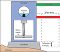 Structure interne d'un tiltmètre.png 427 × 372; 27 KB
-
 Teaching Resistivity.jpg 3,000 × 4,000; 3.39 MB
-
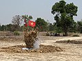
 Vinh Hai@2011Nov21.jpg 1,632 × 1,224; 720 KB
-
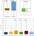 Whisker plots for heat flow data from the IHFC database.png 3,503 × 3,747; 232 KB
-
 Workers performing seismic tests, Seismic Explorations, Inc..jpg 775 × 1,000; 571 KB
-
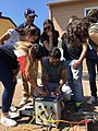
 Young Scientists.jpg 1,600 × 1,200; 269 KB
-
 Бурение льда для в ходе подготовки геофизического эксперимента.jpg 6,240 × 4,160; 7.57 MB
-
 Геогидроакустические буи.jpg 4,160 × 2,768; 1.71 MB
-
 Геофизическая экспедиция на озеро Байкал.jpg 6,240 × 4,160; 7.76 MB
-
 Гидроакустический эксперимент.jpg 6,240 × 4,160; 10.28 MB
-
 Запись акустического эксперимента.jpg 6,240 × 4,160; 4.68 MB
-
 Запуск беспилотного летательного аппарата для составления фотоплана местности.jpg 6,240 × 4,160; 5.34 MB
-
 Запуск беспилотного летательного аппарата.jpg 6,240 × 4,160; 7.84 MB
-
 Запуск подводного дрона.jpg 6,240 × 4,160; 10.25 MB
-
 Изменение локации геофизического оборудования.jpg 6,240 × 4,160; 9.32 MB
-
 Измерение скорости ветра.jpg 6,240 × 4,160; 6.79 MB
-
 Наблюдение за экспериментом.jpg 6,240 × 4,160; 9.35 MB
-
 Подготовка геофизического оборудования 01.jpg 6,240 × 4,160; 7.38 MB
-
 Подготовка геофизического оборудования.jpg 6,240 × 4,160; 9.14 MB
-
 Подготовка подводного дрона к запуску.jpg 6,240 × 4,160; 8.87 MB
-
 Проведение геофизического эксперимента.jpg 6,240 × 4,160; 9.04 MB

.jpg)


.jpg)


