Category:Geology of the Pacific Ocean
Jump to navigation
Jump to search
overview about the geology of the Pacific Ocean | |||||
| Upload media | |||||
| Subclass of | |||||
|---|---|---|---|---|---|
| |||||
Subcategories
This category has the following 57 subcategories, out of 57 total.
+
B
C
- Challenger Deep (6 F)
- Clarion Clipperton Zone (19 F)
- Coiba Transform Fault (1 F)
- Colombia-Ecuador Trench (1 F)
E
F
G
- Geology of Tahiti (2 F)
- Gorda Ridge (7 F)
H
J
K
M
N
- NODINAUT (37 F)
P
- Panama Transform Fault (1 F)
R
- Rivera tectonic plate (4 F)
S
- Sunda tectonic plate (2 F)
T
V
W
Z
Media in category "Geology of the Pacific Ocean"
The following 70 files are in this category, out of 70 total.
-
2019-08-29 Bandon, Oregon M6.3 earthquake shakemap (USGS).jpg 832 × 1,068; 140 KB
-
Americas Tectonic Plate Map - by NOAA.jpg 1,654 × 1,654; 419 KB
-
Asphalt volcanoes bathymetry.jpg 1,200 × 900; 381 KB
-
Bathymetry around Farallon de Pajaros.jpg 596 × 405; 113 KB
-
Block rotation.png 1,334 × 876; 81 KB
-
Block rotation2.png 1,290 × 878; 81 KB
-
Capricorn Seamount-NOAA-Tectonic features hires (cropped).jpg 188 × 190; 75 KB
-
Champ de nodules dans le Pacifique équatorial nord.jpg 674 × 443; 232 KB
-
Chile ridge Fault Zone segments.png 1,270 × 741; 1.72 MB
-
Chile ridge fz segments.png 1,004 × 741; 1.34 MB
-
Chile ridge in a broader view.png 1,466 × 818; 2.18 MB
-
Chile ridge Zoom in.png 889 × 832; 1.3 MB
-
Chile Ridge.png 1,466 × 818; 2.18 MB
-
Coiba & Malpelo Plates and major seismic faults of Colombia.jpg 768 × 759; 476 KB
-
Cross section of mariana trench.jpg 600 × 319; 99 KB
-
East Pacific Rise Oceanic-Crust.jpg 600 × 600; 320 KB
-
EQs 1900-2016 emaustralia tsum.png 764 × 1,009; 1.62 MB
-
Hawaii-Emperor dt.png 1,596 × 1,652; 3.78 MB
-
IBM history.jpg 310 × 479; 46 KB
-
IBM Sections1.jpg 507 × 902; 145 KB
-
IBM Sed.jpg 478 × 349; 136 KB
-
IBM-Locality.jpg 259 × 556; 46 KB
-
Konkrecje manganowe.jpg 638 × 477; 105 KB
-
Kuril Benioff zone.JPG 425 × 305; 17 KB
-
Lau Basin-NOAA-Tectonic features hires.jpg 2,642 × 2,189; 4.65 MB
-
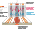
Magnetic anomalies off west coast of North America.gif 435 × 664; 69 KB
-
Magnetic anomalies off west coast of North America.png 435 × 664; 131 KB
-
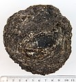
Manganese-nodule0 hg.jpg 3,891 × 3,695; 785 KB
-
Manganese-nodule00 hg.jpg 5,096 × 2,919; 2.22 MB
-
Manganese-nodule000 hg.jpg 3,838 × 3,080; 1.82 MB
-
Manganese-nodule1 hg.jpg 2,329 × 2,329; 1.02 MB
-
Manganese-nodule2 hg.jpg 2,297 × 2,350; 1.24 MB
-
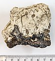
Manganesecrust-bot hg.jpg 3,180 × 2,761; 1.83 MB
-
Manganesecrust-top hg.jpg 3,262 × 2,728; 2.43 MB
-
Manganknolle1 hg.jpg 2,877 × 3,114; 1.82 MB
-
Manganknolle2 hg.jpg 2,982 × 3,035; 1.63 MB
-
Map and Cross Section of Taranaki Basin.jpg 500 × 791; 44 KB
-
Map of the Kermadec and Tonga subduction trench.jpg 3,292 × 3,690; 1.8 MB
-
Map00148 (28286522445).jpg 1,777 × 2,959; 3.29 MB
-
Midway Island, Eastern Island, NE shore lava exposure 1982.jpg 478 × 319; 18 KB
-
Mn-crust1 hg.jpg 2,071 × 2,286; 1.03 MB
-
Mn-crust2 hg.jpg 2,204 × 2,125; 1.04 MB
-
Mn-nodule-cut1 hg.jpg 2,467 × 2,675; 1.36 MB
-
Mn-nodule-cut2 hg.jpg 2,617 × 2,640; 1.3 MB
-
MN-nodule6 hg.jpg 2,022 × 1,919; 662 KB
-
MN-nodule7 hg.jpg 2,221 × 2,033; 751 KB
-
Nodule polymétallique - vue de profil.jpg 850 × 442; 197 KB
-
Nodule polymétallique.jpg 850 × 602; 414 KB
-
North Pacific ocean floor crust age.png 1,380 × 1,096; 1,006 KB
-
Oceanic-continental convergence Fig21oceancont (french).png 450 × 265; 108 KB
-
Oceanic-continental convergence Fig21oceancont.gif 302 × 178; 14 KB
-
Oceanic-oceanic convergence-rus.png 301 × 156; 24 KB
-
Pacific Basin Island Geography Hotspots.jpg 801 × 600; 69 KB
-
Pacific Basin Island Geography.jpg 800 × 600; 65 KB
-
Pacific Ocean 180Ma.jpg 1,517 × 759; 189 KB
-
Pacific seafloor crust age 2.gif 883 × 908; 439 KB
-
Paradoxo11.jpg 1,207 × 1,401; 401 KB
-
Permis miniers accordés par l'ISA-2.jpg 3,300 × 2,550; 3.68 MB
-
Permis miniers accordés par l'ISA.jpg 480 × 371; 42 KB
-
Phosporite-label hg.jpg 3,901 × 3,139; 1.02 MB
-
PlateMovementEaNoPac.png 988 × 768; 253 KB
-
PSMN-nodule1 hg.jpg 2,072 × 1,923; 571 KB
-
PSMN-nodule2 hg.jpg 2,129 × 2,036; 734 KB
-
San Andreas Fault Sequential Diagrams.jpg 800 × 1,130; 138 KB
-
Tai wan.jpg 4,961 × 3,508; 668 KB
-
Tectonic setting western Mexico.png 1,929 × 1,570; 1.8 MB
-
Zealandia and New Zealand 90 ma Gondwana.png 890 × 663; 511 KB


