
Category:Geology of Dordogne
Departments of Metropolitan France: Ain [01] · Aisne [02] · Allier [03] · Alpes-de-Haute-Provence [04] · Hautes-Alpes [05] · Alpes-Maritimes [06] · Ardèche [07] · Ardennes [08] · Ariège [09] · Aube [10] · Aude [11] · Aveyron [12] · Bouches-du-Rhône [13] · Calvados [14] · Cantal [15] · Charente [16] · Charente-Maritime [17] · Cher [18] · Corrèze [19] · Corse-du-Sud [2A]† · Haute-Corse [2B]† · Côte-d’Or [21] · Côtes-d'Armor [22] · Creuse [23] · Dordogne [24] · Doubs [25] · Drôme [26] · Eure [27] · Eure-et-Loir [28] · Finistère [29] · Gard [30] · Haute-Garonne [31] · Gers [32] · Gironde [33] · Hérault [34] · Ille-et-Vilaine [35] · Indre [36] · Indre-et-Loire [37] · Isère [38] · Jura [39] · Landes [40] · Loir-et-Cher [41] · Loire [42] · Haute-Loire [43] · Loire-Atlantique [44] · Loiret [45] · Lot [46] · Lot-et-Garonne [47] · Lozère [48] · Maine-et-Loire [49] · Manche [50] · Marne [51] · Haute-Marne [52] · Mayenne [53] · Meurthe-et-Moselle [54] · Meuse [55] · Morbihan [56] · Moselle [57] · Nièvre [58] · Nord [59] · Oise [60] · Orne [61] · Pas-de-Calais [62] · Puy-de-Dôme [63] · Pyrénées-Atlantiques [64] · Hautes-Pyrénées [65] · Pyrénées-Orientales [66] · Bas-Rhin [67] · Haut-Rhin [68] · departmental district of the Rhône [69] · Rhône [69D]‡ · Haute-Saône [70] · Saône-et-Loire [71] · Sarthe [72] · Savoie [73] · Haute-Savoie [74] · Paris [75] · Seine-Maritime [76] · Seine-et-Marne [77] · Yvelines [78] · Deux-Sèvres [79] · Somme [80] · Tarn [81] · Tarn-et-Garonne [82] · Var [83] · Vaucluse [84] · Vendée [85] · Vienne [86] · Haute-Vienne [87] · Vosges [88] · Yonne [89] · Territoire de Belfort [90] · Essonne [91] · Hauts-de-Seine [92] · Seine-Saint-Denis [93] · Val-de-Marne [94] · Val-d'Oise [95]
Overseas departments and regions: Guadeloupe [971] · Martinique [972] · French Guiana [973] · Réunion [974] · Mayotte [976]
Overseas collectivities: Saint Pierre and Miquelon [975] · Saint Barthélemy [977] · Saint-Martin [978] · Wallis and Futuna [986] · French Polynesia [987] · French Southern and Antarctic Lands [984]+
Sui generis territories: New Caledonia [988]
Wikimedia category | |||||
| Upload media | |||||
| Instance of | |||||
|---|---|---|---|---|---|
| |||||
Subcategories
This category has the following 48 subcategories, out of 48 total.
*
+
A
C
D
E
F
G
H
I
K
L
M
N
O
P
Q
R
S
T
V
W
Media in category "Geology of Dordogne"
The following 51 files are in this category, out of 51 total.
-
 AngoumianMareuil.jpg 3,648 × 2,736; 2.1 MB
-
 AngoumianRudistreef.jpg 3,648 × 2,736; 1.99 MB
-
 AngoumianStrat.jpg 2,500 × 3,448; 361 KB
-
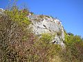
 AngoumienCliff.jpg 3,648 × 2,736; 3.57 MB
-
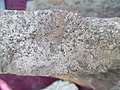 ApliteMyr.jpg 4,608 × 3,456; 3.48 MB
-
 BandiatP.jpg 4,608 × 3,456; 3.64 MB
-
 BandiatP3.jpg 4,608 × 3,456; 3.18 MB
-
 BleiglanzTab.JPG 720 × 540; 111 KB
-
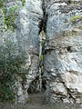 Castelnaud Lacoste parc fissure.JPG 2,448 × 3,264; 4.05 MB
-
 GranoApl2.jpg 3,456 × 4,608; 4.68 MB
-
 GranoApl3.png 3,401 × 2,213; 19.09 MB
-
 Granodiorite Red.jpg 3,264 × 2,448; 3.99 MB
-
 GranodioriteFolS.jpg 1,050 × 750; 98 KB
-
 GranoEpi2.jpg 4,608 × 3,456; 3.74 MB
-
 GranoFine2.png 1,827 × 1,091; 4.48 MB
-
 GranoFol.jpg 4,608 × 3,456; 3.71 MB
-
 GranoNontron4.png 2,676 × 1,068; 5.09 MB
-
 GranoSchlier.jpg 4,608 × 3,456; 2.87 MB
-
 GranoSlick2.png 2,615 × 1,052; 6.56 MB
-
 GranoTApl.jpg 4,608 × 3,456; 4.55 MB
-
 Génis-Unit.jpg 2,437 × 820; 178 KB
-
 Hettangium.png 2,489 × 2,945; 16.89 MB
-
 Hornblendit2.png 3,373 × 2,593; 17.35 MB
-
 LeukoFine.jpg 4,608 × 3,456; 4.19 MB
-
 LeukoFol2.jpg 4,608 × 3,456; 4.35 MB
-
 LeukoNor.jpg 4,608 × 3,456; 4.41 MB
-
 LeukoPeg2.jpg 4,608 × 3,456; 4.37 MB
-
 LigerianSlicko.jpg 3,648 × 2,736; 1.45 MB
-
 NP11.jpg 3,456 × 4,608; 3.94 MB
-
 NP15.jpg 4,608 × 3,456; 4.5 MB
-
 NPC.PNG 1,152 × 445; 1.16 MB
-
 NPC2.PNG 1,104 × 492; 1.39 MB
-
 NPC3.PNG 875 × 557; 1.36 MB
-
 NPC6.PNG 1,307 × 537; 1.89 MB
-
 ParaBus2.jpg 4,608 × 3,456; 3.47 MB
-
 ParagneissSP.jpg 4,608 × 3,456; 3.05 MB
-
 Runit15.PNG 649 × 542; 1.03 MB
-
 Runit16.PNG 942 × 568; 1.39 MB
-
 Runit7.PNG 645 × 541; 988 KB
-
 RunitBard.PNG 644 × 541; 917 KB
-
 Saint-Martin-de-Fressengeas Harzburgit3.jpg 2,736 × 3,648; 4.33 MB
-
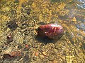
 SandonieCluzeau.jpg 2,736 × 3,648; 3.81 MB
-
 Serizitschiefer.jpg 4,608 × 3,456; 3.4 MB
-
 Serizitschiefer3.jpg 4,608 × 3,456; 3.64 MB
-
 Serizitschiefer4.jpg 4,608 × 3,456; 2.92 MB
-
 St-Paul-Roche-geosite 13 Leptinite.jpg 2,848 × 4,288; 2.15 MB
-
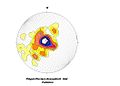
 Stereo2.PNG 568 × 527; 94 KB
-
 Tertiärsand.JPG 3,648 × 2,736; 4.26 MB
-
 ThiviersSand.jpg 4,608 × 3,456; 3.48 MB
-
 ThiviersSNanthiat.jpg 4,608 × 3,456; 3.11 MB
-
 Toarc.jpg 3,456 × 4,608; 5.37 MB


