Category:Geological maps of South America
Jump to navigation
Jump to search
Subcategories
This category has the following 6 subcategories, out of 6 total.
Media in category "Geological maps of South America"
The following 39 files are in this category, out of 39 total.
-
MAGMAARC1.jpg 384 × 580; 39 KB
-
Planície chaco-pampeana.png 762 × 1,091; 425 KB
-
Andes of South America.png 657 × 822; 646 KB
-
Bouclier guyanais.svg 1,500 × 1,200; 59 KB
-
The Deseado Formation of Patagonia (Page 5) BHL21733526.jpg 2,652 × 3,892; 731 KB
-
El Tigre Final Original Figure 1.png 1,174 × 1,127; 2.19 MB
-
El Tigre Final Original Figure.png 1,191 × 1,180; 2.19 MB
-
Geology of the Falkland Islands.svg 2,550 × 1,990; 617 KB
-
Geología de las Islas Malvinas.svg 2,550 × 1,990; 612 KB
-
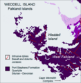
Weddell-Island-Geological-Map.png 729 × 747; 118 KB
-
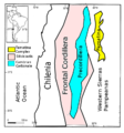
Falla Liquiñe-Ofqui.png 623 × 536; 225 KB
-
Faults in SA.png 1,864 × 1,488; 1.75 MB
-
Geologic map of Catamarca Province, Argentina.tif 3,569 × 4,761; 25.05 MB
-
Geologic map of Chubut Province, Argentina.tif 4,364 × 3,258; 27.16 MB
-
Geologic map of Cordoba Province, Argentina.tif 3,543 × 5,118; 26.71 MB
-
Geologic map of La Rioja Province, Argentina.tif 3,551 × 4,236; 18.59 MB
-
Geologic map of Rio Negro Province, Argentina.tif 6,386 × 4,153; 3.76 MB
-
Geologic map of San Luis Province, Argentina.tif 2,981 × 4,421, 2 pages; 13.77 MB
-
Geologic Map of Tierra del Fuego, Argentina.tif 3,956 × 2,752; 5.41 MB
-
Geological map of French Guyana.jpg 1,198 × 1,458; 108 KB
-
Geologische kaart van Suriname.png 2,385 × 3,339; 1.57 MB
-
Guiana.Shield.en.svg 1,500 × 1,200; 59 KB
-
LocationofPrecordillera01.png 743 × 795; 148 KB
-
Map Geological Map of South America 1928-1940 - Touring Club Italiano CART-TRC-27.jpg 8,213 × 7,176; 9.59 MB
-
Mapa Caraguatypotherium(archivo de prueba).svg 744 × 1,052; 2.66 MB
-
Mapa geologico Malvinas.lmb.png 472 × 569; 12 KB
-
Geología de la Cuenca del Paraná.jpg 1,289 × 1,031; 438 KB
-
Mapa Geologia Bacia do Paraná simples.png 1,289 × 1,040; 1.24 MB
-
Paranabecken.jpg 670 × 689; 97 KB
-
South america geology andes.png 1,801 × 2,360; 563 KB
-
Suriname geology NL annot.svg 716 × 1,002; 7.26 MB
-
Terrenos proterozóicos da América do Sul.jpg 513 × 651; 92 KB
-
Topographic Map of the Cesar-Ranchería Basin - Colombia.jpg 1,429 × 788; 821 KB


