Category:Geological maps of Indonesia
Jump to navigation
Jump to search
Countries of Oceania: Australia · Fiji · Federated States of Micronesia · New Zealand · Papua New Guinea · Samoa · Tonga · Vanuatu
Other areas: French Polynesia · Hawaii · New Caledonia – Partly: Indonesia · French Southern and Antarctic Lands
Other areas: French Polynesia · Hawaii · New Caledonia – Partly: Indonesia · French Southern and Antarctic Lands
Subcategories
This category has the following 2 subcategories, out of 2 total.
E
V
Media in category "Geological maps of Indonesia"
The following 42 files are in this category, out of 42 total.
-
2000 Sumatra earthquake.jpg 454 × 475; 64 KB
-
Banda Arc tectonic map.jpg 868 × 1,158; 242 KB
-
Cengranite2.2-1.jpg 1,014 × 1,688; 193 KB
-
Central Sulawesi Metamorphic Belt.svg 1,000 × 1,105; 164 KB
-
Distribution of key Paleozoic and Mesozoic outcrops in Indonesia.jpg 613 × 434; 68 KB
-
Eastern Belt1.jpg 307 × 559; 777 KB
-
Geological map of Kai Besar and Kai Kecil Islands.JPG 836 × 1,029; 177 KB
-
Geological map of Seram Island.JPG 1,577 × 1,110; 320 KB
-
Geological-summary-map-Barito Basin.jpg 529 × 750; 117 KB
-
Geologische Kaart der Tandjoeng-Kolenvelden Schaal 1-30000 Volgens Mannhardt.png 3,672 × 4,600; 20.6 MB
-
Geology indonesia map.jpg 2,051 × 1,273; 560 KB
-
Indo-basement-map.jpg 920 × 998; 178 KB
-
Indo-structure-map.jpg 630 × 520; 111 KB
-
Indonesia Geology - DPLA - 00a0751adefef1953955df989f62fc34.jpg 9,274 × 5,996; 5.97 MB
-
INDONESIA geology map.jpg 780 × 483; 103 KB
-
Java-tectonic-map.JPG 993 × 629; 125 KB
-
Junghuhn Kaart van het eiland Java - geologische Ausgabe -- Blatt 1.jpg 9,466 × 9,606; 12.69 MB
-
Junghuhn Kaart van het eiland Java - geologische Ausgabe -- Blatt 2.jpg 9,439 × 9,608; 15.51 MB
-
Junghuhn Kaart van het eiland Java - geologische Ausgabe -- Blatt 3.jpg 9,487 × 9,622; 16.63 MB
-
Junghuhn Kaart van het eiland Java - geologische Ausgabe -- Blatt 4.jpg 9,401 × 9,621; 16.54 MB
-
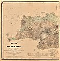
Kaart van het eiland Java - Geologische Ausgabe.jpg 11,472 × 2,959; 9.41 MB
-
Kalimantan Geologic Map--1990.png 3,193 × 2,177; 9.63 MB
-
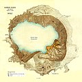
Kawah Ijen.JPG 1,503 × 1,500; 516 KB
-
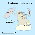
Krakatoa map.svg 400 × 400; 23 KB
-
Mahakam delta geologic map.jpg 1,048 × 1,280; 262 KB
-
Natuna geological map.JPG 933 × 948; 240 KB
-
Natuna Sea bathymetry and seismic location map.JPG 967 × 1,269; 232 KB
-
New Guinea Tectonics.png 691 × 483; 166 KB
-
Nias-geology-map.jpg 580 × 916; 122 KB
-
North-sumatra-basin-map.jpg 1,217 × 812; 203 KB
-
Plate setting Sunda megathrust.png 1,986 × 1,383; 439 KB
-
Pre-tertiary outcrop distribution map in Indonesia.jpg 613 × 434; 68 KB
-
Regional west-east cross section of Indonesia 150924.JPG 1,438 × 1,087; 280 KB
-
Sibolga-basin.jpg 410 × 1,333; 121 KB
-
Sumatra map.jpg 476 × 530; 97 KB
-
SundaMegathrustSeismicity.PNG 468 × 601; 55 KB
-
Tarakan-Geological-summary map.jpg 620 × 920; 143 KB
-
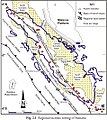
Tectonic setting map of Sumatra.jpg 1,269 × 1,522; 460 KB
-
UB Utrecht - CARTO II L 2 - 1914.jpg 14,294 × 7,115; 41.53 MB
-
WV Sumatra map.png 1,783 × 1,678; 856 KB


