Category:Geological maps of Europe (1900 - 1950)
Jump to navigation
Jump to search
Media in category "Geological maps of Europe (1900 - 1950)"
The following 16 files are in this category, out of 16 total.
-
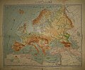
GEOLOGÍA DE EUROPA.jpg 1,299 × 1,100; 1.08 MB
-
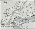
Sketch-map of Europe in the Middle Jurassic period – Geology (1907) (14773981324).jpg 2,048 × 1,722; 351 KB
-
Alsace-Lorraine; past, present, and future (1918) (14772899695).jpg 1,804 × 2,200; 943 KB
-
Central Europe (1903) (14594492488).jpg 1,722 × 3,060; 1.57 MB
-
Central Europe (1903) (14781136495).jpg 1,618 × 2,912; 1.36 MB
-
Geological Map of Europe by Egyptian General Survey Authority in 1913.jpg 2,940 × 2,460; 1.34 MB
-
Geologische Karte von Preußen.jpg 3,859 × 4,024; 7.69 MB
-
Geology of the Caucasus.jpg 590 × 450; 132 KB
-
Map Geological Map of Europe 1928-1940 - Touring Club Italiano CART-TRC-23.jpg 7,613 × 6,403; 32.32 MB
-
A guide to Belfast and the counties of Down and Antrim (1902) (14592665920).jpg 1,434 × 1,885; 441 KB
-
The age of mammals in Europe, Asia and North America (1910) (17757244990).jpg 1,814 × 1,268; 644 KB
-
The age of mammals in Europe, Asia and North America (1910) (17945859371).jpg 1,816 × 1,252; 563 KB
-
Geografja Polski zjednoczonej 1920 (86192226) (cropped).jpg 1,811 × 1,601; 826 KB


