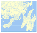
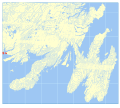
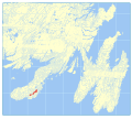
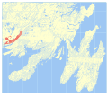
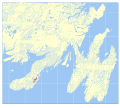
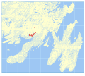
Category:Geological Formations of Newfoundland
Jump to navigation
Jump to search
Media in category "Geological Formations of Newfoundland"
The following 104 files are in this category, out of 104 total.
-
Andersons Cove Formation map.svg 512 × 458; 26.43 MB
-
Barasway Formation map.svg 512 × 458; 26.2 MB
-
Bay de Verde Formation map.svg 512 × 786; 26.5 MB
-
Bay View Formation map.svg 512 × 458; 26.2 MB
-
Beaver Pond Formation map.svg 512 × 458; 26.2 MB
-
Belle Bay Formation map.svg 512 × 458; 26.37 MB
-
Big Head Formation map.svg 512 × 786; 26.96 MB
-
Blackhead Formation map.svg 512 × 786; 26.47 MB
-
Bonavista Formation map.svg 512 × 786; 26.62 MB
-
Bottom Brook Granite map.svg 512 × 458; 26.2 MB
-
Briscal Formation map.svg 512 × 786; 26.49 MB
-
Bull Arm Formation map.svg 512 × 837; 27.56 MB
-
Calmer Formation map.svg 512 × 458; 26.19 MB
-
Cape Ballard Formation map.svg 512 × 786; 26.44 MB
-
Cappahayden Formation map.svg 512 × 786; 26.44 MB
-
Cashel Lookout Formation map.svg 512 × 458; 27.32 MB
-
Chamberlains Brook Formation map.svg 512 × 786; 26.45 MB
-
Chapel Island Formation map.svg 512 × 458; 26.24 MB
-
Cinq Isles Formation map.svg 512 × 458; 26.2 MB
-
Clancey's Pond Complex map.svg 512 × 458; 26.18 MB
-
Corbin Head Formation map.svg 512 × 458; 26.19 MB
-
Creston Formation map.svg 512 × 458; 26.23 MB
-
Crown Hill Formation map.svg 512 × 837; 26.95 MB
-
Cuckold Formation map.svg 512 × 786; 26.47 MB
-
D'Espoir Brook Granite map.svg 512 × 458; 26.27 MB
-
Deadmans Cove Formation map.svg 512 × 458; 26.19 MB
-
Dolland Bight granite map.svg 512 × 458; 26.19 MB
-
Doughball Point Formation map.svg 512 × 458; 26.26 MB
-
Downs Point Formation map.svg 512 × 458; 26.2 MB
-
Drook Formation map.svg 512 × 786; 27.95 MB
-
East Bay Granite map.svg 512 × 458; 26.38 MB
-
Elliotts Cove Formation map.svg 512 × 786; 26.52 MB
-
English Harbour East Formation map.svg 512 × 458; 26.24 MB
-
Fermeuse Formation map.svg 512 × 786; 26.72 MB
-
Ferryland Head Formation map.svg 512 × 786; 26.45 MB
-
Flat Rock Cove Formation map.svg 512 × 786; 26.45 MB
-
Garnish Formation map.svg 512 × 458; 26.19 MB
-
Gaskiers Formation map.svg 512 × 786; 26.47 MB
-
Gaultois Granite map.svg 512 × 458; 26.38 MB
-
Gibbett Hill Formation map.svg 512 × 786; 26.82 MB
-
Grand Bank Sequence map.svg 512 × 458; 26.19 MB
-
Grand Beach Complex map.svg 512 × 458; 26.2 MB
-
Grand Le Pierre Formation map.svg 512 × 458; 26.22 MB
-
Grandy's Pond formation map.svg 512 × 458; 26.4 MB
-
Great Bay de l'Eau Formation map.svg 512 × 458; 26.23 MB
-
Harbour Breton Granite map.svg 512 × 458; 26.26 MB
-
Harbour My God Point Formation map.svg 512 × 458; 26.2 MB
-
Hardy's Cove granite map.svg 512 × 458; 26.2 MB
-
Hare Hills Tuff map.svg 512 × 458; 26.18 MB
-
Heart's Content Formation map.svg 512 × 786; 26.72 MB
-
Heart's Desire Formation map.svg 512 × 786; 26.58 MB
-
Hughes Brook Granite map.svg 512 × 458; 26.19 MB
-
Indian Point granite map.svg 512 × 458; 26.18 MB
-
Isle Galet Formation map.svg 512 × 458; 26.71 MB
-
Jigging Cove Formation map.svg 512 × 458; 26.18 MB
-
Lamaline Basalts map.svg 512 × 458; 26.21 MB
-
Little Bell Island Formation map.svg 512 × 786; 26.46 MB
-
Loughlins Hill Gabbro map.svg 512 × 458; 26.18 MB
-
Mall Bay Formation map.svg 512 × 786; 26.49 MB
-
Maturin Ponds Formation map.svg 512 × 786; 26.66 MB
-
McCallum Granite map.svg 512 × 458; 26.22 MB
-
Mistaken Point Formation map.svg 512 × 786; 26.65 MB
-
Mooring Cove Formation map.svg 512 × 458; 26.29 MB
-
Mount Lucy Anne Formation map.svg 512 × 458; 26.22 MB
-
Mount Margaret Gabbro map.svg 512 × 458; 26.18 MB
-
Mount Saint Anne Formation map.svg 512 × 458; 26.2 MB
-
Northwest Cove granite map.svg 512 × 458; 26.2 MB
-
Old Woman stock map.svg 512 × 458; 26.19 MB
-
Pardy Island Formation map.svg 512 × 458; 26.21 MB
-
Pass Island Granite map.svg 512 × 458; 26.21 MB
-
Path End Formation map.svg 512 × 458; 26.2 MB
-
Piccaire granite map.svg 512 × 458; 26.2 MB
-
Pleasant View Formation map.svg 512 × 458; 26.19 MB
-
Pools Cove Formation map.svg 512 × 458; 26.23 MB
-
Port au Bras Formation map.svg 512 × 458; 26.22 MB
-
Quidi Vidi Formation map.svg 512 × 786; 26.48 MB
-
Random Formation map.svg 512 × 458; 26.34 MB
-
Redmans Formation map.svg 512 × 786; 26.44 MB
-
Rencontre Formation map.svg 512 × 458; 26.29 MB
-
Renews Head Formation map.svg 512 × 786; 26.57 MB
-
Riches Island Formation map.svg 512 × 458; 26.45 MB
-
Rocky Harbour Formation map.svg 512 × 488; 27.32 MB
-
Rocky Ridge Formation map.svg 512 × 458; 26.18 MB
-
Salmon River Dam Formation map.svg 512 × 458; 26.56 MB
-
Salmonier Cove Formation map.svg 512 × 458; 26.18 MB
-
Salt Pond Formation map.svg 512 × 458; 26.19 MB
-
Sam Head Formation map.svg 512 × 458; 26.23 MB
-
Sculpin Point Formation map.svg 512 × 458; 26.19 MB
-
Seal Cove Gabbro map.svg 512 × 458; 26.18 MB
-
Seal Nest Cove tonalite map.svg 512 × 458; 26.18 MB
-
Snooks Tolt Formation map.svg 512 × 458; 26.25 MB
-
Southern Hills Formation map.svg 512 × 458; 26.4 MB
-
Spanish Room Formation map.svg 512 × 458; 26.18 MB
-
St. Josephs Cove Formation map.svg 512 × 458; 26.66 MB
-
St. Lawrence Granite map.svg 512 × 458; 26.27 MB
-
Taylors Bay Formation map.svg 512 × 458; 26.3 MB
-
Terrenceville Formation map.svg 512 × 458; 26.18 MB
-
Tickle Point Formation map.svg 512 × 458; 26.23 MB
-
Tilt Hills Formation map.svg 512 × 458; 26.2 MB
-
Trepassey formation map.svg 512 × 786; 26.56 MB
-
Trinny Cove Formation map.svg 512 × 786; 26.53 MB
-
Upper Salmon Road Granite map.svg 512 × 458; 26.39 MB
-
Wandsworth Formation map.svg 512 × 458; 26.2 MB
-
Wild Cove formation map.svg 512 × 458; 26.19 MB


