Category:Geography of Wisconsin
Jump to navigation
Jump to search
States of the United States: Alabama · Alaska · Arizona · Arkansas · California · Colorado · Connecticut · Delaware · Florida · Georgia · Hawaii · Idaho · Illinois · Indiana · Iowa · Kansas · Kentucky · Louisiana · Maine · Maryland · Massachusetts · Michigan · Minnesota · Mississippi · Missouri · Montana · Nebraska · Nevada · New Hampshire · New Jersey · New Mexico · New York · North Carolina · North Dakota · Ohio · Oklahoma · Oregon · Pennsylvania · Rhode Island · South Carolina · South Dakota · Tennessee · Texas · Utah · Vermont · Virginia · Washington · West Virginia · Wisconsin · Wyoming – District of Columbia: Washington, D.C.
insular area of the United States: American Samoa · Guam · Northern Mariana Islands · Puerto Rico · United States Virgin Islands – Baker Island · Howland Island · Jarvis Island · Johnston Atoll · Kingman Reef · Midway Atoll · Navassa Island · Palmyra Atoll · Wake Island
insular area of the United States: American Samoa · Guam · Northern Mariana Islands · Puerto Rico · United States Virgin Islands – Baker Island · Howland Island · Jarvis Island · Johnston Atoll · Kingman Reef · Midway Atoll · Navassa Island · Palmyra Atoll · Wake Island
physical features of the state in the Midwestern United States. | |||||
| Upload media | |||||
| Instance of |
| ||||
|---|---|---|---|---|---|
| Subclass of | |||||
| Location | Wisconsin | ||||
| |||||
Subcategories
This category has the following 24 subcategories, out of 24 total.
C
- Lake Chicago (16 F)
E
G
I
L
M
N
- Nipissing Great Lakes (5 F)
P
- Porte des Morts (6 F)
R
S
T
V
- Vacant lots in Wisconsin (2 F)
Media in category "Geography of Wisconsin"
The following 30 files are in this category, out of 30 total.
-
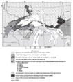
Animikie Group and Marquette Range and Huronian supergroups.PNG 386 × 436; 59 KB
-
Animikie Group, Marquette Range and Huronian supergroups2.PNG 692 × 776; 183 KB
-
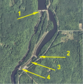
AnnotatedGrandfatherFalls-ver02.png 688 × 696; 1.07 MB
-
CalumetCountyWisconsinRural.jpg 2,304 × 1,728; 706 KB
-
DEATHS DOOR.png 749 × 677; 950 KB
-
Dick-and-reutman2.jpg 697 × 441; 206 KB
-
Door Bluff.jpg 1,600 × 1,200; 386 KB
-
Door County.JPG 993 × 1,408; 688 KB
-
Friendshipmound.JPG 1,280 × 960; 150 KB
-
Lohrville2.JPG 3,072 × 1,728; 2.08 MB
-
Lohrville3.JPG 3,072 × 1,728; 1.97 MB
-
MarinetteCountyWisconsinWoods.jpg 2,304 × 1,728; 841 KB
-
Martin Drive with Trees.JPG 2,816 × 2,112; 4.2 MB
-
Mt. Vernon, Wisconsin - Town Center.jpg 1,024 × 768; 1.03 MB
-
New Richmond tornado 1899 pano.jpg 4,031 × 714; 496 KB
-
NewGlarus Cheese.jpg 600 × 472; 40 KB
-
NewGlarus map.jpg 600 × 429; 48 KB
-
NiagaraEscarpmentCalumetCounty.jpg 2,304 × 1,728; 772 KB
-
OcontoCountyWoods.jpg 2,304 × 1,728; 887 KB
-
PointeBasse-historic.png 627 × 819; 728 KB
-
Schoonmaker-Reef detail Jul.jpg 500 × 337; 38 KB
-
Swiss Reformed Church.jpg 600 × 412; 37 KB
-
Swiss yodelers.jpg 600 × 369; 50 KB
-
TypicalDriftless.jpg 2,048 × 1,536; 655 KB
-
Us 169 flood.PNG 161 × 98; 38 KB
-
Water horizon (compressed and cropped).jpg 649 × 649; 218 KB
-
Water horizon (compressed).jpg 100 × 1,200; 20 KB
-
Water horizon.jpg 1,600 × 1,200; 273 KB
-
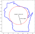
Wisconsin Pole of Inaccessibility.png 628 × 617; 17 KB
-
YubaWisQYC7388.jpg 1,600 × 1,200; 383 KB


