Category:Geography of Neringa
Jump to navigation
Jump to search
Subcategories
This category has the following 10 subcategories, out of 10 total.
*
C
D
M
- Maps of Neringa (3 F)
N
- Neringa in maps (7 F)
- Neringa in topographic maps (6 F)
W
- Winter in Nida (7 F)
Media in category "Geography of Neringa"
The following 12 files are in this category, out of 12 total.
-
 KiaulėsNugaraKuršskkýZálTrajektDFDS LiSCo.jpg 2,693 × 1,795; 2.43 MB
-
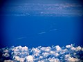 Kuršių nerija, Neringa - Curonian spit through ~80km of atmosphere (5918860265).jpg 4,092 × 3,076; 1.51 MB
-
 Neringa200906097.JPG 2,816 × 2,112; 1.72 MB
-
 Neringadviračių2009061102.JPG 2,816 × 2,112; 1.07 MB
-
 Neringos paplūdimys - panoramio.jpg 909 × 682; 137 KB
-
 Neringos sav., Lithuania - panoramio - Dmitrij M (1).jpg 3,072 × 2,304; 3.83 MB
-
 Neringos sav., Lithuania - panoramio - Dmitrij M (2).jpg 3,072 × 2,304; 3.6 MB
-
 P1210976 - Flickr - davispuh.jpg 2,816 × 2,112; 1.95 MB
-
 P1210987 - Flickr - davispuh.jpg 2,816 × 2,112; 2.22 MB
-
 P1210990 - Flickr - davispuh.jpg 2,816 × 2,112; 2.45 MB
-
 P1210991 - Flickr - davispuh.jpg 2,816 × 2,112; 2.47 MB
-
 Vecekrug2009060902.JPG 2,811 × 1,824; 916 KB

.jpg)


.jpg)
.jpg)


