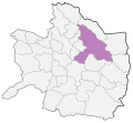
Category:Geography of Mashhad County
Jump to navigation
Jump to search
- Counties of Razavi Khorasan Province
- Bajestan
- Bakharz
- Bardaskan
- Chenaran
- Dargaz
- Davarzan
- Fariman
- Firuzeh
- Golbahar
- Gonabad
- Joghatai
- Joveyn
- Kalat
- Kashmar
- Khaf
- Khalilabad
- Khoshab
- Kuhsorkh
- Mahvelat
- Mashhad
- Miyan Jolgeh
- Nishapur
- Quchan
- Roshtkhar
- Sabzevar
- Salehabad
- Sarakhs
- Sheshtamad
- Taybad
- Torbat-e Heydarieh
- Torbat-e Jam
- Torqabeh and Shandiz
- Zaveh
- Zeberkhan
Wikimedia category | |||||
| Upload media | |||||
| Instance of | |||||
|---|---|---|---|---|---|
| Category combines topics | |||||
| Category contains | |||||
| Mashhad County | |||||
county in Razavi Khorasan Province, Iran | |||||
| Instance of | |||||
| Location | |||||
| Capital | |||||
| Population |
| ||||
 | |||||
Subcategories
This category has the following 4 subcategories, out of 4 total.
B
Media in category "Geography of Mashhad County"
The following 11 files are in this category, out of 11 total.
-
ISS061-E-6518 - View of Earth.jpg 5,568 × 3,712; 2.4 MB
-
ISS061-E-6519 - View of Earth.jpg 5,568 × 3,712; 2.35 MB
-
Mashad Constituency.png 2,000 × 1,859; 112 KB
-
Mashhad County Locator Map.svg 641 × 590; 183 KB
-
Mashhad County Map.svg 642 × 645; 37 KB
-
NJ 40-16 Mashhad, Iran.jpg 5,000 × 3,777; 3.8 MB
-
NJ 40-16 Mashhad.jpg 4,267 × 3,247; 3.16 MB
-
جاده خور سیزده بدر 92 - panoramio (cropped).jpg 768 × 562; 255 KB
-
جاده خور سیزده بدر 92 - panoramio.jpg 768 × 1,024; 413 KB
-
سد طرق 11شهریور1389 Dam torogh 2 septambr 2010 - panoramio (cropped).jpg 1,200 × 877; 176 KB
-
سد طرق 11شهریور1389 Dam torogh 2 septambr 2010 - panoramio.jpg 1,200 × 1,600; 354 KB


