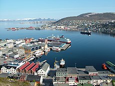
Category:Geography of Hammerfest
Jump to navigation
Jump to search
Wikimedia category | |||||
| Upload media | |||||
| Instance of | |||||
|---|---|---|---|---|---|
| Category combines topics | |||||
| geography | |||||
science that studies the terrestrial surface, the societies that inhabit it and the territories, landscapes, places or regions that form it when interacting with each other | |||||
| Pronunciation audio | |||||
| Instance of |
| ||||
| Different from | |||||
| Partially coincident with | |||||
| Hammerfest Municipality | |||||
municipality in Finnmark, Norway | |||||
| Instance of | |||||
| Location |
| ||||
| Capital | |||||
| Head of government |
| ||||
| Inception |
| ||||
| Significant event |
| ||||
| Population |
| ||||
| Area | |||||
| Different from | |||||
| official website | |||||
 | |||||
Subcategories
This category has the following 14 subcategories, out of 14 total.
B
- Breidalselva (1 F)
H
- Handelstind (1 F)
K
M
P
R
- Repparfjordelva (4 F)
- Rypefjorden (3 F)
S
- Storvannet, Hammerfest (8 F)
T
Media in category "Geography of Hammerfest"
The following 13 files are in this category, out of 13 total.
-
Guoiratrášša Magerfjellet.JPG 2,592 × 1,944; 880 KB
-
Haaja.jpg 300 × 136; 31 KB
-
Lake near Hammerfest.jpg 1,600 × 1,067; 918 KB
-
MS Nordnorge vor der Insel Håja im Sørøysund.jpg 3,888 × 2,592; 3.8 MB
-
Nedre Freidigvannet.jpg 1,600 × 1,067; 551 KB
-
Norwegian Fiord 2.jpg 3,252 × 2,319; 1.01 MB
-
Norwegian Fiord.jpg 500 × 375; 222 KB
-
Panorama Kvalsund.jpg 2,592 × 940; 384 KB
-
Sammelsundet.jpg 4,572 × 1,964; 7.96 MB
-
Small dum near Hammerfest.jpg 1,600 × 1,067; 869 KB
-
Sopnes - panoramio.jpg 3,008 × 2,000; 2.72 MB


