Category:Geography of Caetité
Jump to navigation
Jump to search
Subcategories
This category has the following 8 subcategories, out of 8 total.
A
- Adutora do Algodão (1 F)
B
- Brejinho das Ametistas (7 F)
D
- Santa Luzia (Caetité) (6 F)
F
M
S
- Streets in Caetité (27 F)
T
- Trilha da Pedra Redonda (15 F)
Media in category "Geography of Caetité"
The following 10 files are in this category, out of 10 total.
-
 Bahia Municip Caetite.svg 884 × 919; 1.58 MB
-
 Caetité 1810vila.png 910 × 415; 71 KB
-
 Caetité roads map 2022.svg 1,117 × 1,446; 184 KB
-
 Diagrama climático de Caetité - portuguese version.png 800 × 557; 76 KB
-
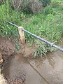 Encanamento da Adutora do Algodão na Invernada Caetité Bahia 01.jpg 3,468 × 4,624; 6.85 MB
-
 Klimadiagramm-Caetite-Brasilien-metrisch-deutsch.png 800 × 557; 31 KB
-
 Mapa Caetité 1986-2012.jpg 679 × 781; 69 KB
-
 Povoado de Aroeira - distrito de Pajeú do Vento Caetité.jpg 4,160 × 2,340; 1.68 MB
-
 Sítio do Caetité Velho.jpg 4,096 × 2,304; 3.29 MB
-
 Vista do distrito de Caldeiras, Caetité.jpg 5,390 × 2,338; 2.65 MB


