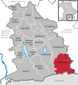
Category:Geography of Bayrischzell
Jump to navigation
Jump to search
Wikimedia category | |||||
| Upload media | |||||
| Instance of | |||||
|---|---|---|---|---|---|
| |||||
Subcategories
This category has the following 19 subcategories, out of 19 total.
A
G
- Gamswand (3 F)
- Großer Traithen (19 F)
H
- Hochmiesing (30 F)
K
R
- Ruchenköpfe (1 P, 19 F)
S
- Sandbichler Alm (2 F)
- Sillbergalm (10 F)
- Soinalm (18 F)
- Soinsee (30 F)
- Spitzingalm (Bayrischzell) (11 F)
- Spitzingscheibe (2 F)
W
Media in category "Geography of Bayrischzell"
The following 34 files are in this category, out of 34 total.
-
4921f1fdc0.jpg 365 × 244; 26 KB
-
Alpbach (Leitzach).jpg 3,000 × 2,250; 3.98 MB
-
Bayerische Voralpenlandschaft - panoramio.jpg 2,048 × 1,536; 813 KB
-
Bayrischzell - Lage im Landkreis.png 270 × 314; 38 KB
-
Bayrischzell in MB.svg 515 × 560; 318 KB
-
Bayrischzell karte.JPG 142 × 175; 4 KB
-
Bayrischzell Luftbild.JPG 1,944 × 1,296; 316 KB
-
Bayrischzell, Germany - panoramio (1).jpg 6,072 × 4,020; 7.18 MB
-
Bergpanorama - panoramio.jpg 4,608 × 3,456; 2.66 MB
-
Bergpanorama im Sonnenuntergang - panoramio.jpg 4,608 × 3,456; 3.24 MB
-
Blick ins Ursprungtal - geo.hlipp.de - 13478.jpg 640 × 425; 140 KB
-
ByZell Melkstatt.jpg 1,313 × 984; 281 KB
-
Cafe Siglhof Bayrischzell 1.jpg 4,000 × 3,000; 4 MB
-
Cafe Siglhof Bayrischzell 2.jpg 4,000 × 3,000; 3.67 MB
-
Ehemalige Niederhofer-Alm - geo.hlipp.de - 13452.jpg 640 × 425; 274 KB
-
Felsen an der Spitzingscheibe - geo.hlipp.de - 11124.jpg 640 × 425; 257 KB
-
Flickr - Jan Beckendorf - P6080004.jpg 1,712 × 2,288; 2.36 MB
-
Gebirgsbach am Sillberg - geo.hlipp.de - 13443.jpg 425 × 640; 341 KB
-
GrenzeUrsprungpass.jpg 800 × 600; 557 KB
-
Im Schnee by Niederkasseler - panoramio.jpg 5,184 × 3,456; 9.86 MB
-
In der Nähe des Taubensteinhauses - panoramio.jpg 2,048 × 1,536; 769 KB
-
Klareralm.jpg 3,000 × 2,250; 4.68 MB
-
Morgen am Berg - panoramio.jpg 4,608 × 3,456; 3.97 MB
-
Ruchenkopfhütte - panoramio.jpg 2,048 × 1,536; 1.41 MB
-
Sonnenuntergang - panoramio (33).jpg 4,608 × 3,456; 2.66 MB
-
Sonnenuntergang am Berg - panoramio.jpg 4,608 × 3,456; 2.29 MB
-
Talkessel Geitau.jpg 5,472 × 3,648; 7.59 MB
-
The long way down - panoramio.jpg 5,936 × 3,926; 6.81 MB
-
Wasserfall Bayrischzell 4.jpg 4,000 × 3,000; 5.87 MB
-
Welten aus Schnee und Eis - panoramio.jpg 4,608 × 3,456; 2.63 MB
-
Wildalpjoch u Lärcherspitz, unten im Vordergrund Grafenherberg.jpg 4,000 × 2,252; 958 KB
-
Wirths-Alm von der Maroldschneid aus gesehen - geo.hlipp.de - 20455.jpg 640 × 425; 102 KB


