Category:Geographical maps of Budapest Metro
Jump to navigation
Jump to search
Media in category "Geographical maps of Budapest Metro"
The following 29 files are in this category, out of 29 total.
-
Bamco abra 9eb258d1275a.jpg 420 × 269; 39 KB
-
Budapest M1 Metro map.png 600 × 572; 15 KB
-
Budapest M2 Metro map.png 600 × 572; 15 KB
-
Budapest M3 Metro map.png 600 × 572; 15 KB
-
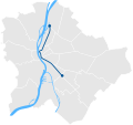
Budapest M4 Metro map.png 600 × 572; 15 KB
-
Budapest Metro 5.PNG 562 × 537; 60 KB
-
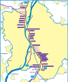
Budapest metro 5.svg 512 × 613; 49 KB
-
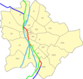
Budapest Metro Geographical Map.SVG 238 × 225; 24 KB
-
Budapest metro line 2 reconstruction.svg 512 × 149; 14 KB
-
Budapest Metro Lines.SVG 600 × 566; 25 KB
-
Budapest metro map 3.svg 512 × 523; 47 KB
-
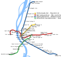
Budapest Metro Map.SVG 256 × 225; 38 KB
-
Budapest metro network 1.svg 600 × 566; 67 KB
-
Budapest metro network 2.svg 600 × 566; 67 KB
-
Budapest metro network 3 plan (1897).svg 512 × 483; 46 KB
-
Budapest metro network 3 plan (1912).svg 512 × 483; 46 KB
-
Budapest metro network 3 plan (1921).svg 512 × 483; 46 KB
-
Budapest metro network 3 plan (1925).svg 512 × 483; 46 KB
-
Budapest metro network 3 plan (1942).svg 512 × 483; 46 KB
-
Budapest metro network 3 plan (1978).svg 512 × 483; 54 KB
-
Budapest metro network 3.svg 600 × 566; 67 KB
-
Budapest metro osszekoto.svg 512 × 351; 22 KB
-
Budapest metro tervek 2007.svg 512 × 477; 872 KB
-
M2G projekt térképe.svg 2,159 × 1,247; 2.66 MB
-
M3-as metró káposztásmegyeri szakasza.png 2,520 × 3,864; 1.75 MB
-
M3-as metró nyomvonalterv (1978).png 2,152 × 2,512; 737 KB
-
Topografischer Linienplan M1 Budapest.png 986 × 804; 98 KB
-
Topografischer Netzplan Metró Budapest.png 2,184 × 2,225; 382 KB
-
Észak-déli regionális gyorsvasút I. ütem.svg 1,591 × 1,610; 1.7 MB


