Category:Geographic diagrams
Jump to navigation
Jump to search
Subcategories
This category has the following 11 subcategories, out of 11 total.
Pages in category "Geographic diagrams"
This category contains only the following page.
Media in category "Geographic diagrams"
The following 101 files are in this category, out of 101 total.
-
 Abflussganglinie.JPG 674 × 434; 24 KB
-
 Altitude (PSF).png 800 × 324; 34 KB
-
 Analisis Espacial.jpg 1,176 × 668; 48 KB
-
 Anchor-point theory in Japanese.png 1,228 × 792; 48 KB
-
 Arctic region.jpg 457 × 434; 54 KB
-
 Auxiliary Latitudes Difference.svg 540 × 360; 47 KB
-
 Bollenkubus web.jpg 500 × 380; 31 KB
-
 Cercleste.svg 478 × 396; 14 KB
-
 Christaller model 1.jpg 300 × 288; 31 KB
-
 Christaller model 1.svg 270 × 279; 65 KB
-
 Christaller model 2.jpg 300 × 285; 26 KB
-
 Christaller model 3.jpg 200 × 201; 11 KB
-
 Christaller model 3.svg 200 × 200; 1 KB
-
 Christaller model2.jpg 300 × 309; 29 KB
-
 Circles of latitude.jpg 551 × 284; 43 KB
-
 Colure-it.png 634 × 590; 216 KB
-
 Colure-it.svg 774 × 684; 7.15 MB
-
 Colure.png 760 × 590; 222 KB
-
 Colure.svg 774 × 684; 7.18 MB
-
 Cylindrical Projection basics2.svg 503 × 231; 38 KB
-
 Cylindrical Projection secant.svg 489 × 206; 22 KB
-
 CylProj infinitesimals2.svg 495 × 142; 44 KB
-
 December solstice geometry ur.png 390 × 267; 35 KB
-
 December solstice geometry.svg 367 × 251; 98 KB
-
 Direction of qibla using shadow.svg 216 × 160; 4 KB
-
 EB1911 Geography - Continental slope.jpg 600 × 364; 82 KB
-
 EIA global transport energy by fuel 2012.png 499 × 271; 19 KB
-
 Enk.jpg 320 × 200; 11 KB
-
 Enkexk.jpg 320 × 200; 13 KB
-
 Eratosthene mesure terre.png 500 × 312; 70 KB
-
 Eratosthenes.svg 427 × 257; 102 KB
-
 Esfera armilar versão da geografia.jpg 846 × 1,104; 80 KB
-
 Esferageo.jpg 177 × 227; 10 KB
-
 Exk.jpg 320 × 200; 20 KB
-
 Figure de poles projection stereographique.png 1,015 × 302; 23 KB
-
 Föhn.svg 1,001 × 667; 26 KB
-
 Geographical matrix - approaches to geography.jpg 1,063 × 798; 123 KB
-
 Geographical matrix - systematic and regional geography.jpg 1,063 × 798; 111 KB
-
 Geographischer Formenwandel.png 533 × 364; 16 KB
-
 Geography Word Cloud.png 1,920 × 1,080; 683 KB
-
 Geonames4.png 1,440 × 720; 169 KB
-
 Grunddaseinsfunktionen.jpg 462 × 500; 72 KB
-
 Heliotermia.jpg 3,050 × 2,189; 695 KB
-
 Hoyt model.png 600 × 323; 17 KB
-
 Inversion by Stereographic.png 365 × 224; 5 KB
-
 Islands by area.png 781 × 745; 49 KB
-
 Kernmechanismus Sahel-Syndrom.pdf 1,239 × 1,752; 81 KB
-
 Kernmechanismus Sahel-Syndrom2.pdf 1,239 × 1,752; 81 KB
-
 Kriptodepresioni.jpg 2,000 × 942; 206 KB
-
 Landscape-sphere.jpg 640 × 480; 73 KB
-
 Landusepiechart.png 537 × 501; 109 KB
-
 Location Theory by August Losch-de.svg 1,052 × 744; 38 KB
-
 Location Theory by August Losch-sr.svg 1,052 × 744; 38 KB
-
 Maury plate 01.jpg 2,723 × 2,947; 2.91 MB
-
 Nachylenie osi obrotu.svg 774 × 684; 7.15 MB
-
 Oceanic basin bangla.svg 1,001 × 705; 25 KB
-
 Oceanic basin bn.svg 1,001 × 705; 24 KB
-
 Orbita Tierra.jpg 720 × 635; 50 KB
-
 Orbita.tierra.Spanish.svg 728 × 624; 18 KB
-
 Osservazione celeste.png 760 × 590; 232 KB
-
 Ost.jpg 320 × 200; 20 KB
-
 Paralelos.png 591 × 443; 7 KB
-
 Pobreznyvanok.jpg 640 × 300; 10 KB
-
 Poledníky.png 450 × 366; 151 KB
-
 Pontos cardeais.png 400 × 149; 11 KB
-
 Prominence.png 1,600 × 999; 29 KB
-
 Rayos.png 770 × 495; 13 KB
-
 RotacionTerrestre.svg 154 × 182; 83 KB
-
 Sahel-syndrom.pdf 1,239 × 1,752; 92 KB
-
 Sahel-Syndrom.pdf 1,239 × 1,752; 92 KB
-
 Schaubild - Kulturlandschaft 2.png 1,301 × 780; 639 KB
-
 Sea-level-rise scheme.svg 842 × 595; 131 KB
-
 Skládání vrstev -7-.png 722 × 595; 73 KB
-
 Standard deviational ellipse.svg 542 × 755; 37 KB
-
 Table of Geography and Hydrography, Cyclopaedia, Volume 1.jpg 1,809 × 2,725; 2.22 MB
-
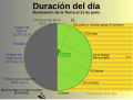 Tageslaenge es.svg 1,946 × 1,465; 23 KB
-
 Temperate zone (PSF).png 3,506 × 1,697; 595 KB
-
 Temperate zone (PSF).svg 526 × 255; 428 KB
-
 Temperature zone of earth.jpg 2,560 × 1,920; 912 KB
-
 Trends des Globalen Wandels.pdf 1,239 × 1,752; 141 KB
-
 Trends des Globalen Wandels2.pdf 1,239 × 1,752; 141 KB
-
 Types of latitude difference.png 512 × 384; 4 KB
-
 Types of latitude difference.svg 640 × 480; 28 KB
-
 Types of latitudes original.png 512 × 384; 4 KB
-
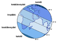 Valaistusvyohykkeet.png 1,305 × 916; 50 KB
-
 Vertikální členění reliéfu.png 1,563 × 931; 95 KB
-
 Von thunen circles city.gif 443 × 363; 4 KB
-
 Von Thunen Model.svg 1,200 × 900; 17 KB
-
 Von Thünen circles city.svg 300 × 300; 4 KB
-
 WeierstrassSubstitution.svg 345 × 210; 7 KB
-
 Wiki WC n7 pb solution.jpg 485 × 700; 99 KB
-
 Wiki WC n7 pb.jpg 486 × 701; 126 KB
-
 World Scale from DMA Series 1150 map.png 3,301 × 890; 14 KB
-
 Zentraleorte.jpg 250 × 231; 17 KB
-
 Zentralitaet k3.png 214 × 234; 3 KB
-
 Zonas terra.png 527 × 535; 60 KB
-
 Zuordnung Kernprobleme.pdf 1,239 × 1,752; 206 KB
-
 Órbita da Terra.jpg 438 × 365; 20 KB
-
 ПТКомплекс.jpg 500 × 500; 137 KB
-
 צלבי פיזור של גידולים חקלאיים.jpg 975 × 666; 100 KB
-
 華倫亭.png 990 × 569; 35 KB


.png)
.svg)


.png)