
Category:Geographic Overlays
Aerial pictures, satellite images, or maps provided with geocoding information suitable to generate a GoogleEarth Overlay.
See also:
Resources:
Pages in category "Geographic Overlays"
The following 2 pages are in this category, out of 2 total.
Media in category "Geographic Overlays"
The following 200 files are in this category, out of 206 total.
(previous page) (next page)-
 Aerial view of Wood Island, East Boston.JPG 4,320 × 3,240; 3.98 MB
-
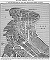
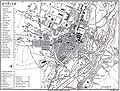
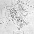
 Albertstadt Map 1895.jpg 1,866 × 912; 463 KB
-
 Alluvial fan, Taklimakan Desert, XinJiang Province, China, NASA, ASTER.jpg 3,774 × 4,086; 3.48 MB
-
 Americus, Indiana 1878.png 1,600 × 1,700; 580 KB
-
 Anzac Cove region topographic battlefield map H.E.C. Robinson 1916 (georeferenced).jpg 3,099 × 3,156; 1.27 MB
-
 Arenas-de-San-Pedro-loc.png 2,950 × 2,725; 1.63 MB
-
 AtomicEffects-p10a.jpg 640 × 420; 106 KB
-
 AtomicEffects-p10b.jpg 640 × 423; 73 KB
-
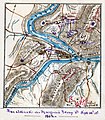 Attack on Harper's Ferrypass5.jpg 1,688 × 1,925; 2.69 MB
-
 Australia Western Australia relief location map.jpg 2,481 × 3,584; 3.35 MB
-
 Bavay - Dinant.svg 600 × 108; 21 KB
-
 Bavay - Gembloux 2.svg 600 × 332; 63 KB
-
 Bavay - Gembloux.svg 600 × 332; 62 KB
-
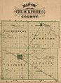 Blackford County, Indiana map from 1876 atlas.jpg 1,242 × 1,704; 1.59 MB
-
 Blüherpark 1895.JPG 999 × 640; 160 KB
-
 Bombay 1909.jpg 1,571 × 2,104; 385 KB
-
 BombayReclamation 1911.jpg 1,622 × 1,948; 2.5 MB
-
 Boston SkySat SSC3 20170730 (cropped).jpg 2,400 × 1,800; 2.68 MB
-
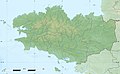 Bretagne region relief location map.jpg 1,615 × 1,001; 348 KB
-
 Brockhaus 14 Karte Berlin und Umgebung (rectified).jpg 3,516 × 3,000; 4.61 MB
-
 Brücken westlich Hauptbahnhof Dresden 1895.jpg 517 × 409; 71 KB
-
 BureCampPlan.jpg 1,024 × 497; 57 KB
-
 Buurtwegen - Oostkerke Diksmuide.jpg 845 × 615; 86 KB
-
 Byzantine Constantinople eu.png 2,883 × 2,602; 2.91 MB
-
 Byzantine Constantinople eu.svg 2,050 × 1,850; 1.25 MB
-
 Byzantine Constantinople-en.png 3,200 × 2,888; 2.35 MB
-
 Camp Cable (Pre-Yarrabilba Development).jpg 10,724 × 15,972; 15.08 MB
-
 Camp Cable area plan number 1 T 296 (georeferenced).png 2,355 × 3,181; 3.83 MB
-
 Carska Droga mapa duża.gif 800 × 485; 34 KB
-
 Carska Droga mapa.gif 320 × 194; 10 KB
-
 Carska Droga Twierdza Osowiec mapa plan.gif 560 × 620; 30 KB
-
 Chartres.svg 795 × 526; 105 KB
-
 Chaussée Brunehault IGN(46 5) 1882.jpg 1,497 × 1,056; 657 KB
-
 City and South London Railway Engineering Drawing.jpg 11,395 × 1,160; 1.29 MB
-
 Clarks Hill, Indiana 1878.png 1,200 × 1,530; 443 KB
-
 CockatooIsland gobeirne.jpg 2,048 × 1,536; 1.15 MB
-
 Colburn, Indiana 1878.png 1,600 × 1,740; 897 KB
-
 Concord, Indiana 1878.png 1,200 × 1,800; 414 KB
-
 Corwin, Indiana 1878.png 600 × 680; 145 KB
-
 Covington, Indiana map from 1876 atlas.jpg 1,302 × 946; 862 KB
-
 Dayton, Indiana 1878.png 2,000 × 1,930; 748 KB
-
 Deutsch Ost-Afrika,1892.jpg 3,503 × 4,498; 10.38 MB
-
 Djibouti City and Balbala Districts.png 1,353 × 1,161; 64 KB
-
 Dresden Map 1895.jpg 2,938 × 3,758; 2.77 MB
-
 Dyfi Forest.svg 512 × 398; 7.29 MB
-
 Edmund Street strip map 1890.png 8,219 × 2,241; 526 KB
-
 Erfurt-1650-Merian.jpg 3,176 × 2,355; 2.39 MB
-
 Etna eruption seen from the International Space Station.jpg 2,720 × 2,000; 1.02 MB
-
 F. Müllhaupt's Militarische & Verkehrs-Karte der Deutsch-Französischen Grenze...jpg 8,150 × 6,978; 75.1 MB
-
 Fig. 1 from Rothermel, General Technical Report INT-299, May 1993.jpg 2,506 × 1,846; 838 KB
-
 First Manassas map2.jpg 4,750 × 4,660; 14.75 MB
-
 Fort XI Warszawa Grochów.jpg 830 × 505; 128 KB
-
 Foto aérea de Unaí detalhando o córrego Canabrava 1.jpg 3,456 × 2,304; 2.71 MB
-
 Foto aérea de Unaí detalhando o córrego Canabrava 2.jpg 3,456 × 2,304; 2.69 MB
-
 Foto aérea de Unaí detalhando o córrego Canabrava 3.jpg 3,456 × 2,304; 3.02 MB
-
 Foto aérea de Unaí detalhando o córrego Canabrava 4.jpg 3,456 × 2,304; 2.61 MB
-
 Foto aérea de Unaí detalhando o córrego Canabrava.jpg 3,456 × 2,304; 2.91 MB
-
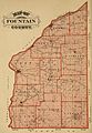 Fountain County, Indiana map from 1876 atlas.jpg 1,521 × 2,190; 2.59 MB
-
 France relief location map.jpg 2,000 × 1,922; 907 KB
-
 Freiberg-1647-Merian-Belagerung.jpg 3,176 × 2,515; 2.36 MB
-
 Gerard, Indiana 1878.png 1,000 × 1,900; 715 KB
-
 Granville, Indiana 1878.png 1,800 × 1,320; 479 KB
-
 Green Hill Indiana map from 1877 atlas.png 1,024 × 1,011; 2.18 MB
-
 GrundrissNantes.JPG 1,170 × 2,128; 277 KB
-
 Gundalakama.png 552 × 231; 165 KB
-
 Górki Grochowskie wieś Fort XI Warszawa.gif 546 × 600; 53 KB
-
 Górki Grochowskie, Oficerska Spółdzielnia Mieszkaniowa Grochów.gif 600 × 870; 56 KB
-
 Independence Indiana map from 1877 atlas.png 1,024 × 802; 1.8 MB
-
 India Jammu and Kashmir locator map.svg 1,574 × 1,738; 966 KB
-
 Istanbul Rapid Transit Map.png 4,159 × 3,118; 2.02 MB
-
 Italybombing4.jpg 3,003 × 2,246; 3.76 MB
-
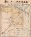 Johnsonville Indiana map from 1877 atlas.png 1,280 × 1,491; 3.06 MB
-
 Kaluzhskaja pl 1812.jpg 176 × 181; 41 KB
-
 Karta öfver universitetsstaden Lund 1866.jpg 3,317 × 4,005; 3.84 MB
-
 Karta över centrala Stockholm på 1910-talet (ur Nordisk familjebok).jpg 2,548 × 2,776; 1.53 MB
-
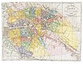
 Karta över Paris på 1910-talet (ur Nordisk familjebok).jpg 3,171 × 2,510; 9.9 MB
-
 Karta över Sankt Petersburg på 1910-talet (ur Nordisk familjebok).jpg 3,432 × 2,548; 2.2 MB
-
 Karta över Venedig på 1920-talet (ur Nordisk familjebok).jpg 4,104 × 2,548; 6.6 MB
-
 Karta över Wien på 1920-talet (ur Nordisk familjebok).jpg 2,548 × 3,480; 2.32 MB
-
 Karte der Navajo Volcanic Fields.jpg 1,280 × 1,467; 565 KB
-
 Karte der Parkstadt Bogenhausen in München.png 4,146 × 5,057; 2.44 MB
-
 Karte der Stadtbahn Stuttgart und des O-Bus Esslingen.png 2,806 × 2,713; 7.75 MB
-
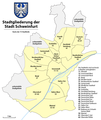 Karte Stadtteile Stadt Schweinfurt.png 1,344 × 1,594; 270 KB
-
 Karte VTO 2012 under CC-by-sa.png 2,000 × 2,357; 632 KB
-
 Kickapoo, Indiana plat.png 1,800 × 1,800; 4.07 MB
-
 Kiritimati.jpg 440 × 340; 14 KB
-
 Köln - Rimburg.svg 600 × 126; 29 KB
-
 Kępa Wieloryb - mapa.png 420 × 160; 30 KB
-
 Lapal Tunnel East 50pc.jpg 3,508 × 2,280; 2.89 MB
-
 Lapal Tunnel West 50pc.jpg 3,388 × 2,552; 2.56 MB
-
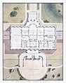 Latrobe White House cropa2.jpg 3,746 × 4,756; 23.1 MB
-
 Lausitzer-Grenzwall Endmoräne Eiszeit.jpg 1,004 × 760; 725 KB
-
 Les carrosses à cinq sols - network map.jpg 2,044 × 1,713; 2.83 MB
-
 Liechtenstein - Gemeinden mit Exklaven.png 1,359 × 2,206; 171 KB
-
 Lindholz Plan von Berlin und Koeln um 1660 (georeferenced).png 1,008 × 941; 359 KB
-
 Littleton station and I-495 - Route 2 interchange aerial view.JPG 4,320 × 3,240; 5.25 MB
-
 Loganholme, Queensland cadastral map 1885 georef.jpg 7,160 × 8,000; 4.61 MB
-
 Map de berlin 1789 (georeferenced).jpg 1,648 × 1,373; 1.24 MB
-
 Map of Bombay (1909) showing Cumballa Hill.png 545 × 515; 436 KB
-
 Map of Corydon, Indiana from 1876 atlas.png 950 × 948; 880 KB
-
 Map of Manchester Metrolink.png 1,986 × 2,736; 4.1 MB
-
 Map of Oxford, Indiana from 1876 atlas.png 1,630 × 1,024; 1.68 MB
-
 Map of the Navajo Volcanic Fields.jpg 1,280 × 1,467; 568 KB
-
 Map of the Timișoara tramway and trolleybus routes.png 3,108 × 2,574; 3.91 MB
-
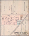 Marshfield Indiana map from 1877 atlas.png 1,280 × 1,556; 3 MB
-
 Midway Islands.svg 365 × 392; 37 KB
-
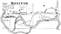 Monitor, Indiana 1878.png 1,800 × 1,000; 483 KB
-
 Monroe, Indiana 1878.png 1,200 × 1,024; 266 KB
-
 Montmorenci, Indiana 1878.png 1,900 × 1,940; 630 KB
-
 Montpellier-Mediterranee de.svg 841 × 530; 45 KB
-
 Montpellier-Mediterranee.svg 841 × 530; 64 KB
-
 Munich 1858 - London, John Murray, 1858.jpg 1,774 × 1,342; 688 KB
-
 NantesGround.gif 1,170 × 2,128; 176 KB
-
 NewZealandInternationalExhibitionBuildings Aerial EditCurves.jpg 2,356 × 992; 943 KB
-
 NewZealandInternationalExhibitionBuildings Plan.jpg 4,919 × 2,852; 2.27 MB
-

-
 North and West Cambridge and North Allston aerial.JPG 4,320 × 3,240; 4.44 MB
-
 North Rhine-Westphalia location map 01.svg 527 × 524; 1.22 MB
-
 North Rhine-Westphalia location map 02.svg 527 × 524; 1.83 MB
-
 North Rhine-Westphalia location map 03.svg 527 × 524; 6.76 MB
-
 North Rhine-Westphalia location map 04.svg 527 × 524; 1.07 MB
-
 North Rhine-Westphalia location map 05.svg 527 × 524; 4.42 MB
-
 North Rhine-Westphalia location map 06.svg 527 × 524; 1.46 MB
-
 North Rhine-Westphalia location map 07.svg 527 × 524; 5.32 MB
-
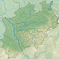 North Rhine-Westphalia relief location map.jpg 1,800 × 1,790; 1.52 MB
-
 NRW cut 5.834–7.678°E, 50.453–52.515°N.png 529 × 792; 301 KB
-
 NRW cut 5.834–7.9546°E, 50.551–52.277°N2.png 598 × 792; 309 KB
-
 NRW relief cut 5.834–7.6046°E, 50.551–52.277°N.png 504 × 792; 281 KB
-
 NRW relief cut 5.834–8.718°E, 50.453–52.515°N.png 808 × 948; 634 KB
-
 Original Stockwell station layout.png 2,400 × 3,200; 379 KB
-
 Pike Township, Warren County, Indiana map from 1877 atlas.png 1,473 × 2,048; 5.29 MB
-
 Pine Village Indiana map from 1877 atlas.png 871 × 1,024; 1.86 MB
-

-
 Plan de Paris 1589-1643 BNF07710699.png 3,868 × 3,169; 15.75 MB
-
 Plan de Paris 1705 BNF07710700.png 3,890 × 3,158; 15.89 MB
-
 Plan de Paris 1705 rue du Dahomey.png 480 × 548; 494 KB
-
 Plan du réseau des tramways de Bordeaux.png 2,567 × 2,444; 4.68 MB
-
 Potok Służewiecki - mapa 2.png 420 × 205; 34 KB
-
 Public transport map of Bilbao (city area).png 2,110 × 2,166; 3.1 MB
-
 Public transport map of Bilbao.png 4,701 × 4,948; 9.36 MB
-
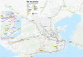 Public transport map of Rio de Janeiro.png 8,777 × 5,996; 15.03 MB
-
 Pumpkin Vine Railroad route.svg 479 × 600; 4 KB
-
 Rade de Cherbourg-fr.svg 850 × 521; 68 KB
-
 Rainsville Indiana map from 1877 atlas.png 717 × 1,024; 1.62 MB
-
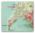
 Rayevo and Rayevo Mescherskago 1900.jpg 406 × 244; 165 KB
-
 Reading, MA aerial view.JPG 4,320 × 3,240; 4.95 MB
-
 Rhode Berlin 1772 (Lotter) (georeferenced).jpg 5,750 × 4,290; 4.74 MB
-
 Romney, Indiana 1878.png 1,036 × 2,502; 578 KB
-
 Rothermel Fig 1 transparent blue.png 2,506 × 1,846; 649 KB
-
 Ruta del Camino de Santiago Frances.svg 1,010 × 850; 128 KB
-
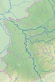
 Saxony-Anhalt location map.png 1,956 × 2,305; 679 KB
-
 Saxony-Anhalt location map.svg 1,957 × 2,306; 1.27 MB
-
 Schmettau Plan de la ville de Berlin (georeferenced) (Panke-SchönhauserGraben).jpg 1,786 × 1,359; 1.08 MB
-
 Schmettau Plan de la ville de Berlin (georeferenced).jpg 5,200 × 5,224; 5.73 MB
-
 Schmettau Plan de la ville de Berlin reduit 1748-1757.jpg 9,153 × 6,700; 26.69 MB
-
 Sediment off the Yucatan Peninsula.jpg 2,400 × 2,000; 1.59 MB
-
 Selter Grundriss von Berlin 1846 (georeferenced) (Blumenstraße).jpg 2,303 × 1,483; 1.18 MB
-
 Selter Grundriss von Berlin 1846 (georeferenced).jpg 9,500 × 7,347; 11.44 MB
-
 Skovbjerg Bakkeø.png 501 × 447; 146 KB
-
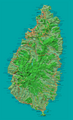 St Lucia map.png 1,912 × 3,147; 4.21 MB
-
 State Line City Indiana map from 1877 atlas.png 1,632 × 1,330; 3.74 MB
-
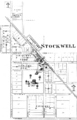 Stockwell, Indiana 1878.png 1,600 × 2,500; 1.1 MB
-
 Stoneham, MA aerial view.JPG 3,863 × 2,897; 4.2 MB
-
 Swampscott, MA aerial view.JPG 4,320 × 3,240; 5.94 MB
-
 Tel Aviv Rapid Transit Network.png 3,500 × 6,373; 26.84 MB
-
 The Pabst Plan Warsaw 1.jpg 998 × 1,006; 790 KB
-
 Thedford, Nebraska.jpg 3,504 × 2,336; 6.71 MB
-
 Thuringia location map.svg 966 × 758; 161 KB
-
 Tongeren - Gembloux.svg 600 × 300; 71 KB
-
 Tongeren - Herstal.svg 600 × 600; 84 KB
-
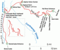
 Trail Ridge Road map north.gif 750 × 295; 42 KB
-
 Trail Ridge Road map small.gif 290 × 243; 13 KB
-
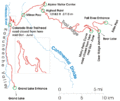 Trail Ridge Road map.gif 800 × 670; 53 KB
-
 Tramway map of Antwerpen (without background).png 4,511 × 3,114; 1.39 MB
-
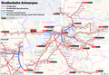 Tramway map of Antwerpen.png 4,511 × 3,114; 4.23 MB
-
 Transilien Île-de-France map.jpg 8,084 × 7,196; 35.37 MB
-
 Transitville, Indiana 1878.png 1,600 × 1,440; 434 KB
-
 Tsaritsyno station on the map.gif 305 × 128; 33 KB
-
 USA Alaska location map.svg 1,553 × 1,160; 1.24 MB
-
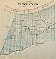 Vincennes, Indiana map from 1876 atlas.JPG 1,501 × 1,600; 1.88 MB
-
 Wachusett aerial, September 2013.JPG 4,320 × 3,240; 5.27 MB
-
 Waimakariri01 gobeirne.jpg 3,072 × 2,304; 2.83 MB
-
 Waimakariri02 gobeirne.jpg 3,072 × 2,304; 2.06 MB
-
 Warren County, Indiana map from 1877 atlas.png 1,698 × 2,048; 6.62 MB
-

-
 Warszawa geomorfologia Wisła taras zalewowy mapa.gif 770 × 800; 60 KB
-
 Washington Township, Warren County, Indiana map from 1877 atlas.png 2,048 × 1,655; 6.52 MB
-
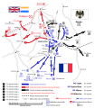 Waterloo Campaign map-alt3 cs.svg 1,500 × 1,706; 602 KB
-
 Waterloo Campaign map-alt3 ita.svg 1,500 × 1,706; 777 KB
-
 Waterloo Campaign map-alt3 tr.svg 1,500 × 1,706; 756 KB
-
 Waterloo Campaign map-alt3.svg 1,500 × 1,706; 1.04 MB
-
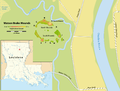 Watson Brake - Map.png 2,478 × 1,872; 613 KB
-
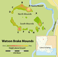 Watson Brake Mounds - Map.png 1,509 × 1,484; 297 KB
-
 West Lebanon, Indiana map from 1877 atlas.png 948 × 1,863; 2.73 MB
-
 West Medford Aerial.JPG 4,320 × 3,240; 4.3 MB
-
 West Point, Indiana 1878.png 1,500 × 1,690; 646 KB
-
 Westbrook station USGS aerial 2008.JPG 797 × 446; 75 KB
-
 Whitechapel Spitalfields 7 murders.JPG 3,315 × 2,020; 6.51 MB
-
 Williamsport, Indiana map from 1877 atlas.png 1,665 × 2,048; 6.72 MB
-
 Wtc-photo.jpg 9,372 × 9,372; 14.03 MB


.jpg)


.jpg)

.jpg)


.jpg)
.png)


_1882.jpg)


.jpg)
.jpg)
.jpg)
.jpg)
.jpg)


.png)


.jpg)
_showing_Cumballa_Hill.png)


_(georeferenced).jpg)


_(Panke-Sch%C3%B6nhauserGraben).jpg)
.jpg)


_(Blumenstra%C3%9Fe).jpg)
.jpg)


.png)


.png)