Category:Geodesic diagrams
Jump to navigation
Jump to search
Media in category "Geodesic diagrams"
The following 156 files are in this category, out of 156 total.
-
3D Trilateration.jpg 1,280 × 910; 72 KB
-
4343АААЫЫ.svg 1,494 × 917; 12 KB
-
Abu Reyhan Biruni-Earth Circumference.svg 1,000 × 900; 16 KB
-
Altitudes.svg 527 × 303; 13 KB
-
AnalemmaVitruvii.jpg 2,326 × 1,591; 302 KB
-
Azymut.svg 300 × 300; 7 KB
-
Bogenschnitt2.png 512 × 384; 5 KB
-
CASSINIS' ELLIPSOID; HUYGEN'S THEORETICAL ELLIPSOID.GIF 623 × 900; 190 KB
-
CD-SurfRef.png 575 × 251; 19 KB
-
CD0003-Méthode Ératosthène.png 1,650 × 1,300; 16 KB
-
CD007b-Méthode de Riccioli.png 3,333 × 2,508; 243 KB
-
CD012-Longueur du degré.png 1,900 × 1,250; 12 KB
-
Compared differentials ds.png 1,199 × 594; 14 KB
-
Comparison of Earth farthest points.svg 512 × 512; 3 KB
-
Cross sections of earth show radius of the circles of latitude.png 377 × 854; 10 KB
-
Delambre, Méchain - Base du système métrique décimal, T.1 (page 738 crop).jpg 3,939 × 2,909; 675 KB
-
Delambre, Méchain - Base du système métrique décimal, T.1 (page 739 crop).jpg 4,200 × 2,747; 684 KB
-
Delambre, Méchain - Base du système métrique décimal, T.1.pdf 2,133 × 3,200, 744 pages; 25.16 MB
-
Direction-finding Triangulation.svg 270 × 355; 20 KB
-
Délka strany.png 2,277 × 1,609; 112 KB
-
EB1911 Geodesy Fig. 1.jpg 203 × 347; 17 KB
-
EB1911 Geodesy Fig. 3.jpg 208 × 207; 13 KB
-
Ecef coordinates.svg 832 × 714; 36 KB
-
Ecef.png 832 × 714; 23 KB
-
Elevation gain.png 830 × 540; 16 KB
-
Elevation.png 830 × 540; 40 KB
-
Elevations.png 544 × 602; 15 KB
-
Elipsoida obrotowa.svg 825 × 730; 20 KB
-
Ellipsoid-ebener-Schnitt.svg 636 × 253; 680 KB
-
Empfangs-GPS.png 1,045 × 543; 25 KB
-
Equatorial bulge model.png 256 × 176; 6 KB
-
Erathostenes-IT.svg 761 × 629; 13 KB
-
Erathostenes.svg 772 × 652; 12 KB
-
Eratosthene mesure terre.png 500 × 312; 70 KB
-
Eratosthenes & measurement of the Earth.png 300 × 207; 9 KB
-
Eratosthenes measure of Earth circumference DE.svg 512 × 341; 50 KB
-
Eratosthenes measure of Earth circumference.svg 512 × 341; 54 KB
-
Eratosthenes' method for determining the size of the Earth.GIF 646 × 900; 374 KB
-
Eratosthenes' method for determining the size of the Earth.png 667 × 929; 46 KB
-
Eratosthenes' method for determining the size of the Earth.svg 626 × 871; 129 KB
-
Eratosthenes.png 701 × 542; 136 KB
-
Exzenter-PP.png 474 × 177; 10 KB
-
Fig01.jpg 400 × 109; 12 KB
-
Gebäudeeinmessung im Einbindeverfahren.svg 480 × 380; 540 KB
-
Geocentric and geodetic latitude.svg 688 × 567; 32 KB
-
Geodeetilised koordinaadid.jpg 459 × 334; 46 KB
-
Geodesic longitude variation for an ellipsoid.svg 512 × 496; 7 KB
-
Geodesic problem mapped to the auxiliary sphere.svg 512 × 382; 13 KB
-
Geodesic problem on an ellipsoid.svg 512 × 371; 16 KB
-
Geodesics and geodesic circles on an oblate ellipsoid.svg 512 × 468; 42 KB
-
Geodesy 4.0.png 3,400 × 1,650; 565 KB
-
Geodetic latitude and the length of Normal.svg 300 × 300; 8 KB
-
Geodetic latitude.png 425 × 425; 34 KB
-
Geodetic problem on an ellipsoid.svg 512 × 371; 14 KB
-
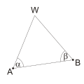
Geodetic Triangulation (Goniometric).svg 348 × 233; 20 KB
-
Geodetic vs Geocentric Latitude v2.svg 744 × 744; 13 KB
-
Geodetic vs Geocentric Latitude.svg 682 × 684; 13 KB
-
Geodetische Basis van Lommel Schema.jpg 774 × 839; 54 KB
-
Geodetische Basis van Oostende-schema.jpg 1,372 × 966; 125 KB
-
Geogebra-export (1).png 3,000 × 2,669; 665 KB
-
Geschlossenes Ringpolygon.jpg 200 × 174; 7 KB
-
Goniometric Triangle.svg 288 × 230; 13 KB
-
GRAVIMETRIC DATUM ORIENTATION mk.SVG 813 × 750; 321 KB
-
GRAVIMETRIC DATUM ORIENTATION.GIF 650 × 691; 158 KB
-
GRAVIMETRIC DATUM ORIENTATION.SVG 813 × 750; 20 KB
-
Gravitational potential components.svg 512 × 448; 12 KB
-
Hauptaufgabe ds.png 540 × 513; 6 KB
-
Helmert (seven-parameter) transformation.svg 530 × 457; 54 KB
-
Horizontal and vertical coordinates (geodetic).svg 145 × 224; 8 KB
-
Horizontal and vertical coordinates (naive).svg 145 × 224; 7 KB
-
How VLBI Works.gif 530 × 496; 40 KB
-
Imagem01.jpg 520 × 326; 19 KB
-
Jason-1 measurement system.gif 651 × 527; 72 KB
-
Landmeetkunde Argument3.png 992 × 763; 27 KB
-
Linienzug.jpg 200 × 214; 4 KB
-
Linked Open Geodata GeoSPARQL.png 2,000 × 734; 133 KB
-
Linked Open Geodata Wikidata.png 2,000 × 1,353; 207 KB
-
Meridian convergence and spehrical excess.png 615 × 598; 13 KB
-
Metoda protínání vpřed.jpg 5,184 × 3,226; 4.27 MB
-
Michell Cavendish Torsion BalanceInstrument001.svg 390 × 354; 161 KB
-
Modèle ellipsoïdal de la Terre.png 228 × 157; 8 KB
-
Método de Eratóstenes para determinar a circunferência da terra.png 3,471 × 4,834; 1.1 MB
-
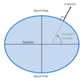
N vector and geodetic latitude.png 551 × 544; 18 KB
-
Nadzór GiK w Polsce - diagram.jpg 781 × 584; 69 KB
-
Nadzór GiK w Polsce od 2015 - diagram.jpg 781 × 584; 106 KB
-
Niwelacja ze srodka-gora.svg 505 × 285; 10 KB
-
NS 5000nm Eq.svg 1,056 × 816; 512 KB
-
NS 5000nm Study.svg 1,056 × 816; 512 KB
-
NSDI layout.JPG 1,151 × 659; 98 KB
-
NYW-voorwaartse-insnijding.png 451 × 331; 4 KB
-
OE Interval Ellps.PNG 585 × 335; 12 KB
-
Offenes Polygon.jpg 200 × 169; 6 KB
-
OffsetWGS84-ETRS89.svg 629 × 500; 44 KB
-
Opis punktu geodezyjnego III kl.jpg 715 × 498; 70 KB
-
OrbisPictus b 208.jpg 1,868 × 1,382; 1.02 MB
-
Orthogonalverfahren.jpg 200 × 187; 10 KB
-
Poloha obou směrníků strany AB, modrá barva ukazuje rozdíl 2R.png 1,996 × 1,410; 56 KB
-
Polohy směrníků ve všech kvadrantech.png 2,037 × 1,561; 101 KB
-
Posição aparente.JPG 248 × 181; 4 KB
-
Principle of geodetic setting-out.jpg 1,308 × 832; 58 KB
-
PSM V47 D320 Exaggerated sectional view of the earth through the equator.jpg 1,601 × 994; 143 KB
-
Rowbotham–curvature.jpg 510 × 161; 44 KB
-
Schnurgerüst 4.jpg 1,024 × 768; 186 KB
-
Schnurgerüst 5.jpg 1,024 × 768; 216 KB
-
SECOR Type I and II size comparison.png 844 × 601; 38 KB
-
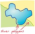
Sliver-polygons.jpg 300 × 289; 74 KB
-
Solution of Geodetic Problem.jpg 421 × 521; 44 KB
-
Souřadnicové rozdíly a směrníky.png 1,765 × 1,247; 41 KB
-
Souřadnicové rozdíly.png 1,962 × 1,423; 49 KB
-
Staffelmessung.jpg 3,154 × 1,527; 291 KB
-
SYD to BKK.svg 1,056 × 816; 132 KB
-
Système de référence fondamental CTS.png 3,016 × 2,583; 536 KB
-
Służba Geodezyjna i Kartograficzna w Polsce - diagram.jpg 806 × 646; 91 KB
-
The hemispheres.JPG 250 × 256; 14 KB
-
The shape of the rotating Earth 3.svg 1,600 × 1,610; 2 KB
-
The shape of the rotating Earth.svg 1,600 × 1,600; 2 KB
-
True polar wander.jpg 900 × 500; 53 KB
-
Ukázka metody měřičského stolu.png 826 × 642; 105 KB
-
Vertical wall are never parallel.PNG 372 × 355; 10 KB
-
VLBI zwischen Kashima und TIGO.jpg 2,252 × 1,860; 1.12 MB
-
Voorwaartse insnijding (basishoekmethode) 2.png 886 × 673; 28 KB
-
Vorwaertseinschneiden.svg 201 × 156; 24 KB
-
Výpočet rajónu.png 2,287 × 1,616; 144 KB
-
Výpočet rajónů ze směrníku.png 2,257 × 1,595; 111 KB
-
Wciecie kątowe 1.svg 300 × 300; 10 KB
-
Wcięcie kątowe 2.svg 300 × 300; 15 KB
-
Wcięcie liniowe 1.svg 300 × 300; 7 KB
-
Wcięcie liniowe 2.svg 300 × 300; 11 KB
-
Wcięcie liniowe.svg 350 × 290; 7 KB
-
WGS 84 reference frame (vector graphic).svg 562 × 512; 18 KB
-
WGS 84 reference frame.png 722 × 546; 37 KB
-
WGS84 mean Earth radius mk.svg 512 × 512; 38 KB
-
WGS84 mean Earth radius.svg 512 × 512; 2 KB
-
Wgs84.png 481 × 266; 63 KB
-
Wikipedia - Trigonometrische Hoogtemeting 3.png 1,284 × 812; 46 KB
-
Zentrale Aufstellung.jpg 200 × 168; 9 KB
-
Zichtafstand.png 659 × 544; 12 KB
-
Συστήματα Αναφοράς Και Γεωδαιτικό Datum.png 887 × 620; 58 KB
-
Геометрична нивелация.pdf 1,239 × 1,754, 2 pages; 61 KB
-
Здвоєний ряд тріангуляції.JPG 500 × 352; 20 KB
-
Из прямоугольной в эллипсоидальную.svg 858 × 917; 12 KB
-
Из прямоугольной в эллипсоидальную1.svg 634 × 581; 17 KB
-
Найвигідніша форма трикутників.JPG 318 × 416; 12 KB
-
Нормальная высота альтернативный рисунок.jpg 1,280 × 975; 49 KB
-
Нормальная высота.jpg 1,280 × 795; 85 KB
-
Преобразования датумов (переход-между-основами).svg 1,625 × 1,293; 94 KB
-
Прямоугольная система координат .svg 1,494 × 917; 8 KB
-
Прямоугольная система координат Максимов А.С..svg 1,171 × 892; 10 KB
-
Прямоугольная система координат Максимов.svg 1,492 × 917; 7 KB
-
Рис1.Проект спеціальної мережі тріангуляції обласного центру.JPG 364 × 300; 12 KB
-
Снимок121212.svg 1,115 × 976; 15 KB
-
Фукг.TIF 751 × 566; 39 KB
-
エラトステネスの考え.svg 500 × 500; 27 KB


